![](/images/other/stat-length.png)
![Randonnée Vélo de route Fleurie - Fleurie - Roche Solutre - Julienas - Photo](https://media.geolcdn.com/t/1900/400/ext.pjpeg?maxdim=2&url=https%3A%2F%2Fstatic1.geolcdn.com%2Fsiteimages%2Fupload%2Ffiles%2F1524743154velo.jpg)
Fleurie - Roche Solutre - Julienas
henristraetmans
Utilisateur
![Longueur](/images/other/stat-length.png)
Longueur
54 km
![Altitude max](https://static1.geolcdn.com/siteimages/upload/files/1508320355ic_sort_altitude_max_24dp.png)
Altitude max
748 m
![Dénivelé positif](https://static1.geolcdn.com/siteimages/upload/files/1508320355ic_sort_den_pos_24dp.png)
Dénivelé positif
1222 m
![Km-Effort](/images/other/stat-length.png)
Km-Effort
71 km
![Altitude min](https://static1.geolcdn.com/siteimages/upload/files/1508320355ic_sort_altitude_min_24dp.png)
Altitude min
231 m
![Dénivelé négatif](https://static1.geolcdn.com/siteimages/upload/files/1508320355ic_sort_den_neg_24dp.png)
Dénivelé négatif
1221 m
![Boucle](https://static1.geolcdn.com/siteimages/upload/files/16400158638029165_repeat_loop_refresh_sync_direction_icon.png)
Boucle
Oui
Date de création :
2022-07-31 08:36:21.765
Dernière modification :
2022-08-02 08:01:14.452
![Vélo de route](https://static1.geolcdn.com/sitytour/trail-icons/201.png)
3h30
Difficulté : Très difficile
![Scannez ce code QR pour ouvrir la randonnée dans l'application SityTrail](https://capi.geolives.com/qq0zvz2zws4bq2lad0pu/sitytour/trails/3337140/qr.png?size=200)
Application GPS de randonnée GRATUITE
À propos
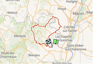
Randonnée Vélo de route de 54 km à découvrir à Auvergne-Rhône-Alpes, Rhône, Fleurie. Cette randonnée est proposée par henristraetmans.
Description
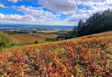
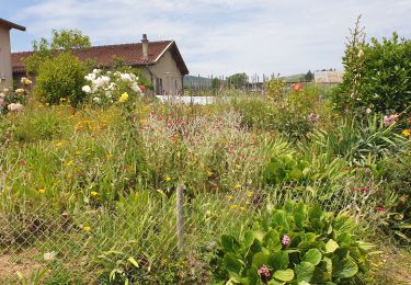
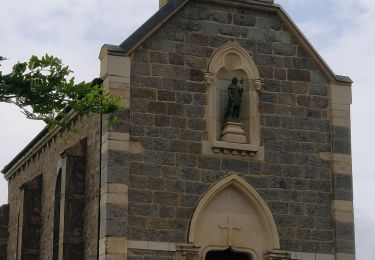
Magnifique rando dans les villages du beaujolais et vue depuis la terasse (maison des crus de Chiroubles)
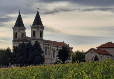
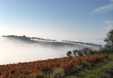
Retour par la Roche de solutre, Saint Veran, Saint Amour, Julienas
Localisation
Pays :
France
Région :
Auvergne-Rhône-Alpes
Département/Province :
Rhône
Commune :
Fleurie
Localité :
Unknown
Départ:(Dec)
Départ:(UTM)
630673 ; 5115115 (31T) N.
Commentaires
Randonnées à proximité
![Randonnée Marche Vauxrenard - Itinérant Beaujolais rouge étape 6 Foretal - Macon gare TGV - Photo](https://media.geolcdn.com/t/375/260/413cab1b-506e-4c3e-962c-5987ea1a88f6.jpg&format=jpg&maxdim=2)
![Marche Marche](https://static1.geolcdn.com/sitytour/trail-icons/101.png)
Itinérant Beaujolais rouge étape 6 Foretal - Macon gare TGV
Marche
Très difficile
Vauxrenard,
Auvergne-Rhône-Alpes,
Rhône,
France
![](/images/other/stat-length.png)
23 km | 28 km-effort
6h 26min
![](https://static1.geolcdn.com/siteimages/upload/files/16400158638029165_repeat_loop_refresh_sync_direction_icon.png)
Non
![Randonnée Marche Chiroubles - Itinérant Beaujolais rouge étape 5 Chiroubles- Foretal - Photo](https://media.geolcdn.com/t/375/260/bf6c4c39-6cf0-41e3-8fc7-ac4d114e4ee5.jpg&format=jpg&maxdim=2)
![Marche Marche](https://static1.geolcdn.com/sitytour/trail-icons/101.png)
Itinérant Beaujolais rouge étape 5 Chiroubles- Foretal
Marche
Moyen
Chiroubles,
Auvergne-Rhône-Alpes,
Rhône,
France
![](/images/other/stat-length.png)
23 km | 32 km-effort
5h 44min
![](https://static1.geolcdn.com/siteimages/upload/files/16400158638029165_repeat_loop_refresh_sync_direction_icon.png)
Non
![Randonnée Marche Vauxrenard - vauxrenard - Photo](https://media.geolcdn.com/t/375/260/ext.jpg?maxdim=2&url=https%3A%2F%2Fstatic1.geolcdn.com%2Fsiteimages%2Fupload%2Ffiles%2F1553511878bg_sport_marche.png)
![Marche Marche](https://static1.geolcdn.com/sitytour/trail-icons/101.png)
vauxrenard
Marche
Difficile
(1)
Vauxrenard,
Auvergne-Rhône-Alpes,
Rhône,
France
![](/images/other/stat-length.png)
21 km | 31 km-effort
5h 7min
![](https://static1.geolcdn.com/siteimages/upload/files/16400158638029165_repeat_loop_refresh_sync_direction_icon.png)
Oui
![Randonnée Marche Chénas - Chénas - Le Venet - Photo](https://media.geolcdn.com/t/375/260/d8ea6745-554d-47dd-be4a-fb50b3697e17.jpeg&format=jpg&maxdim=2)
![Marche Marche](https://static1.geolcdn.com/sitytour/trail-icons/101.png)
Chénas - Le Venet
Marche
Très facile
Chénas,
Auvergne-Rhône-Alpes,
Rhône,
France
![](/images/other/stat-length.png)
3,4 km | 4,5 km-effort
1h 1min
![](https://static1.geolcdn.com/siteimages/upload/files/16400158638029165_repeat_loop_refresh_sync_direction_icon.png)
Oui
![Randonnée Marche Villié-Morgon - sentier Victor Villié morgon - Photo](https://media.geolcdn.com/t/375/260/b8bcac3e-3fe0-47b1-9d02-47fe9d1beb00.jpg&format=jpg&maxdim=2)
![Marche Marche](https://static1.geolcdn.com/sitytour/trail-icons/101.png)
sentier Victor Villié morgon
Marche
Difficile
Villié-Morgon,
Auvergne-Rhône-Alpes,
Rhône,
France
![](/images/other/stat-length.png)
15,9 km | 21 km-effort
3h 35min
![](https://static1.geolcdn.com/siteimages/upload/files/16400158638029165_repeat_loop_refresh_sync_direction_icon.png)
Oui
![Randonnée Marche Chiroubles - Chiroubles - Photo](https://media.geolcdn.com/t/375/260/ext.jpg?maxdim=2&url=https%3A%2F%2Fstatic1.geolcdn.com%2Fsiteimages%2Fupload%2Ffiles%2F1553511878bg_sport_marche.png)
![Marche Marche](https://static1.geolcdn.com/sitytour/trail-icons/101.png)
Chiroubles
Marche
Très difficile
(1)
Chiroubles,
Auvergne-Rhône-Alpes,
Rhône,
France
![](/images/other/stat-length.png)
16,9 km | 26 km-effort
5h 49min
![](https://static1.geolcdn.com/siteimages/upload/files/16400158638029165_repeat_loop_refresh_sync_direction_icon.png)
Oui
![Randonnée A pied Régnié-Durette - Régnié-Durette - Vignes et Sous-Bois - Photo](https://media.geolcdn.com/t/375/260/3d2e7483-074f-47cf-a21e-968074b112a3.jpg&format=jpg&maxdim=2)
![A pied A pied](https://static1.geolcdn.com/sitytour/trail-icons/100.png)
Régnié-Durette - Vignes et Sous-Bois
A pied
Moyen
Régnié-Durette,
Auvergne-Rhône-Alpes,
Rhône,
France
![](/images/other/stat-length.png)
18,1 km | 25 km-effort
5h 40min
![](https://static1.geolcdn.com/siteimages/upload/files/16400158638029165_repeat_loop_refresh_sync_direction_icon.png)
Oui
![Randonnée Marche Fleurie - Fleurie (Rhône) 17 km - D. 498 m - Photo](https://media.geolcdn.com/t/375/260/bed9306c-bb98-4d5f-82e4-deb4dfda36c9.jpeg&format=jpg&maxdim=2)
![Marche Marche](https://static1.geolcdn.com/sitytour/trail-icons/101.png)
Fleurie (Rhône) 17 km - D. 498 m
Marche
Moyen
Fleurie,
Auvergne-Rhône-Alpes,
Rhône,
France
![](/images/other/stat-length.png)
16,7 km | 23 km-effort
5h 25min
![](https://static1.geolcdn.com/siteimages/upload/files/16400158638029165_repeat_loop_refresh_sync_direction_icon.png)
Oui
![Randonnée Marche Fleurie - les vignes de Fleurie - Photo](https://media.geolcdn.com/t/375/260/817911dc-059a-4b4a-8816-06d5f0491acb.jpg&format=jpg&maxdim=2)
![Marche Marche](https://static1.geolcdn.com/sitytour/trail-icons/101.png)
les vignes de Fleurie
Marche
Facile
Fleurie,
Auvergne-Rhône-Alpes,
Rhône,
France
![](/images/other/stat-length.png)
8,1 km | 10,8 km-effort
2h 1min
![](https://static1.geolcdn.com/siteimages/upload/files/16400158638029165_repeat_loop_refresh_sync_direction_icon.png)
Oui