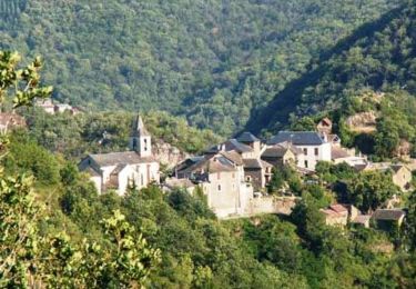
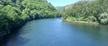
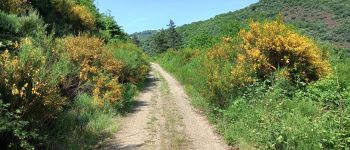
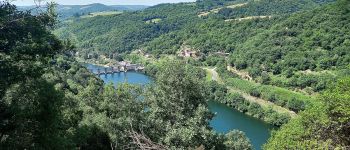
Randonnée Marche Unknown - Au long du Tarn: d' Ayssènes à Brousse le Château - Photo

Au long du Tarn: d' Ayssènes à Brousse le Château

 canardDenis
canardDenis

Utilisateur

© OpenStreetMap contributors
Longueur
Longueur
23 km
Altitude max
Altitude max
527 m
Dénivelé positif
Dénivelé positif
746 m
Km-Effort
Km-Effort  
33 km
Altitude min
Altitude min
248 m
Dénivelé négatif
Dénivelé négatif
863 m
Boucle
Boucle
Non
Date de création :
2022-07-23 13:44:25.716
Dernière modification :
2022-07-27 08:48:30.366

(0 Avis)

Marche
Marche
7h29
Difficulté : Moyen

Scannez ce code QR pour ouvrir la randonnée dans l'application SityTrail

Application GPS de randonnée GRATUITE

Logo SityTrail SityTrail
IGN / Instituts géographiques

Télécharger SityTrail sur l'App Store Télécharger SityTrail sur Google Play

Logo SityTrail SityTrail World
Le monde est à vous

Télécharger SityTrail sur l'App Store Télécharger SityTrail sur Google Play Télécharger SityTrail sur Huawei AppGallery

À propos

Randonnée Marche de 23 km à découvrir à Occitanie, Aveyron. Cette randonnée est proposée par canardDenis.

Description

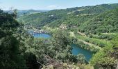
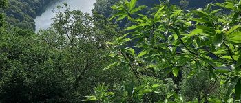
Marcher sur les spectaculaires sentiers en corniche des Raspes du Tarn, descendre au bord de l'eau au Truel, passer en rive gauche pour longer la rivière qui lutte entre ses barrages, qui sort des Raspes dans sa moyenne vallée pour se faufiler entre rochers et châteaux; terminer la journée devant celui de Brousse.

Profil altimétrique

Photos

Points d'intérêt

Point d'intérêt Ayssènes - Moulin d'Ayssènes - Photo
canardDenis
Point d'intérêt Ayssènes - Intersection Route Oustals-Cremats - Photo
canardDenis
Point d'intérêt Ayssènes - Le Pouget - Photo
canardDenis
AYSSÈNES 
Point d'intérêt Ayssènes - Départ Sentier balisé GR - Photo
canardDenis
Point d'intérêt Le Truel - Le Truel - Photo
canardDenis
LE TRUEL 
Point d'intérêt Le Truel - Le Truel -cité ouvrière - Photo
canardDenis
Point d'intérêt Le Truel - Pont du Truel - Photo
canardDenis
LE TRUEL 
Point d'intérêt Le Truel - Départ Sentier - Photo
canardDenis
LE TRUEL 
Point d'intérêt Broquiès - Senmap-Jonction piste - Photo
canardDenis
Point d'intérêt Broquiès - La Jourdanie -Barrage - Photo
canardDenis
Point d'intérêt Broquiès - Attention Ruches - Photo
canardDenis
BROQUIÈS 
Point d'intérêt Broquiès - Intersection Sentier  - Photo
canardDenis
Point d'intérêt Broquiès - garder GR montant droit  - Photo
canardDenis
Point d'intérêt Broquiès - Jonction Route - Photo
canardDenis
BROQUIÈS 
Point d'intérêt Broquiès - Pont de Broquiès - Photo
canardDenis
Point d'intérêt Broquiès - Broquies  - Photo
canardDenis
BROQUIÈS 
Point d'intérêt Broquiès - Cimetière Broquiès - Photo
canardDenis
Point d'intérêt Broquiès - Carrefour -Le PY - Photo
canardDenis
BROQUIÈS 
Point d'intérêt Brousse-le-Château - Croisement Route - Photo
canardDenis
BROUSSE-LE-CHÂTEAU 
Point d'intérêt Brousse-le-Château - carrefour Routes - Photo
canardDenis
BROUSSE-LE-CHÂTEAU 
Point d'intérêt Brousse-le-Château - Croisement Route-Sentier - Photo
canardDenis
BROUSSE-LE-CHÂTEAU 
Point d'intérêt Brousse-le-Château - Brousse-le-Château - Photo
canardDenis
BROUSSE-LE-CHÂTEAU 

Localisation

Pays :
France
Région :
Occitanie
Département/Province :
Aveyron
Commune :
Unknown
Localité :
Unknown
Départ:(Dec)
Départ:(UTM)
482361 ; 4879591 (31T) N.

Randonnées à proximité

Randonnée Marche  - Le chemin des Raspes - Ayssènes  - Photo
Marche
tracegps

Marche

Difficile
, Occitanie, Aveyron, France
14,1 km | 23 km-effort
4h 30min
Oui
Randonnée Marche Le Truel - la Sabaterie reco - Photo
Marche
sergedurand

Marche

Difficile
Le Truel, Occitanie, Aveyron, France
11,5 km | 15,7 km-effort
4h 51min
Oui
Randonnée Marche Le Truel - brousse le château  - Photo
Marche
tosan

Marche

Très difficile
Le Truel, Occitanie, Aveyron, France
19,8 km | 28 km-effort
9h 4min
Non
Randonnée Marche Le Truel - de truel au viala du tarn in live - Photo
Marche
CASSISFRAMBOISE

Marche

Difficile
Le Truel, Occitanie, Aveyron, France
21 km | 32 km-effort
5h 7min
Non
Randonnée Marche Le Truel - costecalde - Photo
Marche
Pascal Lemaire

Marche

Moyen
Le Truel, Occitanie, Aveyron, France
8,7 km | 12,7 km-effort
2h 54min
Oui
Randonnée Marche Saint-Victor-et-Melvieu - rando du bosq le truel - Photo
Marche
Pascal Lemaire

Marche

Moyen
Saint-Victor-et-Melvieu, Occitanie, Aveyron, France
8,3 km | 12,2 km-effort
2h 41min
Oui
Randonnée Marche Viala-du-Tarn - Le Palmoulet randonnée 09/2021 - Photo
Marche
J-Mi

Marche

Moyen
Viala-du-Tarn, Occitanie, Aveyron, France
10,8 km | 17,1 km-effort
2h 22min
Oui
Randonnée Marche Le Truel - circuit le bourastel - Photo
Marche
yvesmonteillet

Marche

Moyen
Le Truel, Occitanie, Aveyron, France
5,7 km | 9,8 km-effort
2h 52min
Non
Randonnée Marche Le Truel - Le Truel La Romiguière - Photo
Marche
ZITO12

Marche

Moyen
Le Truel, Occitanie, Aveyron, France
9,6 km | 15,2 km-effort
3h 8min
Oui


Fermer
Mes abonnements