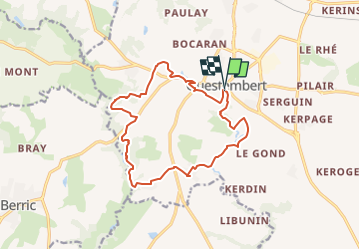
![](/images/other/stat-length.png)
![Randonnée Questembert - SityTrail - 3312871 - sentier-des-popinettesx-questembert - Photo](https://media.geolcdn.com/t/1900/400/ext.pjpeg?maxdim=2&url=https%3A%2F%2Fsecurestorage.geolives.com%2Fsitytour%2Ftrail-bg%2Fdefault.jpg)
SityTrail - 3312871 - sentier-des-popinettesx-questembert
leho.yannick@orange.fr
Utilisateur
![Longueur](/images/other/stat-length.png)
![Altitude max](https://static1.geolcdn.com/siteimages/upload/files/1508320355ic_sort_altitude_max_24dp.png)
![Dénivelé positif](https://static1.geolcdn.com/siteimages/upload/files/1508320355ic_sort_den_pos_24dp.png)
![Km-Effort](/images/other/stat-length.png)
![Altitude min](https://static1.geolcdn.com/siteimages/upload/files/1508320355ic_sort_altitude_min_24dp.png)
![Dénivelé négatif](https://static1.geolcdn.com/siteimages/upload/files/1508320355ic_sort_den_neg_24dp.png)
![Boucle](https://static1.geolcdn.com/siteimages/upload/files/16400158638029165_repeat_loop_refresh_sync_direction_icon.png)
![Scannez ce code QR pour ouvrir la randonnée dans l'application SityTrail](https://capi.geolives.com/qq0zvz2zws4bq2lad0pu/sitytour/trails/3322323/qr.png?size=200)
Application GPS de randonnée GRATUITE
À propos
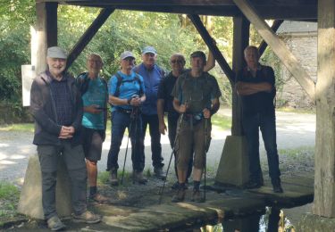
Randonnée de 14,5 km à découvrir à Bretagne, Morbihan, Questembert. Cette randonnée est proposée par leho.yannick@orange.fr.
Description
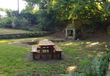
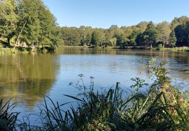
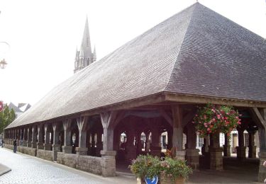
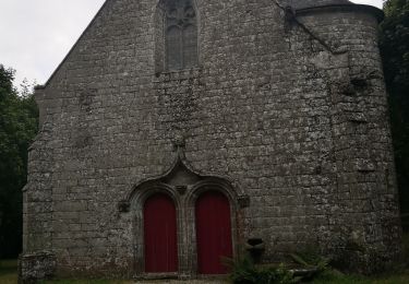
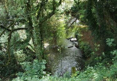
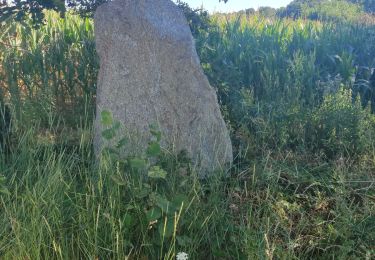
Le nom de Questembert vient de Kisten Beh qui signifie Pays des Châtaignes en breton. Tout près du centre-ville, ce circuit vous emmène le long des chemins creux vers le ruisseau de Cohignac puis la Chapelle St Jean. Sur les talus ou dans les bois, au printemps, fleurissent les asphodèles, hautes sur tige avec une hampe florale blanche. Leur nom local est « popinettes » d’où le nom du sentier. Balisage jaune. A partir de ce circuit, il est possible de rejoindre Berric par des chemins balisés.
Points d'intérêt
Localisation
Commentaires
Randonnées à proximité
![Randonnée Marche Questembert - PR_56_Questembert_AA_01_Circuit1b_Sentier-Des-Popinettes_20200521 - Photo](https://media.geolcdn.com/t/375/260/8a6cc9c1-1a36-4087-863e-60a39a6c581a.jpg&format=jpg&maxdim=2)
![Marche Marche](https://static1.geolcdn.com/sitytour/trail-icons/101.png)
Marche
![](/images/other/stat-length.png)
![](https://static1.geolcdn.com/siteimages/upload/files/16400158638029165_repeat_loop_refresh_sync_direction_icon.png)
![Randonnée Marche Questembert - AUDAX 50 KMS QUESTEMBERT - Photo](https://media.geolcdn.com/t/375/260/a6562aab-35aa-4c4f-aa2d-671056bc7778.jpg&format=jpg&maxdim=2)
![Marche Marche](https://static1.geolcdn.com/sitytour/trail-icons/101.png)
Marche
![](/images/other/stat-length.png)
![](https://static1.geolcdn.com/siteimages/upload/files/16400158638029165_repeat_loop_refresh_sync_direction_icon.png)
![Randonnée Marche Questembert - PR_56_Questembert_BA_02_Circuit1b_La-Boucle-Du-St-Eloi_20220807 - Photo](https://media.geolcdn.com/t/375/260/4b588668-3cbe-4b4a-b8e2-52d369ef1476.jpg&format=jpg&maxdim=2)
![Marche Marche](https://static1.geolcdn.com/sitytour/trail-icons/101.png)
Marche
![](/images/other/stat-length.png)
![](https://static1.geolcdn.com/siteimages/upload/files/16400158638029165_repeat_loop_refresh_sync_direction_icon.png)
![Randonnée A pied Questembert - Boucles du Bois de St Martin - Photo](https://media.geolcdn.com/t/375/260/580e6622-a3f2-4b7b-ade4-4511184eac56.jpeg&format=jpg&maxdim=2)
![A pied A pied](https://static1.geolcdn.com/sitytour/trail-icons/100.png)
A pied
![](/images/other/stat-length.png)
![](https://static1.geolcdn.com/siteimages/upload/files/16400158638029165_repeat_loop_refresh_sync_direction_icon.png)
![Randonnée Marche Questembert - 228 - rando de Cela à Saint Doué par la Vraie Croix - Photo](https://media.geolcdn.com/t/375/260/f30505d5-3e72-4a67-afea-95442ba7db42.jpg&format=jpg&maxdim=2)
![Marche Marche](https://static1.geolcdn.com/sitytour/trail-icons/101.png)
Marche
![](/images/other/stat-length.png)
![](https://static1.geolcdn.com/siteimages/upload/files/16400158638029165_repeat_loop_refresh_sync_direction_icon.png)
![Randonnée Marche Questembert - 188- la boucle de Saint Eloi - Photo](https://media.geolcdn.com/t/375/260/f07ae92b-00df-4cd0-805e-36bccb449673.jpg&format=jpg&maxdim=2)
![Marche Marche](https://static1.geolcdn.com/sitytour/trail-icons/101.png)
Marche
![](/images/other/stat-length.png)
![](https://static1.geolcdn.com/siteimages/upload/files/16400158638029165_repeat_loop_refresh_sync_direction_icon.png)
![Randonnée Marche Questembert - 181 La boucle de Brangolo - Photo](https://media.geolcdn.com/t/375/260/b7b3446e-266b-4b93-8f5c-6e49ba47c6ad.jpg&format=jpg&maxdim=2)
![Marche Marche](https://static1.geolcdn.com/sitytour/trail-icons/101.png)
Marche
![](/images/other/stat-length.png)
![](https://static1.geolcdn.com/siteimages/upload/files/16400158638029165_repeat_loop_refresh_sync_direction_icon.png)
![Randonnée Marche Questembert - castel - Photo](https://media.geolcdn.com/t/375/260/dd5a5316-a5b0-4f45-b47e-dfc03f26faeb.jpg&format=jpg&maxdim=2)
![Marche Marche](https://static1.geolcdn.com/sitytour/trail-icons/101.png)
Marche
![](/images/other/stat-length.png)
![](https://static1.geolcdn.com/siteimages/upload/files/16400158638029165_repeat_loop_refresh_sync_direction_icon.png)
![Randonnée Marche Questembert - questembert - Photo](https://media.geolcdn.com/t/375/260/ext.jpg?maxdim=2&url=https%3A%2F%2Fstatic1.geolcdn.com%2Fsiteimages%2Fupload%2Ffiles%2F1553511878bg_sport_marche.png)
![Marche Marche](https://static1.geolcdn.com/sitytour/trail-icons/101.png)
Marche
![](/images/other/stat-length.png)
![](https://static1.geolcdn.com/siteimages/upload/files/16400158638029165_repeat_loop_refresh_sync_direction_icon.png)