


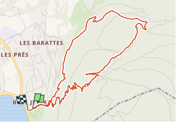

8,1 km | 18,5 km-effort


Utilisateur


Application GPS de randonnée GRATUITE
 SityTrail
IGN / Instituts géographiques
SityTrail World
Le monde est à vous
Randonnée Marche de 7 km à découvrir à Auvergne-Rhône-Alpes, Haute-Savoie, Annecy. Cette randonnée est proposée par Thierry.T.
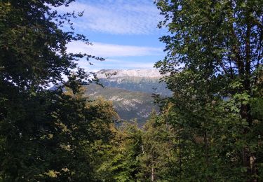
Une belle montée mais rapide. Un beau point de vue, possibilité de monter sur les monts au dessus avec 1h/2h de rando supplémentaire.
Plusieurs redescendes possibles.

Marche

V.T.T.

V.T.C.

Marche

Marche

Marche

Cyclotourisme
Marche
Marche