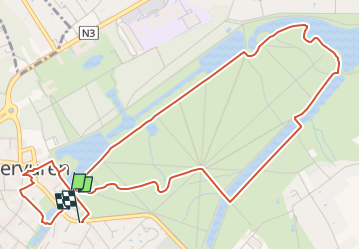
![](/images/other/stat-length.png)
![Randonnée Autre activité Tervueren - Tervuren_0722 - Photo](https://media.geolcdn.com/t/1900/400/ext.pjpeg?maxdim=2&url=https%3A%2F%2Fstatic1.geolcdn.com%2Fsiteimages%2Fupload%2Ffiles%2F1545311037marcheuse_200dpi.jpg)
Tervuren_0722
calofrancis
Utilisateur
![Longueur](/images/other/stat-length.png)
![Altitude max](https://static1.geolcdn.com/siteimages/upload/files/1508320355ic_sort_altitude_max_24dp.png)
![Dénivelé positif](https://static1.geolcdn.com/siteimages/upload/files/1508320355ic_sort_den_pos_24dp.png)
![Km-Effort](/images/other/stat-length.png)
![Altitude min](https://static1.geolcdn.com/siteimages/upload/files/1508320355ic_sort_altitude_min_24dp.png)
![Dénivelé négatif](https://static1.geolcdn.com/siteimages/upload/files/1508320355ic_sort_den_neg_24dp.png)
![Boucle](https://static1.geolcdn.com/siteimages/upload/files/16400158638029165_repeat_loop_refresh_sync_direction_icon.png)
![Autre activité](https://static1.geolcdn.com/sitytour/trail-icons/900.png)
0m
Difficulté : Très facile
![Scannez ce code QR pour ouvrir la randonnée dans l'application SityTrail](https://capi.geolives.com/qq0zvz2zws4bq2lad0pu/sitytour/trails/3309868/qr.png?size=200)
Application GPS de randonnée GRATUITE
À propos
Randonnée Autre activité de 5,9 km à découvrir à Flandre, Brabant flamand, Tervueren. Cette randonnée est proposée par calofrancis.
Description
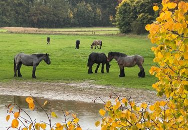
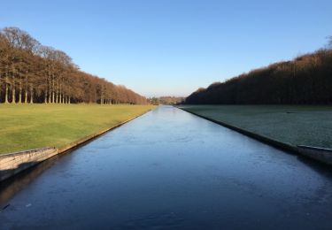
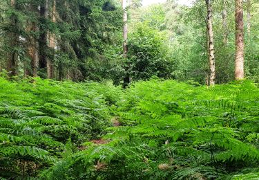
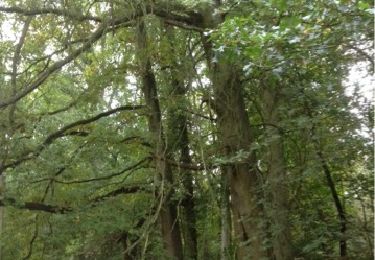
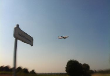
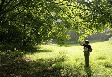
tracé de la balade dans le parc de Tervueren, pour la journée du 28 juillet 2022
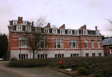
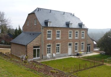
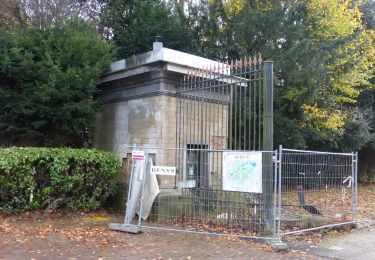
Départ du parking Panquin, passage et commentaires historiques devant les pricipaux batiments et lieux de l'histoire du parc.
Arrivée au resto "Cantina italiana" par la porte du mur d'enceinte
Localisation
Commentaires
Randonnées à proximité
![Randonnée Marche Tervueren - #221017 - Duisburg, Wolfkensberg, Raffelberg***** - Photo](https://media.geolcdn.com/t/375/260/eb11e242-b355-4cb6-a158-313432558930.jpg&format=jpg&maxdim=2)
![Marche Marche](https://static1.geolcdn.com/sitytour/trail-icons/101.png)
Marche
![](/images/other/stat-length.png)
![](https://static1.geolcdn.com/siteimages/upload/files/16400158638029165_repeat_loop_refresh_sync_direction_icon.png)
![Randonnée Marche Tervueren - Tervuren Leefdaal 22 km - Photo](https://media.geolcdn.com/t/375/260/ext.jpg?maxdim=2&url=https%3A%2F%2Fservices.sitytrail.com%2FGeolivesWS%2FDownloadMedia.ashx%3FTrailID%3D1084200%26Media%3D20181213150951.jpg)
![Marche Marche](https://static1.geolcdn.com/sitytour/trail-icons/101.png)
Marche
![](/images/other/stat-length.png)
![](https://static1.geolcdn.com/siteimages/upload/files/16400158638029165_repeat_loop_refresh_sync_direction_icon.png)
![Randonnée Marche Tervueren - Arboretum - Kapucijnenbos - Photo](https://media.geolcdn.com/t/375/260/b9913596-de24-4332-b79b-b09410acdfbd.jpg&format=jpg&maxdim=2)
![Marche Marche](https://static1.geolcdn.com/sitytour/trail-icons/101.png)
Marche
![](/images/other/stat-length.png)
![](https://static1.geolcdn.com/siteimages/upload/files/16400158638029165_repeat_loop_refresh_sync_direction_icon.png)
![Randonnée Marche Tervueren - arboretum - Photo](https://media.geolcdn.com/t/375/260/ext.jpg?maxdim=2&url=https%3A%2F%2Fservices.sitytrail.com%2FGeolivesWS%2FDownloadMedia.ashx%3FTrailID%3D226959%26Media%3D20131013134220.jpg)
![Marche Marche](https://static1.geolcdn.com/sitytour/trail-icons/101.png)
Marche
![](/images/other/stat-length.png)
![](https://static1.geolcdn.com/siteimages/upload/files/16400158638029165_repeat_loop_refresh_sync_direction_icon.png)
![Randonnée Vélo Wezembeek-Ophem - ox2 - Photo](https://media.geolcdn.com/t/375/260/ext.jpg?maxdim=2&url=https%3A%2F%2Fservices.sitytrail.com%2FGeolivesWS%2FDownloadMedia.ashx%3FTrailID%3D151603%26Media%3D20120904141505.jpg)
![Vélo Vélo](https://static1.geolcdn.com/sitytour/trail-icons/200.png)
Vélo
![](/images/other/stat-length.png)
![](https://static1.geolcdn.com/siteimages/upload/files/16400158638029165_repeat_loop_refresh_sync_direction_icon.png)
![Randonnée A pied Zaventem - Meester Crapswandeling - Photo](https://media.geolcdn.com/t/375/260/3dfabf4c-91ef-4e01-b655-1f27a780941d.jpeg&format=jpg&maxdim=2)
![A pied A pied](https://static1.geolcdn.com/sitytour/trail-icons/100.png)
A pied
![](/images/other/stat-length.png)
![](https://static1.geolcdn.com/siteimages/upload/files/16400158638029165_repeat_loop_refresh_sync_direction_icon.png)
![Randonnée A pied Huldenberg - Vossekouterwandeling - Photo](https://media.geolcdn.com/t/375/260/f9edc4ad-a3ef-4882-9a56-b4ff71f9dcfa.jpeg&format=jpg&maxdim=2)
![A pied A pied](https://static1.geolcdn.com/sitytour/trail-icons/100.png)
A pied
![](/images/other/stat-length.png)
![](https://static1.geolcdn.com/siteimages/upload/files/16400158638029165_repeat_loop_refresh_sync_direction_icon.png)
![Randonnée A pied Tervueren - Warandewandeling - Photo](https://media.geolcdn.com/t/375/260/87c065a8-2320-4622-bcf3-9c4a54024d3f.jpeg&format=jpg&maxdim=2)
![A pied A pied](https://static1.geolcdn.com/sitytour/trail-icons/100.png)
A pied
![](/images/other/stat-length.png)
![](https://static1.geolcdn.com/siteimages/upload/files/16400158638029165_repeat_loop_refresh_sync_direction_icon.png)
![Randonnée A pied Tervueren - Kap(ucijnen)bos van Duisburgwandeling - Photo](https://media.geolcdn.com/t/375/260/716ca0df-5263-43cf-b6ba-7d16b36dfeb0.jpeg&format=jpg&maxdim=2)
![A pied A pied](https://static1.geolcdn.com/sitytour/trail-icons/100.png)
A pied
![](/images/other/stat-length.png)
![](https://static1.geolcdn.com/siteimages/upload/files/16400158638029165_repeat_loop_refresh_sync_direction_icon.png)