![](/images/other/stat-length.png)
![Randonnée Marche Arles-sur-Tech - Gr10 suite Arles sur tech - Photo](https://media.geolcdn.com/t/1900/400/ext.pjpeg?maxdim=2&url=https%3A%2F%2Fstatic1.geolcdn.com%2Fsiteimages%2Fupload%2Ffiles%2F1553511878bg_sport_marche.png)
Gr10 suite Arles sur tech
georghinio
Utilisateur
![Longueur](/images/other/stat-length.png)
Longueur
27 km
![Altitude max](https://static1.geolcdn.com/siteimages/upload/files/1508320355ic_sort_altitude_max_24dp.png)
Altitude max
2175 m
![Dénivelé positif](https://static1.geolcdn.com/siteimages/upload/files/1508320355ic_sort_den_pos_24dp.png)
Dénivelé positif
2421 m
![Km-Effort](/images/other/stat-length.png)
Km-Effort
53 km
![Altitude min](https://static1.geolcdn.com/siteimages/upload/files/1508320355ic_sort_altitude_min_24dp.png)
Altitude min
309 m
![Dénivelé négatif](https://static1.geolcdn.com/siteimages/upload/files/1508320355ic_sort_den_neg_24dp.png)
Dénivelé négatif
580 m
![Boucle](https://static1.geolcdn.com/siteimages/upload/files/16400158638029165_repeat_loop_refresh_sync_direction_icon.png)
Boucle
Non
Date de création :
2022-07-07 05:08:30.0
Dernière modification :
2022-07-12 11:54:22.93
![Marche](https://static1.geolcdn.com/sitytour/trail-icons/101.png)
12h07
Difficulté : Très difficile
![Scannez ce code QR pour ouvrir la randonnée dans l'application SityTrail](https://capi.geolives.com/qq0zvz2zws4bq2lad0pu/sitytour/trails/3309085/qr.png?size=200)
Application GPS de randonnée GRATUITE
À propos
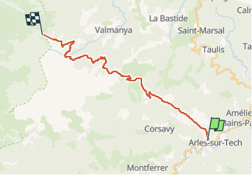
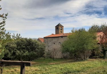
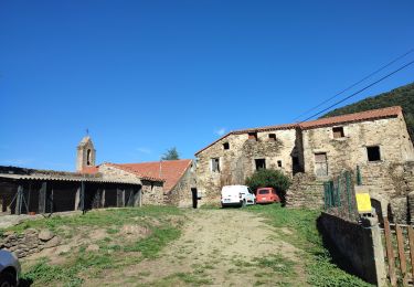
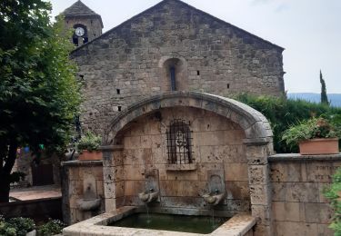
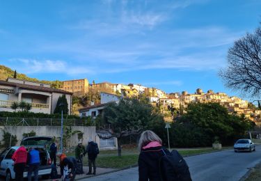
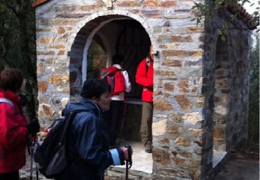
Randonnée Marche de 27 km à découvrir à Occitanie, Pyrénées-Orientales, Arles-sur-Tech. Cette randonnée est proposée par georghinio.
Description
Départ d'Arles sur Tech jusqu'au refuge des Cortalets, rando longue et difficile car beaucoup de dénivelé mais de très beaux points de vues!
Localisation
Pays :
France
Région :
Occitanie
Département/Province :
Pyrénées-Orientales
Commune :
Arles-sur-Tech
Localité :
Unknown
Départ:(Dec)
Départ:(UTM)
469286 ; 4700725 (31T) N.
Commentaires
Randonnées à proximité
![Randonnée Marche Arles-sur-Tech - Col de Paracols depuis Arles sur Tech - Photo](https://media.geolcdn.com/t/375/260/a0402a51-31aa-492f-83e3-f467a80c0c62.jpg&format=jpg&maxdim=2)
![Marche Marche](https://static1.geolcdn.com/sitytour/trail-icons/101.png)
Col de Paracols depuis Arles sur Tech
Marche
Moyen
Arles-sur-Tech,
Occitanie,
Pyrénées-Orientales,
France
![](/images/other/stat-length.png)
12,8 km | 23 km-effort
5h 0min
![](https://static1.geolcdn.com/siteimages/upload/files/16400158638029165_repeat_loop_refresh_sync_direction_icon.png)
Oui
![Randonnée Marche Montbolo - Montbolo: du col dela reducta au col de Formentera - Photo](https://media.geolcdn.com/t/375/260/754853e5-7593-4cab-8eb6-e99d080b4823.jpg&format=jpg&maxdim=2)
![Marche Marche](https://static1.geolcdn.com/sitytour/trail-icons/101.png)
Montbolo: du col dela reducta au col de Formentera
Marche
Moyen
Montbolo,
Occitanie,
Pyrénées-Orientales,
France
![](/images/other/stat-length.png)
11,9 km | 17 km-effort
3h 4min
![](https://static1.geolcdn.com/siteimages/upload/files/16400158638029165_repeat_loop_refresh_sync_direction_icon.png)
Oui
![Randonnée Marche Montferrer - montferrer . El castel . Puiq de volafort .. retour par la piste - Photo](https://media.geolcdn.com/t/375/260/0038a41d-1b8d-49b6-87ad-9d0340b81119.jpg&format=jpg&maxdim=2)
![Marche Marche](https://static1.geolcdn.com/sitytour/trail-icons/101.png)
montferrer . El castel . Puiq de volafort .. retour par la piste
Marche
Facile
Montferrer,
Occitanie,
Pyrénées-Orientales,
France
![](/images/other/stat-length.png)
7,5 km | 11,9 km-effort
3h 21min
![](https://static1.geolcdn.com/siteimages/upload/files/16400158638029165_repeat_loop_refresh_sync_direction_icon.png)
Oui
![Randonnée Marche Montferrer - montferer - Photo](https://media.geolcdn.com/t/375/260/c8bf2bfd-54cc-4016-8546-91889da7514e.jpg&format=jpg&maxdim=2)
![Marche Marche](https://static1.geolcdn.com/sitytour/trail-icons/101.png)
montferer
Marche
Difficile
(1)
Montferrer,
Occitanie,
Pyrénées-Orientales,
France
![](/images/other/stat-length.png)
11,8 km | 16,9 km-effort
5h 32min
![](https://static1.geolcdn.com/siteimages/upload/files/16400158638029165_repeat_loop_refresh_sync_direction_icon.png)
Oui
![Randonnée Marche Amélie-les-Bains-Palalda - A/R Roc St sauveur - Photo](https://media.geolcdn.com/t/375/260/bea18181-f87f-4a55-9cfc-b2ffb71caf48.jpg&format=jpg&maxdim=2)
![Marche Marche](https://static1.geolcdn.com/sitytour/trail-icons/101.png)
A/R Roc St sauveur
Marche
Moyen
Amélie-les-Bains-Palalda,
Occitanie,
Pyrénées-Orientales,
France
![](/images/other/stat-length.png)
6,4 km | 14,4 km-effort
2h 46min
![](https://static1.geolcdn.com/siteimages/upload/files/16400158638029165_repeat_loop_refresh_sync_direction_icon.png)
Oui
![Randonnée Marche Montferrer - Montferrer . El Castel . Puig de Vilafort - retour par la piste - Photo](https://media.geolcdn.com/t/375/260/42383815-0ae2-4167-8591-fc1dd32f5296.jpg&format=jpg&maxdim=2)
![Marche Marche](https://static1.geolcdn.com/sitytour/trail-icons/101.png)
Montferrer . El Castel . Puig de Vilafort - retour par la piste
Marche
Facile
Montferrer,
Occitanie,
Pyrénées-Orientales,
France
![](/images/other/stat-length.png)
7,8 km | 12,2 km-effort
2h 38min
![](https://static1.geolcdn.com/siteimages/upload/files/16400158638029165_repeat_loop_refresh_sync_direction_icon.png)
Oui
![Randonnée Marche Amélie-les-Bains-Palalda - Amélie les Bains - Roc de la Campana - Photo](https://media.geolcdn.com/t/375/260/1842026f-51ff-49df-a557-6a7ae07b89ff.jpg&format=jpg&maxdim=2)
![Marche Marche](https://static1.geolcdn.com/sitytour/trail-icons/101.png)
Amélie les Bains - Roc de la Campana
Marche
Très difficile
Amélie-les-Bains-Palalda,
Occitanie,
Pyrénées-Orientales,
France
![](/images/other/stat-length.png)
13,5 km | 22 km-effort
6h 16min
![](https://static1.geolcdn.com/siteimages/upload/files/16400158638029165_repeat_loop_refresh_sync_direction_icon.png)
Oui
![Randonnée Marche Arles-sur-Tech - D'Arles sur Tech à Saint Laurent de Cerdans - Photo](https://media.geolcdn.com/t/375/260/ext.jpg?maxdim=2&url=https%3A%2F%2Fservices.sitytrail.com%2FGeolivesWS%2FDownloadMedia.ashx%3FTrailID%3D191536%26Media%3D15145_4.jpg)
![Marche Marche](https://static1.geolcdn.com/sitytour/trail-icons/101.png)
D'Arles sur Tech à Saint Laurent de Cerdans
Marche
Difficile
Arles-sur-Tech,
Occitanie,
Pyrénées-Orientales,
France
![](/images/other/stat-length.png)
18,5 km | 30 km-effort
6h 0min
![](https://static1.geolcdn.com/siteimages/upload/files/16400158638029165_repeat_loop_refresh_sync_direction_icon.png)
Non
![Randonnée Marche Montferrer - Château de Montferrer - Photo](https://media.geolcdn.com/t/375/260/ext.jpg?maxdim=2&url=https%3A%2F%2Fservices.sitytrail.com%2FGeolivesWS%2FDownloadMedia.ashx%3FTrailID%3D176058%26Media%3D20130219170939.jpg)
![Marche Marche](https://static1.geolcdn.com/sitytour/trail-icons/101.png)
Château de Montferrer
Marche
Facile
(2)
Montferrer,
Occitanie,
Pyrénées-Orientales,
France
![](/images/other/stat-length.png)
9,8 km | 14,2 km-effort
3h 32min
![](https://static1.geolcdn.com/siteimages/upload/files/16400158638029165_repeat_loop_refresh_sync_direction_icon.png)
Oui