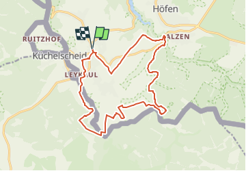
![](/images/other/stat-length.png)
![Randonnée Marche Montjoie - Kalterherberg_855 - Photo](https://media.geolcdn.com/t/1900/400/ext.pjpeg?maxdim=2&url=https%3A%2F%2Fstatic1.geolcdn.com%2Fsiteimages%2Fupload%2Ffiles%2F1553511878bg_sport_marche.png)
Kalterherberg_855
mumu.larandonneuse
Utilisateur GUIDE
![Longueur](/images/other/stat-length.png)
![Altitude max](https://static1.geolcdn.com/siteimages/upload/files/1508320355ic_sort_altitude_max_24dp.png)
![Dénivelé positif](https://static1.geolcdn.com/siteimages/upload/files/1508320355ic_sort_den_pos_24dp.png)
![Km-Effort](/images/other/stat-length.png)
![Altitude min](https://static1.geolcdn.com/siteimages/upload/files/1508320355ic_sort_altitude_min_24dp.png)
![Dénivelé négatif](https://static1.geolcdn.com/siteimages/upload/files/1508320355ic_sort_den_neg_24dp.png)
![Boucle](https://static1.geolcdn.com/siteimages/upload/files/16400158638029165_repeat_loop_refresh_sync_direction_icon.png)
![Marche](https://static1.geolcdn.com/sitytour/trail-icons/101.png)
4h34
Difficulté : Facile
![Scannez ce code QR pour ouvrir la randonnée dans l'application SityTrail](https://capi.geolives.com/qq0zvz2zws4bq2lad0pu/sitytour/trails/3302356/qr.png?size=200)
Application GPS de randonnée GRATUITE
À propos
Randonnée Marche de 16,5 km à découvrir à Rhénanie-du-Nord-Westphalie, Région urbaine d'Aix-la-Chapelle, Montjoie. Cette randonnée est proposée par mumu.larandonneuse.
Description
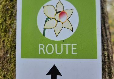
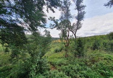
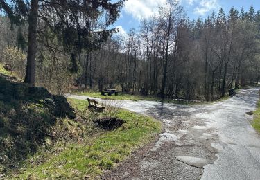
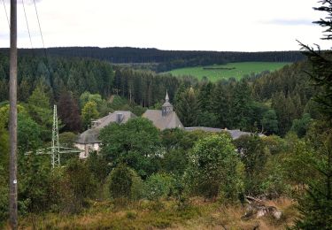
ℹ www.wandelgidszuidlimburg.com n° 855 ➡️ Au cours de cette visite facile et panoramique de l'Eifel, vous découvrirez les magnifiques environs de Kalterherberg. Vous marchez pendant un certain temps le long de belles lisières de forêts, à travers des prairies et sur des sentiers jusqu'à la vallée du Perlenbach. Ensuite, vous traversez la vallée des jonquilles, qui fleurissent ici au printemps dans les prés. Après un bon tronçon le long du Perlenbach, vous passez le Perlenbacher Mühle, puis la seule courte montée de cette promenade.
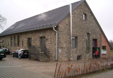
Localisation
Commentaires
Randonnées à proximité
![Randonnée Marche Montjoie - Route des jonquilles Monschau-Höfen - Photo](https://media.geolcdn.com/t/375/260/f78b6422-c27b-477b-b695-82eecbd61b40.jpg&format=jpg&maxdim=2)
![Marche Marche](https://static1.geolcdn.com/sitytour/trail-icons/101.png)
Marche
![](/images/other/stat-length.png)
![](https://static1.geolcdn.com/siteimages/upload/files/16400158638029165_repeat_loop_refresh_sync_direction_icon.png)
![Randonnée Marche Montjoie - Montjoie - Ternell en ligne - Photo](https://media.geolcdn.com/t/375/260/d0229e76-e80b-4ee0-af20-8e96d215cea3.jpg&format=jpg&maxdim=2)
![Marche Marche](https://static1.geolcdn.com/sitytour/trail-icons/101.png)
Marche
![](/images/other/stat-length.png)
![](https://static1.geolcdn.com/siteimages/upload/files/16400158638029165_repeat_loop_refresh_sync_direction_icon.png)
![Randonnée Marche Butgenbach - Küchelscheid 🇧🇪/Kalterherberg 🇩🇪 - Photo](https://media.geolcdn.com/t/375/260/f30f3eaf-c1e4-41d4-bcfb-42e5cbece161.jpg&format=jpg&maxdim=2)
![Marche Marche](https://static1.geolcdn.com/sitytour/trail-icons/101.png)
Marche
![](/images/other/stat-length.png)
![](https://static1.geolcdn.com/siteimages/upload/files/16400158638029165_repeat_loop_refresh_sync_direction_icon.png)
![Randonnée Marche Montjoie - rando kalterherberg-rocher bieley 11/08/2021 - Photo](https://media.geolcdn.com/t/375/260/b8400c0e-5378-474d-9c63-b53205ca548b.jpg&format=jpg&maxdim=2)
![Marche Marche](https://static1.geolcdn.com/sitytour/trail-icons/101.png)
Marche
![](/images/other/stat-length.png)
![](https://static1.geolcdn.com/siteimages/upload/files/16400158638029165_repeat_loop_refresh_sync_direction_icon.png)
![Randonnée Marche Montjoie - Rando Eifel des jonquilles narcisses 18,3 - Photo](https://media.geolcdn.com/t/375/260/29cf751c-7851-449b-b365-4b88ea56faf3.jpg&format=jpg&maxdim=2)
![Marche Marche](https://static1.geolcdn.com/sitytour/trail-icons/101.png)
Marche
![](/images/other/stat-length.png)
![](https://static1.geolcdn.com/siteimages/upload/files/16400158638029165_repeat_loop_refresh_sync_direction_icon.png)
![Randonnée A pied Montjoie - Eifelverein Rohren - Weg 57 - Photo](https://media.geolcdn.com/t/375/260/a620ba14-736e-46ad-b0d4-965dfc1d4df3.jpeg&format=jpg&maxdim=2)
![A pied A pied](https://static1.geolcdn.com/sitytour/trail-icons/100.png)
A pied
![](/images/other/stat-length.png)
![](https://static1.geolcdn.com/siteimages/upload/files/16400158638029165_repeat_loop_refresh_sync_direction_icon.png)
![Randonnée A pied Montjoie - Monschauer Nationalpark-Wanderweg](https://media.geolcdn.com/t/375/260/6ecae744-a5e1-4d67-8c65-d4bc2433654d.jpeg&format=jpg&maxdim=2)
![A pied A pied](https://static1.geolcdn.com/sitytour/trail-icons/100.png)
A pied
![](/images/other/stat-length.png)
![](https://static1.geolcdn.com/siteimages/upload/files/16400158638029165_repeat_loop_refresh_sync_direction_icon.png)
![Randonnée A pied Montjoie - Narzissenroute Höfen (Eifel) - Photo](https://media.geolcdn.com/t/375/260/4209bd6d-0e5a-4c94-aa91-ecdefe50dbb3.jpeg&format=jpg&maxdim=2)
![A pied A pied](https://static1.geolcdn.com/sitytour/trail-icons/100.png)
A pied
![](/images/other/stat-length.png)
![](https://static1.geolcdn.com/siteimages/upload/files/16400158638029165_repeat_loop_refresh_sync_direction_icon.png)
![Randonnée A pied Montjoie - Klosterroute - Photo](https://media.geolcdn.com/t/375/260/d4896ddf-a189-42c6-b0a5-59bf65f3272d.jpeg&format=jpg&maxdim=2)
![A pied A pied](https://static1.geolcdn.com/sitytour/trail-icons/100.png)
A pied
![](/images/other/stat-length.png)
![](https://static1.geolcdn.com/siteimages/upload/files/16400158638029165_repeat_loop_refresh_sync_direction_icon.png)