![](/images/other/stat-length.png)
![Randonnée Marche Tintigny - AUTOUR DE BELLEFONTAINE - Photo](https://media.geolcdn.com/t/1900/400/07dce5a4-c684-481b-ab8e-f371645d9a95.jpg&format=pjpeg&maxdim=2)
AUTOUR DE BELLEFONTAINE
JEANMINNE
Utilisateur
![Longueur](/images/other/stat-length.png)
Longueur
23 km
![Altitude max](https://static1.geolcdn.com/siteimages/upload/files/1508320355ic_sort_altitude_max_24dp.png)
Altitude max
387 m
![Dénivelé positif](https://static1.geolcdn.com/siteimages/upload/files/1508320355ic_sort_den_pos_24dp.png)
Dénivelé positif
378 m
![Km-Effort](/images/other/stat-length.png)
Km-Effort
28 km
![Altitude min](https://static1.geolcdn.com/siteimages/upload/files/1508320355ic_sort_altitude_min_24dp.png)
Altitude min
292 m
![Dénivelé négatif](https://static1.geolcdn.com/siteimages/upload/files/1508320355ic_sort_den_neg_24dp.png)
Dénivelé négatif
374 m
![Boucle](https://static1.geolcdn.com/siteimages/upload/files/16400158638029165_repeat_loop_refresh_sync_direction_icon.png)
Boucle
Oui
Date de création :
2022-07-02 07:59:18.895
Dernière modification :
2022-07-02 14:51:00.349
![Marche](https://static1.geolcdn.com/sitytour/trail-icons/101.png)
5h07
Difficulté : Moyen
![Scannez ce code QR pour ouvrir la randonnée dans l'application SityTrail](https://capi.geolives.com/qq0zvz2zws4bq2lad0pu/sitytour/trails/3301946/qr.png?size=200)
Application GPS de randonnée GRATUITE
À propos
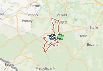
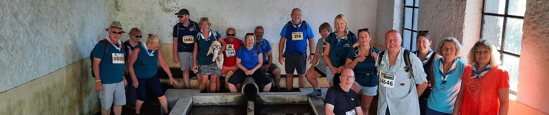
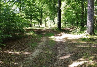
Randonnée Marche de 23 km à découvrir à Wallonie, Luxembourg, Tintigny. Cette randonnée est proposée par JEANMINNE.
Description
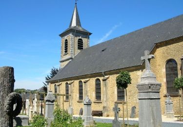
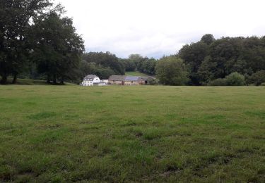
Ferme de la vieille Hage-Lahage-Le grand Cron-Les Bienséances-La Chavrotte-Bords de Bellefontaine-Bois de Tintigny-Cimetiere du Radan-Tintigny-Chateau de Villemont-Bellefontaine-Vieille ferme de Hage.
Localisation
Pays :
Belgique
Région :
Wallonie
Département/Province :
Luxembourg
Commune :
Tintigny
Localité :
Unknown
Départ:(Dec)
Départ:(UTM)
681069 ; 5502527 (31U) N.
Commentaires
Randonnées à proximité
![Randonnée Marche Tintigny - ADEPS à Saint-Vincent. - Photo](https://media.geolcdn.com/t/375/260/ext.jpg?maxdim=2&url=https%3A%2F%2Fstatic1.geolcdn.com%2Fsiteimages%2Fupload%2Ffiles%2F1553511878bg_sport_marche.png)
![Marche Marche](https://static1.geolcdn.com/sitytour/trail-icons/101.png)
ADEPS à Saint-Vincent.
Marche
Moyen
(1)
Tintigny,
Wallonie,
Luxembourg,
Belgique
![](/images/other/stat-length.png)
9,4 km | 11 km-effort
1h 45min
![](https://static1.geolcdn.com/siteimages/upload/files/16400158638029165_repeat_loop_refresh_sync_direction_icon.png)
Oui
![Randonnée Marche Tintigny - À l’ombre de la forêt gaumaise - Photo](https://media.geolcdn.com/t/375/260/986c7bad-e287-4939-909a-6f941fb4d982.jpg&format=jpg&maxdim=2)
![Marche Marche](https://static1.geolcdn.com/sitytour/trail-icons/101.png)
À l’ombre de la forêt gaumaise
Marche
Facile
(4)
Tintigny,
Wallonie,
Luxembourg,
Belgique
![](/images/other/stat-length.png)
14,6 km | 17 km-effort
2h 49min
![](https://static1.geolcdn.com/siteimages/upload/files/16400158638029165_repeat_loop_refresh_sync_direction_icon.png)
Oui
![Randonnée Marche Tintigny - La Rando du Bian: Autour de Lahage - Photo](https://media.geolcdn.com/t/375/260/0375adaf-9b4d-45ec-8668-73d72fc0e5ca.jpg&format=jpg&maxdim=2)
![Marche Marche](https://static1.geolcdn.com/sitytour/trail-icons/101.png)
La Rando du Bian: Autour de Lahage
Marche
Facile
(1)
Tintigny,
Wallonie,
Luxembourg,
Belgique
![](/images/other/stat-length.png)
18,8 km | 22 km-effort
3h 58min
![](https://static1.geolcdn.com/siteimages/upload/files/16400158638029165_repeat_loop_refresh_sync_direction_icon.png)
Oui
![Randonnée A pied Tintigny - Promenade Tintigny-Han - Photo](https://media.geolcdn.com/t/375/260/ext.jpg?maxdim=2&url=https%3A%2F%2Fpivotmedia.tourismewallonie.be%2FOTH-A0-006F-3M12%2FOTH-A0-006F-3M12.jpg)
![A pied A pied](https://static1.geolcdn.com/sitytour/trail-icons/100.png)
Promenade Tintigny-Han
A pied
Facile
Tintigny,
Wallonie,
Luxembourg,
Belgique
![](/images/other/stat-length.png)
4,4 km | 5 km-effort
1h 7min
![](https://static1.geolcdn.com/siteimages/upload/files/16400158638029165_repeat_loop_refresh_sync_direction_icon.png)
Oui
![Randonnée A pied Étalle - La Fratinotte - Photo](https://media.geolcdn.com/t/375/260/ext.jpg?maxdim=2&url=https%3A%2F%2Fpivotmedia.tourismewallonie.be%2FOTH-A0-006F-0W6H%2FOTH-A0-006F-0W6H.jpg)
![A pied A pied](https://static1.geolcdn.com/sitytour/trail-icons/100.png)
La Fratinotte
A pied
Facile
Étalle,
Wallonie,
Luxembourg,
Belgique
![](/images/other/stat-length.png)
5,4 km | 6,1 km-effort
1h 23min
![](https://static1.geolcdn.com/siteimages/upload/files/16400158638029165_repeat_loop_refresh_sync_direction_icon.png)
Oui
![Randonnée Marche Tintigny - Bellefontaine, Gros Cron, Baraque Payat - Photo](https://media.geolcdn.com/t/375/260/6add515d-9069-4041-b983-a40bd7d1411c.jpg&format=jpg&maxdim=2)
![Marche Marche](https://static1.geolcdn.com/sitytour/trail-icons/101.png)
Bellefontaine, Gros Cron, Baraque Payat
Marche
Moyen
Tintigny,
Wallonie,
Luxembourg,
Belgique
![](/images/other/stat-length.png)
19,2 km | 23 km-effort
4h 56min
![](https://static1.geolcdn.com/siteimages/upload/files/16400158638029165_repeat_loop_refresh_sync_direction_icon.png)
Oui
![Randonnée Marche Tintigny - Bellefontaine _ Marche Privée - Photo](https://media.geolcdn.com/t/375/260/60a2e525-68fc-4f3a-8083-a867827a4b5b.jpg&format=jpg&maxdim=2)
![Marche Marche](https://static1.geolcdn.com/sitytour/trail-icons/101.png)
Bellefontaine _ Marche Privée
Marche
Facile
Tintigny,
Wallonie,
Luxembourg,
Belgique
![](/images/other/stat-length.png)
20 km | 24 km-effort
5h 8min
![](https://static1.geolcdn.com/siteimages/upload/files/16400158638029165_repeat_loop_refresh_sync_direction_icon.png)
Oui
![Randonnée Marche Tintigny - Bellefontaine 020720 - Photo](https://media.geolcdn.com/t/375/260/d8eb1ae1-30c7-410a-8376-c69c2ee2a8bc.jpg&format=jpg&maxdim=2)
![Marche Marche](https://static1.geolcdn.com/sitytour/trail-icons/101.png)
Bellefontaine 020720
Marche
Facile
Tintigny,
Wallonie,
Luxembourg,
Belgique
![](/images/other/stat-length.png)
18,6 km | 23 km-effort
3h 58min
![](https://static1.geolcdn.com/siteimages/upload/files/16400158638029165_repeat_loop_refresh_sync_direction_icon.png)
Oui
![Randonnée Marche Tintigny - Lahage 15 septembre 2018 - Photo](https://media.geolcdn.com/t/375/260/2820b4d3-a000-4f68-8612-907240b067bb.jpg&format=jpg&maxdim=2)
![Marche Marche](https://static1.geolcdn.com/sitytour/trail-icons/101.png)
Lahage 15 septembre 2018
Marche
Moyen
Tintigny,
Wallonie,
Luxembourg,
Belgique
![](/images/other/stat-length.png)
8 km | 10,2 km-effort
2h 19min
![](https://static1.geolcdn.com/siteimages/upload/files/16400158638029165_repeat_loop_refresh_sync_direction_icon.png)
Oui