![](/images/other/stat-length.png)
![Randonnée Marche Ciney - Chevetogne 280622 - Photo](https://media.geolcdn.com/t/1900/400/c613c737-4372-48b4-a10b-d4cb78bd8fff.jpg&format=pjpeg&maxdim=2)
Chevetogne 280622
guyernage25
Utilisateur
![Longueur](/images/other/stat-length.png)
Longueur
14,3 km
![Altitude max](https://static1.geolcdn.com/siteimages/upload/files/1508320355ic_sort_altitude_max_24dp.png)
Altitude max
340 m
![Dénivelé positif](https://static1.geolcdn.com/siteimages/upload/files/1508320355ic_sort_den_pos_24dp.png)
Dénivelé positif
240 m
![Km-Effort](/images/other/stat-length.png)
Km-Effort
17,5 km
![Altitude min](https://static1.geolcdn.com/siteimages/upload/files/1508320355ic_sort_altitude_min_24dp.png)
Altitude min
228 m
![Dénivelé négatif](https://static1.geolcdn.com/siteimages/upload/files/1508320355ic_sort_den_neg_24dp.png)
Dénivelé négatif
243 m
![Boucle](https://static1.geolcdn.com/siteimages/upload/files/16400158638029165_repeat_loop_refresh_sync_direction_icon.png)
Boucle
Oui
Date de création :
2022-06-28 09:09:11.763
Dernière modification :
2022-06-28 13:23:46.418
![Marche](https://static1.geolcdn.com/sitytour/trail-icons/101.png)
3h50
Difficulté : Difficile
![Scannez ce code QR pour ouvrir la randonnée dans l'application SityTrail](https://capi.geolives.com/qq0zvz2zws4bq2lad0pu/sitytour/trails/3297652/qr.png?size=200)
Application GPS de randonnée GRATUITE
À propos
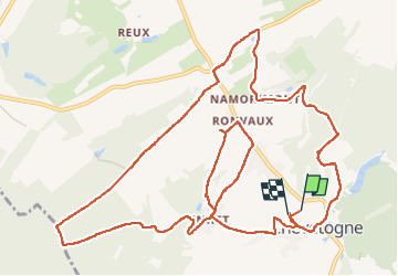
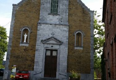
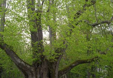
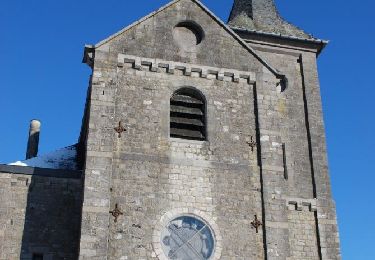
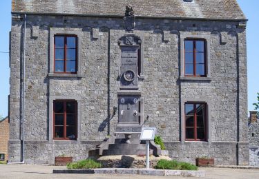
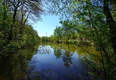
Randonnée Marche de 14,3 km à découvrir à Wallonie, Namur, Ciney. Cette randonnée est proposée par guyernage25.
Description
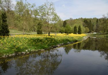
belle rando avec de beaux paysages.
attention au hameau de Ronveaux, suite à un chemin privé j ai du revenir sur le hameau de Henet d ou la forme étriquée de la rando.
Localisation
Pays :
Belgique
Région :
Wallonie
Département/Province :
Namur
Commune :
Ciney
Localité :
Unknown
Départ:(Dec)
Départ:(UTM)
651068 ; 5565811 (31U) N.
Commentaires
Randonnées à proximité
![Marche Marche](https://static1.geolcdn.com/sitytour/trail-icons/101.png)
RB-Na-25_Chapois
Marche
Très difficile
(11)
Ciney,
Wallonie,
Namur,
Belgique
![](/images/other/stat-length.png)
18,9 km | 24 km-effort
5h 28min
![](https://static1.geolcdn.com/siteimages/upload/files/16400158638029165_repeat_loop_refresh_sync_direction_icon.png)
Oui
![Randonnée Marche Ciney - CINEY- Chevetogne- Promenade de l'Ywoigne - Photo](https://media.geolcdn.com/t/375/260/ext.jpg?maxdim=2&url=https%3A%2F%2Fservices.sitytrail.com%2FGeolivesWS%2FDownloadMedia.ashx%3FTrailID%3D250674%26Media%3D8a32e342-1555-4b9f-9653-7b95be5cb295.jpg)
![Marche Marche](https://static1.geolcdn.com/sitytour/trail-icons/101.png)
CINEY- Chevetogne- Promenade de l'Ywoigne
Marche
Très facile
(9)
Ciney,
Wallonie,
Namur,
Belgique
![](/images/other/stat-length.png)
5 km | 6,5 km-effort
1h 22min
![](https://static1.geolcdn.com/siteimages/upload/files/16400158638029165_repeat_loop_refresh_sync_direction_icon.png)
Oui
![Randonnée Marche Ciney - CINEY- Chevetogne- Promenade du Tige de Ronvaux - Photo](https://media.geolcdn.com/t/375/260/ext.jpg?maxdim=2&url=https%3A%2F%2Fservices.sitytrail.com%2FGeolivesWS%2FDownloadMedia.ashx%3FTrailID%3D250673%26Media%3D8a32e342-1555-4b9f-9653-7b95be5cb295.jpg)
![Marche Marche](https://static1.geolcdn.com/sitytour/trail-icons/101.png)
CINEY- Chevetogne- Promenade du Tige de Ronvaux
Marche
Moyen
(6)
Ciney,
Wallonie,
Namur,
Belgique
![](/images/other/stat-length.png)
10,5 km | 13,2 km-effort
2h 50min
![](https://static1.geolcdn.com/siteimages/upload/files/16400158638029165_repeat_loop_refresh_sync_direction_icon.png)
Oui
![Randonnée Marche Ciney - chevetogne ac 2 - Photo](https://media.geolcdn.com/t/375/260/bce6b811-b90d-4ac9-9c30-184ef4de226e.jpg&format=jpg&maxdim=2)
![Marche Marche](https://static1.geolcdn.com/sitytour/trail-icons/101.png)
chevetogne ac 2
Marche
Facile
(1)
Ciney,
Wallonie,
Namur,
Belgique
![](/images/other/stat-length.png)
9,7 km | 12,2 km-effort
3h 19min
![](https://static1.geolcdn.com/siteimages/upload/files/16400158638029165_repeat_loop_refresh_sync_direction_icon.png)
Oui
![Randonnée Marche Ciney - CHEVETOGNE (village) - Photo](https://media.geolcdn.com/t/375/260/ext.jpg?maxdim=2&url=https%3A%2F%2Fservices.sitytrail.com%2FGeolivesWS%2FDownloadMedia.ashx%3FTrailID%3D460046%26Media%3Dfix__20150816101035.jpg)
![Marche Marche](https://static1.geolcdn.com/sitytour/trail-icons/101.png)
CHEVETOGNE (village)
Marche
Facile
(3)
Ciney,
Wallonie,
Namur,
Belgique
![](/images/other/stat-length.png)
10,4 km | 12,5 km-effort
2h 43min
![](https://static1.geolcdn.com/siteimages/upload/files/16400158638029165_repeat_loop_refresh_sync_direction_icon.png)
Oui
![Randonnée Marche Ciney - CINEY- Conjoux- Promenade du Tilleul de Conjoux - Photo](https://media.geolcdn.com/t/375/260/ext.jpg?maxdim=2&url=https%3A%2F%2Fservices.sitytrail.com%2FGeolivesWS%2FDownloadMedia.ashx%3FTrailID%3D250678%26Media%3D35afc09f-bf4c-4284-baa5-6441c5e98513.jpg)
![Marche Marche](https://static1.geolcdn.com/sitytour/trail-icons/101.png)
CINEY- Conjoux- Promenade du Tilleul de Conjoux
Marche
Très facile
(5)
Ciney,
Wallonie,
Namur,
Belgique
![](/images/other/stat-length.png)
8,5 km | 10,8 km-effort
2h 22min
![](https://static1.geolcdn.com/siteimages/upload/files/16400158638029165_repeat_loop_refresh_sync_direction_icon.png)
Oui
![Randonnée Marche Ciney - CINEY- Chapois- Promenade des Etangs de Happe - Photo](https://media.geolcdn.com/t/375/260/ext.jpg?maxdim=2&url=https%3A%2F%2Fservices.sitytrail.com%2FGeolivesWS%2FDownloadMedia.ashx%3FTrailID%3D250672%26Media%3D67c0e05a-f83b-4879-9800-bcc133a249bf.jpg)
![Marche Marche](https://static1.geolcdn.com/sitytour/trail-icons/101.png)
CINEY- Chapois- Promenade des Etangs de Happe
Marche
Très facile
(3)
Ciney,
Wallonie,
Namur,
Belgique
![](/images/other/stat-length.png)
8,1 km | 9,8 km-effort
2h 1min
![](https://static1.geolcdn.com/siteimages/upload/files/16400158638029165_repeat_loop_refresh_sync_direction_icon.png)
Oui
![Randonnée A pied Ciney - Chapois: Promenade des Tiennes - Photo](https://media.geolcdn.com/t/375/260/ext.jpg?maxdim=2&url=https%3A%2F%2Fpivotmedia.tourismewallonie.be%2FOTH-A0-004L-0D9D%2FOTH-A0-004L-0D9D.jpg)
![A pied A pied](https://static1.geolcdn.com/sitytour/trail-icons/100.png)
Chapois: Promenade des Tiennes
A pied
Facile
Ciney,
Wallonie,
Namur,
Belgique
![](/images/other/stat-length.png)
10,4 km | 13,3 km-effort
3h 1min
![](https://static1.geolcdn.com/siteimages/upload/files/16400158638029165_repeat_loop_refresh_sync_direction_icon.png)
Oui
![Randonnée A pied Ciney - Chapois: Promenade des étangs de Happe - Photo](https://media.geolcdn.com/t/375/260/ext.jpg?maxdim=2&url=https%3A%2F%2Fpivotmedia.tourismewallonie.be%2FOTH-A0-004L-0ZWV%2FOTH-A0-004L-0ZWV.jpg)
![A pied A pied](https://static1.geolcdn.com/sitytour/trail-icons/100.png)
Chapois: Promenade des étangs de Happe
A pied
Facile
(3)
Ciney,
Wallonie,
Namur,
Belgique
![](/images/other/stat-length.png)
8 km | 9,7 km-effort
2h 12min
![](https://static1.geolcdn.com/siteimages/upload/files/16400158638029165_repeat_loop_refresh_sync_direction_icon.png)
Oui