![](/images/other/stat-length.png)
![Randonnée Marche Thiviers - boucle de la table d'orientation - Photo](https://media.geolcdn.com/t/1900/400/ext.pjpeg?maxdim=2&url=https%3A%2F%2Fstatic1.geolcdn.com%2Fsiteimages%2Fupload%2Ffiles%2F1553511878bg_sport_marche.png)
boucle de la table d'orientation
Patricew
Utilisateur
![Longueur](/images/other/stat-length.png)
Longueur
11,6 km
![Altitude max](https://static1.geolcdn.com/siteimages/upload/files/1508320355ic_sort_altitude_max_24dp.png)
Altitude max
242 m
![Dénivelé positif](https://static1.geolcdn.com/siteimages/upload/files/1508320355ic_sort_den_pos_24dp.png)
Dénivelé positif
205 m
![Km-Effort](/images/other/stat-length.png)
Km-Effort
14,3 km
![Altitude min](https://static1.geolcdn.com/siteimages/upload/files/1508320355ic_sort_altitude_min_24dp.png)
Altitude min
150 m
![Dénivelé négatif](https://static1.geolcdn.com/siteimages/upload/files/1508320355ic_sort_den_neg_24dp.png)
Dénivelé négatif
204 m
![Boucle](https://static1.geolcdn.com/siteimages/upload/files/16400158638029165_repeat_loop_refresh_sync_direction_icon.png)
Boucle
Oui
Date de création :
2022-06-28 06:59:45.945
Dernière modification :
2022-06-30 17:03:24.842
![Marche](https://static1.geolcdn.com/sitytour/trail-icons/101.png)
2h28
Difficulté : Facile
![Scannez ce code QR pour ouvrir la randonnée dans l'application SityTrail](https://capi.geolives.com/qq0zvz2zws4bq2lad0pu/sitytour/trails/3297368/qr.png?size=200)
Application GPS de randonnée GRATUITE
À propos
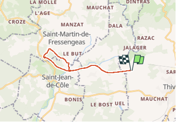
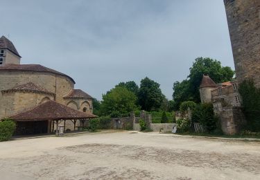
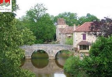
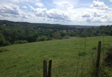
Randonnée Marche de 11,6 km à découvrir à Nouvelle-Aquitaine, Dordogne, Thiviers. Cette randonnée est proposée par Patricew.
Description
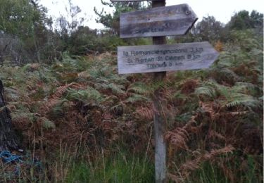
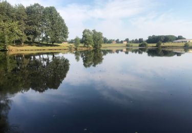
niveau moyen,bien ombragée,jolie
Une grande partie de la randonnée est un aller - retour voie verte, mais la boucle à partir du parking de saint jean est très jolie et ombragée
Localisation
Pays :
France
Région :
Nouvelle-Aquitaine
Département/Province :
Dordogne
Commune :
Thiviers
Localité :
Unknown
Départ:(Dec)
Départ:(UTM)
334999 ; 5032479 (31T) N.
Commentaires
Randonnées à proximité
![Randonnée Marche Saint-Jean-de-Côle - Saint-Jean de colle la côte 12 km - Photo](https://media.geolcdn.com/t/375/260/b7af3448-8976-4374-bf55-0b6f9de554da.jpg&format=jpg&maxdim=2)
![Marche Marche](https://static1.geolcdn.com/sitytour/trail-icons/101.png)
Saint-Jean de colle la côte 12 km
Marche
Facile
(1)
Saint-Jean-de-Côle,
Nouvelle-Aquitaine,
Dordogne,
France
![](/images/other/stat-length.png)
12 km | 14,4 km-effort
2h 51min
![](https://static1.geolcdn.com/siteimages/upload/files/16400158638029165_repeat_loop_refresh_sync_direction_icon.png)
Oui
![Randonnée V.T.T. Thiviers - Thiviers vtt - Photo](https://media.geolcdn.com/t/375/260/df34d907-768b-4b26-a7b5-5ec7cdc86a99.jpg&format=jpg&maxdim=2)
![V.T.T. V.T.T.](https://static1.geolcdn.com/sitytour/trail-icons/202.png)
Thiviers vtt
V.T.T.
Très facile
Thiviers,
Nouvelle-Aquitaine,
Dordogne,
France
![](/images/other/stat-length.png)
48 km | 58 km-effort
6h 2min
![](https://static1.geolcdn.com/siteimages/upload/files/16400158638029165_repeat_loop_refresh_sync_direction_icon.png)
Oui
![Randonnée Marche Saint-Jean-de-Côle - Saint jean de Côle/St Martin - Photo](https://media.geolcdn.com/t/375/260/8665702b-ffe2-48bb-a76f-45247ee7e571.jpg&format=jpg&maxdim=2)
![Marche Marche](https://static1.geolcdn.com/sitytour/trail-icons/101.png)
Saint jean de Côle/St Martin
Marche
Saint-Jean-de-Côle,
Nouvelle-Aquitaine,
Dordogne,
France
![](/images/other/stat-length.png)
12 km | 15,3 km-effort
3h 23min
![](https://static1.geolcdn.com/siteimages/upload/files/16400158638029165_repeat_loop_refresh_sync_direction_icon.png)
Oui
![Randonnée Marche Eyzerac - La Servolle 2 - Photo](https://media.geolcdn.com/t/375/260/ext.jpg?maxdim=2&url=https%3A%2F%2Fservices.sitytrail.com%2FGeolivesWS%2FDownloadMedia.ashx%3FTrailID%3D226050%26Media%3D20131008110344.jpg)
![Marche Marche](https://static1.geolcdn.com/sitytour/trail-icons/101.png)
La Servolle 2
Marche
Facile
Eyzerac,
Nouvelle-Aquitaine,
Dordogne,
France
![](/images/other/stat-length.png)
12,4 km | 14,9 km-effort
3h 16min
![](https://static1.geolcdn.com/siteimages/upload/files/16400158638029165_repeat_loop_refresh_sync_direction_icon.png)
Oui
![Randonnée Marche Saint-Jean-de-Côle - St-Jean de Côle - St-Martin - Photo](https://media.geolcdn.com/t/375/260/143ff9ac-a165-4b59-9523-935f63a9a082.jpg&format=jpg&maxdim=2)
![Marche Marche](https://static1.geolcdn.com/sitytour/trail-icons/101.png)
St-Jean de Côle - St-Martin
Marche
Moyen
Saint-Jean-de-Côle,
Nouvelle-Aquitaine,
Dordogne,
France
![](/images/other/stat-length.png)
5,9 km | 7,3 km-effort
1h 29min
![](https://static1.geolcdn.com/siteimages/upload/files/16400158638029165_repeat_loop_refresh_sync_direction_icon.png)
Oui
![Marche Marche](https://static1.geolcdn.com/sitytour/trail-icons/101.png)
St Martin de Fressengeas
Marche
Moyen
(1)
Saint-Martin-de-Fressengeas,
Nouvelle-Aquitaine,
Dordogne,
France
![](/images/other/stat-length.png)
12,6 km | 16,7 km-effort
4h 46min
![](https://static1.geolcdn.com/siteimages/upload/files/16400158638029165_repeat_loop_refresh_sync_direction_icon.png)
Oui
![Randonnée Marche Saint-Jean-de-Côle - Saint Jean de Côle - Photo](https://media.geolcdn.com/t/375/260/97f1191d-d6a8-4caf-b34c-213f3218b637.jpg&format=jpg&maxdim=2)
![Marche Marche](https://static1.geolcdn.com/sitytour/trail-icons/101.png)
Saint Jean de Côle
Marche
Difficile
Saint-Jean-de-Côle,
Nouvelle-Aquitaine,
Dordogne,
France
![](/images/other/stat-length.png)
13 km | 15,6 km-effort
3h 32min
![](https://static1.geolcdn.com/siteimages/upload/files/16400158638029165_repeat_loop_refresh_sync_direction_icon.png)
Oui
![Randonnée Marche Saint-Jean-de-Côle - 24 Saint-Jean-de-Côle - Photo](https://media.geolcdn.com/t/375/260/ext.jpg?maxdim=2&url=https%3A%2F%2Fservices.sitytrail.com%2FGeolivesWS%2FDownloadMedia.ashx%3FTrailID%3D752771%26Media%3D20170514153645.jpg)
![Marche Marche](https://static1.geolcdn.com/sitytour/trail-icons/101.png)
24 Saint-Jean-de-Côle
Marche
Facile
Saint-Jean-de-Côle,
Nouvelle-Aquitaine,
Dordogne,
France
![](/images/other/stat-length.png)
16,3 km | 20 km-effort
4h 21min
![](https://static1.geolcdn.com/siteimages/upload/files/16400158638029165_repeat_loop_refresh_sync_direction_icon.png)
Non
![Randonnée sport Saint-Martin-de-Fressengeas - Ràndo Bernard saint Martin de fressengeas - Photo](https://media.geolcdn.com/t/375/260/ext.jpg?maxdim=2&url=https%3A%2F%2Fsecurestorage.geolives.com%2Fsitytour%2Ftrail-bg%2Fdefault.jpg)
Ràndo Bernard saint Martin de fressengeas
sport
Très facile
Saint-Martin-de-Fressengeas,
Nouvelle-Aquitaine,
Dordogne,
France
![](/images/other/stat-length.png)
9,1 km | 11,8 km-effort
Inconnu
![](https://static1.geolcdn.com/siteimages/upload/files/16400158638029165_repeat_loop_refresh_sync_direction_icon.png)
Oui