Randonnée Marche Mostuéjouls - Au long du Tarn: de Mostuéjouls à Millau - Photo

Au long du Tarn: de Mostuéjouls à Millau

 canardDenis
canardDenis

Utilisateur

© OpenStreetMap contributors
Longueur
Longueur
22 km
Altitude max
Altitude max
626 m
Dénivelé positif
Dénivelé positif
653 m
Km-Effort
Km-Effort  
31 km
Altitude min
Altitude min
355 m
Dénivelé négatif
Dénivelé négatif
669 m
Boucle
Boucle
Non
Date de création :
2022-06-27 09:35:31.694
Dernière modification :
2022-06-29 13:14:00.363

(0 Avis)

Marche
Marche
6h57
Difficulté : Moyen

Scannez ce code QR pour ouvrir la randonnée dans l'application SityTrail

Application GPS de randonnée GRATUITE

Logo SityTrail SityTrail

IGN / Instituts géographiques

Télécharger SityTrail sur l'App Store Télécharger SityTrail sur Google Play

Logo SityTrail SityTrail World

Le monde est à vous

Télécharger SityTrail sur l'App Store Télécharger SityTrail sur Google Play Télécharger SityTrail sur Huawei AppGallery

À propos

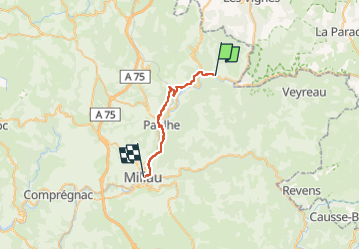
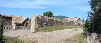
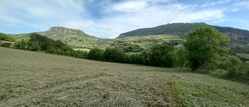
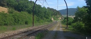
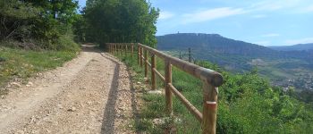
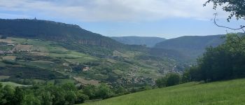
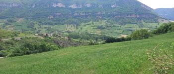
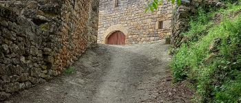
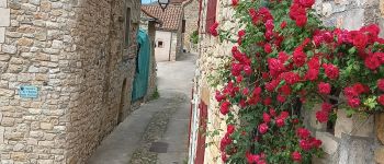
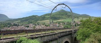
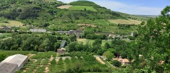
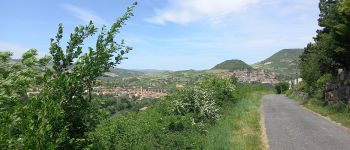
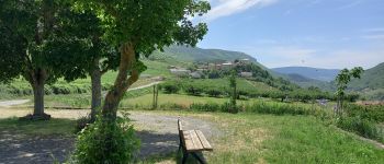
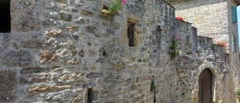
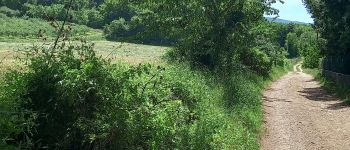
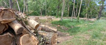
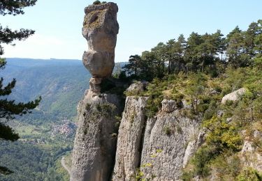
Randonnée Marche de 22 km à découvrir à Occitanie, Aveyron, Mostuéjouls. Cette randonnée est proposée par canardDenis.

Description

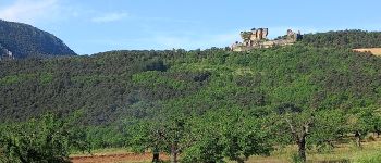
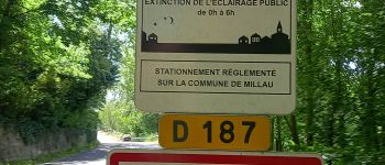
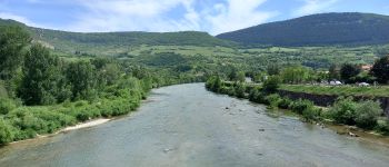
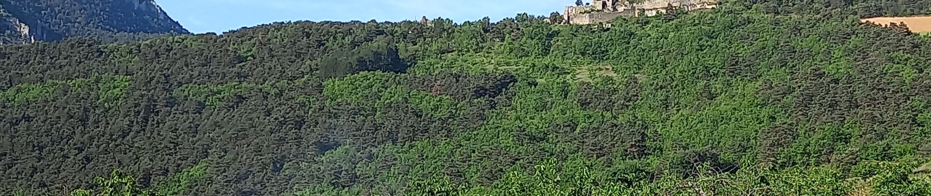
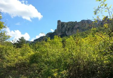
Pour cette septième étape, on s'écarte des circuits plus fréquentés. De la Calquière-Mostuéjouls, visitez la forteresse de Peyrelevade, Compeyre, Aiguessac, passez le Tarn à Paulhe et continuez par Carbassas jusqu'à Millau

Profil altimétrique

Photos

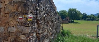
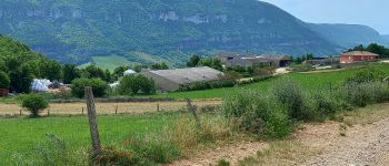
45 photos au total. Cliquez sur une photo pour les afficher toutes dans la galerie.

Points d'intérêt

Point d'intérêt Rivière-sur-Tarn - Embranchement-Boyne - Photo
canardDenis
RIVIÈRE-SUR-TARN 
Point d'intérêt Rivière-sur-Tarn - Château fort de Peyrelade - Photo
canardDenis
RIVIÈRE-SUR-TARN 
Point d'intérêt Rivière-sur-Tarn - sentier derriere château - Photo
canardDenis
RIVIÈRE-SUR-TARN 
Point d'intérêt Rivière-sur-Tarn - croix de Louradou  - Photo
canardDenis
RIVIÈRE-SUR-TARN 
Point d'intérêt Rivière-sur-Tarn - Intersection route - Photo
canardDenis
RIVIÈRE-SUR-TARN 
Point d'intérêt Rivière-sur-Tarn - Intersection route vers Millau(D907) - Photo
canardDenis
Point d'intérêt Rivière-sur-Tarn - tourner à droite rue du Palhie  - Photo
canardDenis
Point d'intérêt Rivière-sur-Tarn - Intersection - Photo
canardDenis
RIVIÈRE-SUR-TARN 
Point d'intérêt Rivière-sur-Tarn - laisser piste à droite  - Photo
canardDenis
RIVIÈRE-SUR-TARN 
Point d'intérêt Rivière-sur-Tarn - passage à niveau chemin de fer - Photo
canardDenis
Point d'intérêt Compeyre - balisage GR - Photo
canardDenis
COMPEYRE 
Point d'intérêt Compeyre - Intersection - Photo
canardDenis
COMPEYRE 
Point d'intérêt Compeyre - Les Combes - Photo
canardDenis
COMPEYRE 
Point d'intérêt Compeyre - Soulacroup - Photo
canardDenis
COMPEYRE 
Point d'intérêt Compeyre - sentier-à-gauche - Photo
canardDenis
Point d'intérêt Compeyre - Intersection pistes - Photo
canardDenis
Point d'intérêt Compeyre - Compeyre-Entrée - Photo
canardDenis
Point d'intérêt Compeyre - Compeyre  - Photo
canardDenis
COMPEYRE 
Point d'intérêt Compeyre - passage à niveau  - Photo
canardDenis
Point d'intérêt Aguessac - pont vers Paulhe - Photo
canardDenis
Point d'intérêt Paulhe - Paulhe - Photo
canardDenis
PAULHE 
Point d'intérêt Paulhe - Route vers Carbassas - Photo
canardDenis
Point d'intérêt Paulhe - cimetière Paulhe-Carbassas - Photo
canardDenis
Point d'intérêt Paulhe - Carbassas - Photo
canardDenis
PAULHE 
Point d'intérêt Paulhe - piste GR-VTT-Trail - Photo
canardDenis
Point d'intérêt Millau - Intersection de pistes - Photo
canardDenis
Point d'intérêt Millau - Sentier à droite - Photo
canardDenis
Point d'intérêt Millau - Mas Rougnous - Photo
canardDenis
MILLAU 
Point d'intérêt Millau - Jonction Rte D187 - Photo
canardDenis
Point d'intérêt Millau - Millau-limite commune - Photo
canardDenis
Point d'intérêt Millau - Déboisage - Photo
canardDenis
MILLAU 
Point d'intérêt Millau - pont de Millau - Photo
canardDenis

Localisation

Pays :
France
Région :
Occitanie
Département/Province :
Aveyron
Commune :
Mostuéjouls
Localité :
Unknown
Départ:(Dec)
Départ:(UTM)
514167 ; 4894212 (31T) N.

Randonnées à proximité

Randonnée Marche Le Rozier - 12 vase de Sèvres Chine ch. brunet - Photo
Marche
GUIDE
randodyssée

Marche

Moyen
(1)
Le Rozier, Occitanie, Lozère, France
10,1 km | 18,8 km-effort
5h 40min
Oui
Randonnée Marche Mostuéjouls - Cirque de Saint Marcellin - Mostuéjouls - Liaucous - Photo
Marche
tracegps

Marche

Moyen
(1)
Mostuéjouls, Occitanie, Aveyron, France
15,4 km | 24 km-effort
5h 0min
Oui
Randonnée Marche Le Rozier - Causse et gorges au pays des vautours  - Photo
Marche
GUIDE
nadinebondoux

Marche

Difficile
Le Rozier, Occitanie, Lozère, France
27 km | 40 km-effort
7h 48min
Non
Randonnée Marche Rivière-sur-Tarn - Rivière-sur-Tarn - Château Peyrelade - 9.9km 400m 3h30 (40mn) - 2016 09 09 - Photo
Marche
GUIDE
Orcal37

Marche

Moyen
Rivière-sur-Tarn, Occitanie, Aveyron, France
9,9 km | 15,2 km-effort
3h 30min
Oui
Randonnée Marche Peyreleau - Peyreleau - Corniches du Causse Noir - 12.5km 650m 6h40 (1h) - 2016 09 06 - Photo
Marche
GUIDE
Orcal37

Marche

Difficile
Peyreleau, Occitanie, Aveyron, France
12,5 km | 21 km-effort
6h 40min
Oui
Randonnée Marche Mostuéjouls - Liaucous - St-Marcellin (AR) - 14.3km 510m 4h50 (45mn) - 2016 07 04 - Photo
Marche
GUIDE
Orcal37

Marche

Moyen
Mostuéjouls, Occitanie, Aveyron, France
14,3 km | 21 km-effort
4h 50min
Oui
Randonnée Marche Saint-Pierre-des-Tripiers - Les corniches du Méjean - Photo
Marche
ZURMELY

Marche

Moyen
(3)
Saint-Pierre-des-Tripiers, Occitanie, Lozère, France
6 km | 9,5 km-effort
2h 31min
Oui
Randonnée Marche Peyreleau - Peyreleau - Gorges de la Jonte - 9km 295m 3h25 (40mn) - 2014 09 09 - Photo
Marche
GUIDE
Orcal37

Marche

Facile
Peyreleau, Occitanie, Aveyron, France
9 km | 12,9 km-effort
3h 25min
Oui
Randonnée Marche Le Rozier - Le Rozier - Causse Méjean Gorges du Tarn et de la Jonte - 12.5km 750m 4h50 (1h20) - 2014 09 07 - Photo
Marche
GUIDE
Orcal37

Marche

Difficile
Le Rozier, Occitanie, Lozère, France
12,5 km | 23 km-effort
4h 50min
Oui


Fermer
Mes abonnements