

GR341-Quistinic "la grange à Marie" Kerléguennec-Bubry

AHervé56
Utilisateur


4h46
Difficulté : Très difficile

Application GPS de randonnée GRATUITE
À propos
Randonnée Marche de 17,8 km à découvrir à Bretagne, Morbihan, Quistinic. Cette randonnée est proposée par AHervé56.
Description
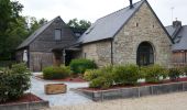
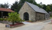
Départ du gite "La grange à Marie" ( que je recommande vivement pour l'accueil, le confort et la convivialité) de Kerléguennec vers Bubry.
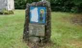
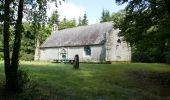
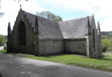
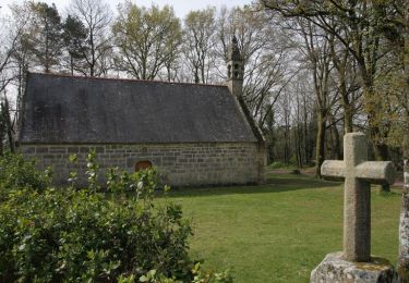
Détour du GR341 au niveau de Helleguy pour se rendre à la chapelle du cloître qui fut une infirmerie de la résistance pendant la 2ème guerre mondiale et où 14 résistants ont été fusillés par les nazis. Le site est doté de tables de pique-nique et est ombragé.
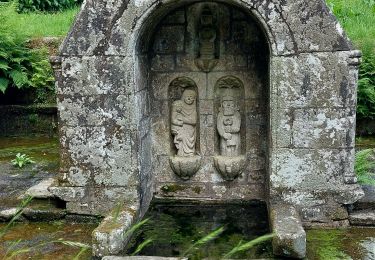
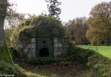
Une belle fontaine se trouve en bas de la colline.
Photos
 "
data-pinterest-text="Pin it"
data-tweet-text="share on twitter"
data-facebook-share-url="https://www.sitytrail.com/fr/trails/3292356-quistinic--gr341xquistinic-xla-grange-a-mariex-kerleguennecxbubry/?photo=1#lg=1&slide=1"
data-twitter-share-url="https://www.sitytrail.com/fr/trails/3292356-quistinic--gr341xquistinic-xla-grange-a-mariex-kerleguennecxbubry/?photo=1#lg=1&slide=1"
data-googleplus-share-url="https://www.sitytrail.com/fr/trails/3292356-quistinic--gr341xquistinic-xla-grange-a-mariex-kerleguennecxbubry/?photo=1#lg=1&slide=1"
data-pinterest-share-url="https://www.sitytrail.com/fr/trails/3292356-quistinic--gr341xquistinic-xla-grange-a-mariex-kerleguennecxbubry/?photo=1#lg=1&slide=1">
 "
data-pinterest-text="Pin it"
data-tweet-text="share on twitter"
data-facebook-share-url="https://www.sitytrail.com/fr/trails/3292356-quistinic--gr341xquistinic-xla-grange-a-mariex-kerleguennecxbubry/?photo=2#lg=1&slide=2"
data-twitter-share-url="https://www.sitytrail.com/fr/trails/3292356-quistinic--gr341xquistinic-xla-grange-a-mariex-kerleguennecxbubry/?photo=2#lg=1&slide=2"
data-googleplus-share-url="https://www.sitytrail.com/fr/trails/3292356-quistinic--gr341xquistinic-xla-grange-a-mariex-kerleguennecxbubry/?photo=2#lg=1&slide=2"
data-pinterest-share-url="https://www.sitytrail.com/fr/trails/3292356-quistinic--gr341xquistinic-xla-grange-a-mariex-kerleguennecxbubry/?photo=2#lg=1&slide=2">
 "
data-pinterest-text="Pin it"
data-tweet-text="share on twitter"
data-facebook-share-url="https://www.sitytrail.com/fr/trails/3292356-quistinic--gr341xquistinic-xla-grange-a-mariex-kerleguennecxbubry/?photo=3#lg=1&slide=3"
data-twitter-share-url="https://www.sitytrail.com/fr/trails/3292356-quistinic--gr341xquistinic-xla-grange-a-mariex-kerleguennecxbubry/?photo=3#lg=1&slide=3"
data-googleplus-share-url="https://www.sitytrail.com/fr/trails/3292356-quistinic--gr341xquistinic-xla-grange-a-mariex-kerleguennecxbubry/?photo=3#lg=1&slide=3"
data-pinterest-share-url="https://www.sitytrail.com/fr/trails/3292356-quistinic--gr341xquistinic-xla-grange-a-mariex-kerleguennecxbubry/?photo=3#lg=1&slide=3">
 "
data-pinterest-text="Pin it"
data-tweet-text="share on twitter"
data-facebook-share-url="https://www.sitytrail.com/fr/trails/3292356-quistinic--gr341xquistinic-xla-grange-a-mariex-kerleguennecxbubry/?photo=4#lg=1&slide=4"
data-twitter-share-url="https://www.sitytrail.com/fr/trails/3292356-quistinic--gr341xquistinic-xla-grange-a-mariex-kerleguennecxbubry/?photo=4#lg=1&slide=4"
data-googleplus-share-url="https://www.sitytrail.com/fr/trails/3292356-quistinic--gr341xquistinic-xla-grange-a-mariex-kerleguennecxbubry/?photo=4#lg=1&slide=4"
data-pinterest-share-url="https://www.sitytrail.com/fr/trails/3292356-quistinic--gr341xquistinic-xla-grange-a-mariex-kerleguennecxbubry/?photo=4#lg=1&slide=4">
 "
data-pinterest-text="Pin it"
data-tweet-text="share on twitter"
data-facebook-share-url="https://www.sitytrail.com/fr/trails/3292356-quistinic--gr341xquistinic-xla-grange-a-mariex-kerleguennecxbubry/?photo=5#lg=1&slide=5"
data-twitter-share-url="https://www.sitytrail.com/fr/trails/3292356-quistinic--gr341xquistinic-xla-grange-a-mariex-kerleguennecxbubry/?photo=5#lg=1&slide=5"
data-googleplus-share-url="https://www.sitytrail.com/fr/trails/3292356-quistinic--gr341xquistinic-xla-grange-a-mariex-kerleguennecxbubry/?photo=5#lg=1&slide=5"
data-pinterest-share-url="https://www.sitytrail.com/fr/trails/3292356-quistinic--gr341xquistinic-xla-grange-a-mariex-kerleguennecxbubry/?photo=5#lg=1&slide=5">
Localisation
Commentaires
Randonnées à proximité
A pied

Marche


Marche

Marche

Marche

Marche


Cheval

Cheval

Cheval


 SityTrail


