![](/images/other/stat-length.png)
![Randonnée Cheval Saint-Léger-en-Yvelines - Les Bréviaires Plaine - Photo](https://media.geolcdn.com/t/1900/400/ext.pjpeg?maxdim=2&url=https%3A%2F%2Fstatic1.geolcdn.com%2Fsiteimages%2Fupload%2Ffiles%2F1524743154cheval.jpg)
Les Bréviaires Plaine
Murielle.g7
Utilisateur
![Longueur](/images/other/stat-length.png)
Longueur
24 km
![Altitude max](https://static1.geolcdn.com/siteimages/upload/files/1508320355ic_sort_altitude_max_24dp.png)
Altitude max
194 m
![Dénivelé positif](https://static1.geolcdn.com/siteimages/upload/files/1508320355ic_sort_den_pos_24dp.png)
Dénivelé positif
191 m
![Km-Effort](/images/other/stat-length.png)
Km-Effort
26 km
![Altitude min](https://static1.geolcdn.com/siteimages/upload/files/1508320355ic_sort_altitude_min_24dp.png)
Altitude min
163 m
![Dénivelé négatif](https://static1.geolcdn.com/siteimages/upload/files/1508320355ic_sort_den_neg_24dp.png)
Dénivelé négatif
191 m
![Boucle](https://static1.geolcdn.com/siteimages/upload/files/16400158638029165_repeat_loop_refresh_sync_direction_icon.png)
Boucle
Oui
Date de création :
2014-12-10 00:00:00.0
Dernière modification :
2014-12-10 00:00:00.0
![Cheval](https://static1.geolcdn.com/sitytour/trail-icons/300.png)
3h19
Difficulté : Inconnu
![Scannez ce code QR pour ouvrir la randonnée dans l'application SityTrail](https://capi.geolives.com/qq0zvz2zws4bq2lad0pu/sitytour/trails/328326/qr.png?size=200)
Application GPS de randonnée GRATUITE
À propos
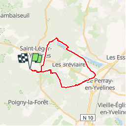
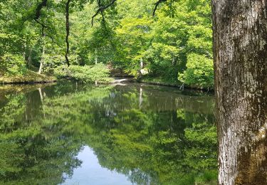
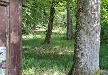
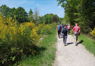
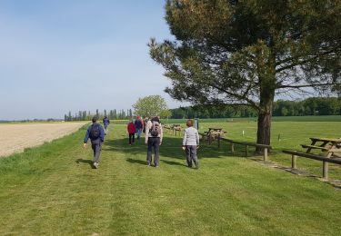
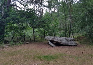
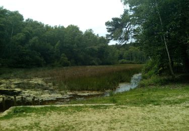
Randonnée Cheval de 24 km à découvrir à Île-de-France, Yvelines, Saint-Léger-en-Yvelines. Cette randonnée est proposée par Murielle.g7.
Description
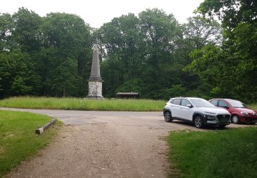
Un bon tour, bons terrains, un peu chaud en plaine et des chevaux pas trop fiers devant la piste d’aéromodélisme ou des avions décollaient !
Localisation
Pays :
France
Région :
Île-de-France
Département/Province :
Yvelines
Commune :
Saint-Léger-en-Yvelines
Localité :
Unknown
Départ:(Dec)
Départ:(UTM)
408515 ; 5395569 (31U) N.
Commentaires
Randonnées à proximité
![Randonnée Marche Saint-Léger-en-Yvelines - Yvelines_Croix-Vilpert=>Rochers-d'Angennes=>Petit-Etang-Neuf - Photo](https://media.geolcdn.com/t/375/260/6d489e7d-9a8c-4142-91a9-ca62eb9af4d0.jpg&format=jpg&maxdim=2)
![Marche Marche](https://static1.geolcdn.com/sitytour/trail-icons/101.png)
Yvelines_Croix-Vilpert=>Rochers-d'Angennes=>Petit-Etang-Neuf
Marche
Moyen
(1)
Saint-Léger-en-Yvelines,
Île-de-France,
Yvelines,
France
![](/images/other/stat-length.png)
21 km | 25 km-effort
3h 35min
![](https://static1.geolcdn.com/siteimages/upload/files/16400158638029165_repeat_loop_refresh_sync_direction_icon.png)
Oui
![Randonnée V.T.T. Rambouillet - _Les étangs de Hollande - Photo](https://media.geolcdn.com/t/375/260/ext.jpg?maxdim=2&url=https%3A%2F%2Fservices.sitytrail.com%2FGeolivesWS%2FDownloadMedia.ashx%3FTrailID%3D800162%26Media%3D52612154-f602-4842-8786-57578e341d5c.jpg)
![V.T.T. V.T.T.](https://static1.geolcdn.com/sitytour/trail-icons/202.png)
_Les étangs de Hollande
V.T.T.
Moyen
(2)
Rambouillet,
Île-de-France,
Yvelines,
France
![](/images/other/stat-length.png)
29 km | 33 km-effort
2h 9min
![](https://static1.geolcdn.com/siteimages/upload/files/16400158638029165_repeat_loop_refresh_sync_direction_icon.png)
Oui
![Randonnée Marche Poigny-la-Forêt - Sortie du 25/06/2015 - Photo](https://media.geolcdn.com/t/375/260/ext.jpg?maxdim=2&url=https%3A%2F%2Fservices.sitytrail.com%2FGeolivesWS%2FDownloadMedia.ashx%3FTrailID%3D438058%26Media%3Dfix__20150625121933.jpg)
![Marche Marche](https://static1.geolcdn.com/sitytour/trail-icons/101.png)
Sortie du 25/06/2015
Marche
Moyen
(1)
Poigny-la-Forêt,
Île-de-France,
Yvelines,
France
![](/images/other/stat-length.png)
12,5 km | 14,6 km-effort
3h 13min
![](https://static1.geolcdn.com/siteimages/upload/files/16400158638029165_repeat_loop_refresh_sync_direction_icon.png)
Oui
![Randonnée Marche Poigny-la-Forêt - poigny - Photo](https://media.geolcdn.com/t/375/260/4048684d-3aec-49d6-ad34-88a4a7b23eb9.jpg&format=jpg&maxdim=2)
![Marche Marche](https://static1.geolcdn.com/sitytour/trail-icons/101.png)
poigny
Marche
Très facile
(1)
Poigny-la-Forêt,
Île-de-France,
Yvelines,
France
![](/images/other/stat-length.png)
13,9 km | 15,7 km-effort
3h 11min
![](https://static1.geolcdn.com/siteimages/upload/files/16400158638029165_repeat_loop_refresh_sync_direction_icon.png)
Oui
![Randonnée Marche Poigny-la-Forêt - Rochers d'Angennes Yvelines - Photo](https://media.geolcdn.com/t/375/260/84e3942c-3b91-4957-8e21-15467325743e.jpg&format=jpg&maxdim=2)
![Marche Marche](https://static1.geolcdn.com/sitytour/trail-icons/101.png)
Rochers d'Angennes Yvelines
Marche
Moyen
Poigny-la-Forêt,
Île-de-France,
Yvelines,
France
![](/images/other/stat-length.png)
6,3 km | 7,6 km-effort
1h 58min
![](https://static1.geolcdn.com/siteimages/upload/files/16400158638029165_repeat_loop_refresh_sync_direction_icon.png)
Oui
![Randonnée Marche Rambouillet - 2022-05-01_EtangCoupeGorge_MaresDeVilpert - Photo](https://media.geolcdn.com/t/375/260/d83fd5ca-af67-44e9-9faf-d4f46e427b71.jpg&format=jpg&maxdim=2)
![Marche Marche](https://static1.geolcdn.com/sitytour/trail-icons/101.png)
2022-05-01_EtangCoupeGorge_MaresDeVilpert
Marche
Facile
Rambouillet,
Île-de-France,
Yvelines,
France
![](/images/other/stat-length.png)
11,2 km | 12,3 km-effort
2h 34min
![](https://static1.geolcdn.com/siteimages/upload/files/16400158638029165_repeat_loop_refresh_sync_direction_icon.png)
Oui
![Randonnée Marche Rambouillet - 2022-05-01_ EtangCoupeGorge_EtangsDeHollande - Photo](https://media.geolcdn.com/t/375/260/98fd7541-1073-4e75-a91f-288b568a2179.jpg&format=jpg&maxdim=2)
![Marche Marche](https://static1.geolcdn.com/sitytour/trail-icons/101.png)
2022-05-01_ EtangCoupeGorge_EtangsDeHollande
Marche
Facile
Rambouillet,
Île-de-France,
Yvelines,
France
![](/images/other/stat-length.png)
14,9 km | 16,4 km-effort
3h 19min
![](https://static1.geolcdn.com/siteimages/upload/files/16400158638029165_repeat_loop_refresh_sync_direction_icon.png)
Oui
![Randonnée Marche Saint-Léger-en-Yvelines - Saint Léger en Yvelines - Le Perray en Yvelines - Photo](https://media.geolcdn.com/t/375/260/12e7c091-5dfb-494c-a01e-255d1b9f37f3.jpg&format=jpg&maxdim=2)
![Marche Marche](https://static1.geolcdn.com/sitytour/trail-icons/101.png)
Saint Léger en Yvelines - Le Perray en Yvelines
Marche
Facile
Saint-Léger-en-Yvelines,
Île-de-France,
Yvelines,
France
![](/images/other/stat-length.png)
24 km | 28 km-effort
5h 34min
![](https://static1.geolcdn.com/siteimages/upload/files/16400158638029165_repeat_loop_refresh_sync_direction_icon.png)
Non
![Randonnée Marche Poigny-la-Forêt - Poigny la forêt - Photo](https://media.geolcdn.com/t/375/260/b0786c16-338b-4af3-9f14-5f27a0350f88.jpg&format=jpg&maxdim=2)
![Marche Marche](https://static1.geolcdn.com/sitytour/trail-icons/101.png)
Poigny la forêt
Marche
Facile
Poigny-la-Forêt,
Île-de-France,
Yvelines,
France
![](/images/other/stat-length.png)
18,9 km | 22 km-effort
5h 13min
![](https://static1.geolcdn.com/siteimages/upload/files/16400158638029165_repeat_loop_refresh_sync_direction_icon.png)
Oui