


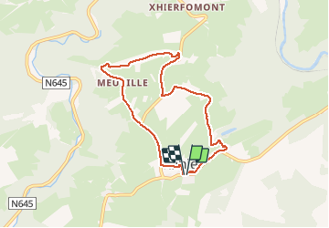

6,1 km | 8,9 km-effort


Utilisateur


Application GPS de randonnée GRATUITE
 SityTrail
IGN / Instituts géographiques
SityTrail World
Le monde est à vous
Randonnée Marche de 6,8 km à découvrir à Wallonie, Liège, Stoumont. Cette randonnée est proposée par lucspa.
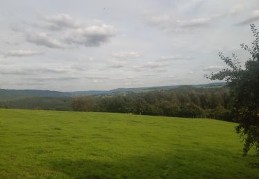
Promenade des 5km de l'ADEPS du 27 juillet 2014. Superbe point de vue sur la Vallée de l'Amblève dans le région de Stoumont. L'arrivée se fait par un champs,je suppose que ce passage est temporaire.

Marche

Marche

Marche

Marche

Marche

Marche
Marche

Marche
Marche
some steep climbs, beautiful vistas over Amblève valley.