Randonnée Cyclotourisme Vohburg an der Donau - Volburg Regenburg - Photo
 pierrebourhis
pierrebourhis

Utilisateur

© OpenStreetMap contributors
Longueur
Longueur
73 km
Altitude max
Altitude max
480 m
Dénivelé positif
Dénivelé positif
653 m
Km-Effort
Km-Effort  
82 km
Altitude min
Altitude min
308 m
Dénivelé négatif
Dénivelé négatif
677 m
Boucle
Boucle
Non
Date de création :
2022-06-11 05:58:45.0
Dernière modification :
2022-06-11 18:06:41.849

(0 Avis)

Cyclotourisme
Cyclotourisme
8h43
Difficulté : Moyen

Scannez ce code QR pour ouvrir la randonnée dans l'application SityTrail

Application GPS de randonnée GRATUITE

Logo SityTrail SityTrail

IGN / Instituts géographiques

Télécharger SityTrail sur l'App Store Télécharger SityTrail sur Google Play

Logo SityTrail SityTrail World

Le monde est à vous

Télécharger SityTrail sur l'App Store Télécharger SityTrail sur Google Play Télécharger SityTrail sur Huawei AppGallery

À propos

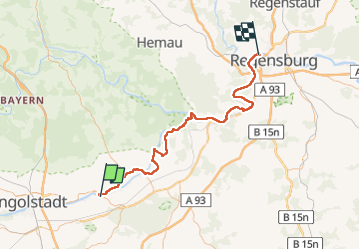
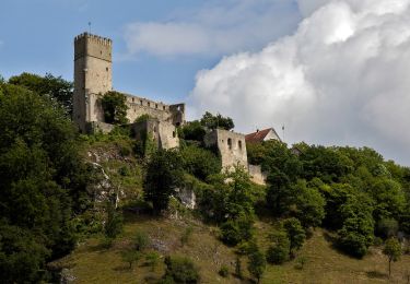
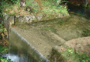
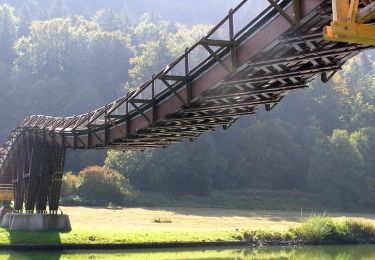
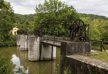
Randonnée Cyclotourisme de 73 km à découvrir à Bavière, Landkreis Pfaffenhofen an der Ilm, Vohburg an der Donau. Cette randonnée est proposée par pierrebourhis.

Profil altimétrique

Localisation

Pays :
Allemagne
Région :
Bavière
Département/Province :
Landkreis Pfaffenhofen an der Ilm
Commune :
Vohburg an der Donau
Localité :
Unknown
Départ:(Dec)
Départ:(UTM)
692599 ; 5405505 (32U) N.

Randonnées à proximité

Randonnée A pied Kösching - Rundweg Kösching 6 - Photo
A pied
GUIDE+

A pied

Facile
Kösching, Bavière, Landkreis Eichstätt, Allemagne
3,5 km | 4,7 km-effort
1h 4min
Non
Randonnée A pied Kösching - Rundweg Kösching 5 - Photo
A pied
GUIDE+

A pied

Facile
Kösching, Bavière, Landkreis Eichstätt, Allemagne
8 km | 10,1 km-effort
2h 17min
Non
Randonnée A pied Kösching - Rundweg Kösching 3 - Photo
A pied
GUIDE+

A pied

Facile
Kösching, Bavière, Landkreis Eichstätt, Allemagne
6,3 km | 8,1 km-effort
1h 49min
Non
Randonnée A pied Kösching - Rundweg Kösching 2 - Photo
A pied
GUIDE+

A pied

Facile
Kösching, Bavière, Landkreis Eichstätt, Allemagne
4,1 km | 5,1 km-effort
1h 9min
Non
Randonnée A pied Essing - Rundweg Essing 21 - Photo
A pied
GUIDE+

A pied

Facile
Essing, Bavière, Landkreis Kelheim, Allemagne
6,9 km | 9,8 km-effort
2h 13min
Non
Randonnée A pied Essing - Rundweg Essing 6 - Photo
A pied
GUIDE+

A pied

Facile
Essing, Bavière, Landkreis Kelheim, Allemagne
12,9 km | 17,3 km-effort
3h 56min
Non
Randonnée A pied Hienheimer Forst - Rundweg Essing 5 - Photo
A pied
GUIDE+

A pied

Facile
Hienheimer Forst, Bavière, Landkreis Kelheim, Allemagne
6 km | 7,9 km-effort
1h 47min
Non
Randonnée A pied Essing - Rundweg Essing 4 - Photo
A pied
GUIDE+

A pied

Facile
Essing, Bavière, Landkreis Kelheim, Allemagne
6,8 km | 8,9 km-effort
2h 1min
Oui
Randonnée A pied Riedenburg - Rundweg Essing 3 - Photo
A pied
GUIDE+

A pied

Facile
Riedenburg, Bavière, Landkreis Kelheim, Allemagne
11,4 km | 15,1 km-effort
3h 25min
Oui


Fermer
Mes abonnements