![](/images/other/stat-length.png)
![Randonnée Vélo de route Arzenc-de-Randon - lac de Charpal - Photo](https://media.geolcdn.com/t/1900/400/3f7c5fe6-3e82-45cc-b69f-ed6645d295d6.jpg&format=pjpeg&maxdim=2)
lac de Charpal
nadd73
Utilisateur GUIDE
![Longueur](/images/other/stat-length.png)
Longueur
38 km
![Altitude max](https://static1.geolcdn.com/siteimages/upload/files/1508320355ic_sort_altitude_max_24dp.png)
Altitude max
1434 m
![Dénivelé positif](https://static1.geolcdn.com/siteimages/upload/files/1508320355ic_sort_den_pos_24dp.png)
Dénivelé positif
659 m
![Km-Effort](/images/other/stat-length.png)
Km-Effort
47 km
![Altitude min](https://static1.geolcdn.com/siteimages/upload/files/1508320355ic_sort_altitude_min_24dp.png)
Altitude min
1171 m
![Dénivelé négatif](https://static1.geolcdn.com/siteimages/upload/files/1508320355ic_sort_den_neg_24dp.png)
Dénivelé négatif
659 m
![Boucle](https://static1.geolcdn.com/siteimages/upload/files/16400158638029165_repeat_loop_refresh_sync_direction_icon.png)
Boucle
Oui
Date de création :
2022-06-10 13:24:49.886
Dernière modification :
2022-06-11 07:49:23.578
![Vélo de route](https://static1.geolcdn.com/sitytour/trail-icons/201.png)
3h12
Difficulté : Facile
![Scannez ce code QR pour ouvrir la randonnée dans l'application SityTrail](https://capi.geolives.com/qq0zvz2zws4bq2lad0pu/sitytour/trails/3277591/qr.png?size=200)
Application GPS de randonnée GRATUITE
À propos
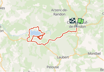
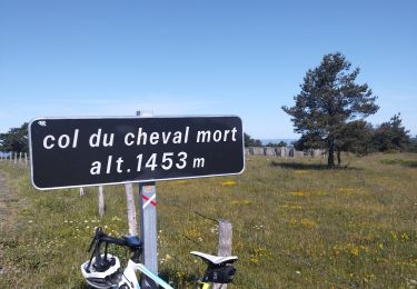
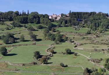
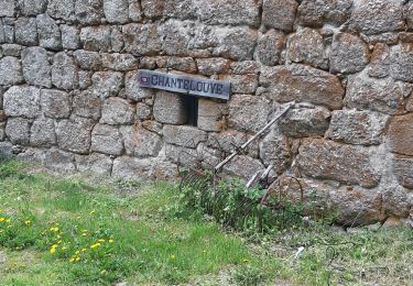
Randonnée Vélo de route de 38 km à découvrir à Occitanie, Lozère, Arzenc-de-Randon. Cette randonnée est proposée par nadd73.
Description
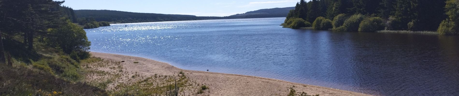
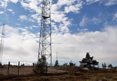
Avec quelques tours et détours à ne pas faire. Sinon très joli lac, un spot pour les pêcheurs. La route pour y accéder Est très vallonnée.
Localisation
Pays :
France
Région :
Occitanie
Département/Province :
Lozère
Commune :
Arzenc-de-Randon
Localité :
Unknown
Départ:(Dec)
Départ:(UTM)
553377 ; 4942644 (31T) N.
Commentaires
Randonnées à proximité
![Randonnée Vélo de route Châteauneuf-de-Randon - col du cheval mort - Photo](https://media.geolcdn.com/t/375/260/7aff11be-1e32-4bec-9331-ac96b472b4cf.jpg&format=jpg&maxdim=2)
![Vélo de route Vélo de route](https://static1.geolcdn.com/sitytour/trail-icons/201.png)
col du cheval mort
Vélo de route
Moyen
Châteauneuf-de-Randon,
Occitanie,
Lozère,
France
![](/images/other/stat-length.png)
52 km | 63 km-effort
2h 36min
![](https://static1.geolcdn.com/siteimages/upload/files/16400158638029165_repeat_loop_refresh_sync_direction_icon.png)
Oui
![Randonnée Vélo électrique Arzenc-de-Randon - AUBRAC 3dle étape - Photo](https://media.geolcdn.com/t/375/260/d376c1b4-9c6e-4202-afd1-aac42f285ca4.jpg&format=jpg&maxdim=2)
![Vélo électrique Vélo électrique](https://static1.geolcdn.com/sitytour/trail-icons/205.png)
AUBRAC 3dle étape
Vélo électrique
Moyen
Arzenc-de-Randon,
Occitanie,
Lozère,
France
![](/images/other/stat-length.png)
74 km | 89 km-effort
8h 5min
![](https://static1.geolcdn.com/siteimages/upload/files/16400158638029165_repeat_loop_refresh_sync_direction_icon.png)
Non
![Randonnée Randonnée équestre Châteauneuf-de-Randon - 2022-09-18 Rando CVA Lozere Chateauneuf de Randon vers Chasserades - Photo](https://media.geolcdn.com/t/375/260/4de9d141-8b47-4780-80cf-3f0f751d0dba.jpg&format=jpg&maxdim=2)
![Randonnée équestre Randonnée équestre](https://static1.geolcdn.com/sitytour/trail-icons/301.png)
2022-09-18 Rando CVA Lozere Chateauneuf de Randon vers Chasserades
Randonnée équestre
Moyen
Châteauneuf-de-Randon,
Occitanie,
Lozère,
France
![](/images/other/stat-length.png)
31 km | 42 km-effort
5h 20min
![](https://static1.geolcdn.com/siteimages/upload/files/16400158638029165_repeat_loop_refresh_sync_direction_icon.png)
Non
![Randonnée Marche Arzenc-de-Randon - Arzenc de Rendon - Photo](https://media.geolcdn.com/t/375/260/884848ea-c75f-40b5-bbe1-9d52dd42c755.jpg&format=jpg&maxdim=2)
![Marche Marche](https://static1.geolcdn.com/sitytour/trail-icons/101.png)
Arzenc de Rendon
Marche
Facile
Arzenc-de-Randon,
Occitanie,
Lozère,
France
![](/images/other/stat-length.png)
10,6 km | 14,5 km-effort
3h 9min
![](https://static1.geolcdn.com/siteimages/upload/files/16400158638029165_repeat_loop_refresh_sync_direction_icon.png)
Oui
![Randonnée Marche Châteauneuf-de-Randon - CHATEAUNEUF DE RANDON vers LE PIC DE FORTUNIO - Photo](https://media.geolcdn.com/t/375/260/c12376eb-b4e0-491b-bdc5-bb7632689f13.jpg&format=jpg&maxdim=2)
![Marche Marche](https://static1.geolcdn.com/sitytour/trail-icons/101.png)
CHATEAUNEUF DE RANDON vers LE PIC DE FORTUNIO
Marche
Difficile
Châteauneuf-de-Randon,
Occitanie,
Lozère,
France
![](/images/other/stat-length.png)
17,6 km | 25 km-effort
6h 38min
![](https://static1.geolcdn.com/siteimages/upload/files/16400158638029165_repeat_loop_refresh_sync_direction_icon.png)
Non
![Randonnée Randonnée équestre Châteauneuf-de-Randon - Etoile Etoile du Château Hotel de la Poste - Photo](https://media.geolcdn.com/t/375/260/ext.jpg?maxdim=2&url=https%3A%2F%2Fstatic1.geolcdn.com%2Fsiteimages%2Fupload%2Ffiles%2F1524743154cheval.jpg)
![Randonnée équestre Randonnée équestre](https://static1.geolcdn.com/sitytour/trail-icons/301.png)
Etoile Etoile du Château Hotel de la Poste
Randonnée équestre
Facile
Châteauneuf-de-Randon,
Occitanie,
Lozère,
France
![](/images/other/stat-length.png)
32 km | 41 km-effort
2h 28min
![](https://static1.geolcdn.com/siteimages/upload/files/16400158638029165_repeat_loop_refresh_sync_direction_icon.png)
Oui
![Randonnée Vélo électrique Châteauneuf-de-Randon - Tour du Fortunio - Photo](https://media.geolcdn.com/t/375/260/ext.jpg?maxdim=2&url=https%3A%2F%2Fstatic1.geolcdn.com%2Fsiteimages%2Fupload%2Ffiles%2F1524743154velo.jpg)
![Vélo électrique Vélo électrique](https://static1.geolcdn.com/sitytour/trail-icons/205.png)
Tour du Fortunio
Vélo électrique
Moyen
Châteauneuf-de-Randon,
Occitanie,
Lozère,
France
![](/images/other/stat-length.png)
48 km | 59 km-effort
3h 43min
![](https://static1.geolcdn.com/siteimages/upload/files/16400158638029165_repeat_loop_refresh_sync_direction_icon.png)
Oui
![Randonnée Camping-car Laubert - larzalier - Photo](https://media.geolcdn.com/t/375/260/ext.jpg?maxdim=2&url=https%3A%2F%2Fstatic1.geolcdn.com%2Fsiteimages%2Fupload%2Ffiles%2F15247431544x4.jpg)
![Camping-car Camping-car](https://static1.geolcdn.com/sitytour/trail-icons/405.png)
larzalier
Camping-car
Très facile
Laubert,
Occitanie,
Lozère,
France
![](/images/other/stat-length.png)
9,5 km | 11,1 km-effort
12min
![](https://static1.geolcdn.com/siteimages/upload/files/16400158638029165_repeat_loop_refresh_sync_direction_icon.png)
Non
![Randonnée Quad Arzenc-de-Randon - boucle chateauneuf de randon - Photo](https://media.geolcdn.com/t/375/260/ext.jpg?maxdim=2&url=https%3A%2F%2Fstatic1.geolcdn.com%2Fsiteimages%2Fupload%2Ffiles%2F15247431544x4.jpg)
![Quad Quad](https://static1.geolcdn.com/sitytour/trail-icons/404.png)
boucle chateauneuf de randon
Quad
Très facile
Arzenc-de-Randon,
Occitanie,
Lozère,
France
![](/images/other/stat-length.png)
134 km | 178 km-effort
10h 27min
![](https://static1.geolcdn.com/siteimages/upload/files/16400158638029165_repeat_loop_refresh_sync_direction_icon.png)
Oui