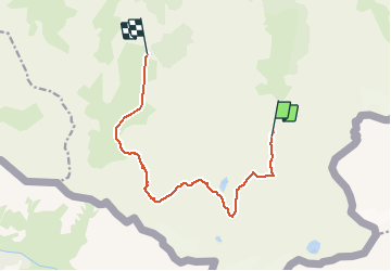
![](/images/other/stat-length.png)
![Randonnée Marche Val-Cenis - Circuit Ambin Etache - Photo](https://media.geolcdn.com/t/1900/400/ext.pjpeg?maxdim=2&url=https%3A%2F%2Fstatic1.geolcdn.com%2Fsiteimages%2Fupload%2Ffiles%2F1553511878bg_sport_marche.png)
Circuit Ambin Etache
GGsavoie
Utilisateur
![Longueur](/images/other/stat-length.png)
![Altitude max](https://static1.geolcdn.com/siteimages/upload/files/1508320355ic_sort_altitude_max_24dp.png)
![Dénivelé positif](https://static1.geolcdn.com/siteimages/upload/files/1508320355ic_sort_den_pos_24dp.png)
![Km-Effort](/images/other/stat-length.png)
![Altitude min](https://static1.geolcdn.com/siteimages/upload/files/1508320355ic_sort_altitude_min_24dp.png)
![Dénivelé négatif](https://static1.geolcdn.com/siteimages/upload/files/1508320355ic_sort_den_neg_24dp.png)
![Boucle](https://static1.geolcdn.com/siteimages/upload/files/16400158638029165_repeat_loop_refresh_sync_direction_icon.png)
![Marche](https://static1.geolcdn.com/sitytour/trail-icons/101.png)
6h00
Difficulté : Difficile
![Scannez ce code QR pour ouvrir la randonnée dans l'application SityTrail](https://capi.geolives.com/qq0zvz2zws4bq2lad0pu/sitytour/trails/327345/qr.png?size=200)
Application GPS de randonnée GRATUITE
À propos
Randonnée Marche de 11 km à découvrir à Auvergne-Rhône-Alpes, Savoie, Val-Cenis. Cette randonnée est proposée par GGsavoie.
Description
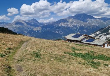
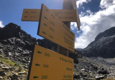
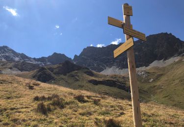
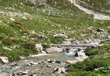
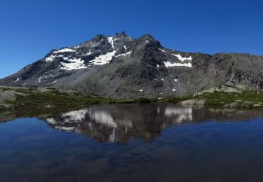
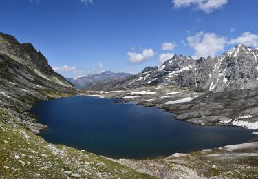
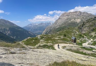
Départ du refuge d'Ambin ou nous avons passé la soirée et la nuit. Accueil très sympathique dans un refuge du CAF un peu rustique. Montée au pas de la coche puis descente dans la vallée d'Etace en passant par plan des eaux (il en avait beaucoup ce jour là) Nois retrouvons la voiture laissée la veille à la ferme d'Etache.
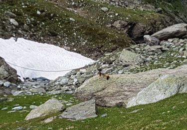
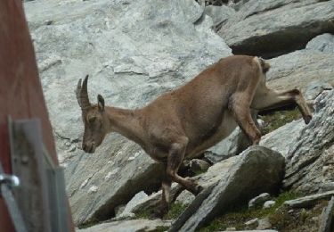
Vallon très sauvage. Beaucoup de ruisseau passer. Bonnes chaussures étanches indispensables.
Localisation
Commentaires
Randonnées à proximité
![Randonnée Marche Val-Cenis - Savoie_Bramans-LePlanay=>Alpages_de_Montbas - Photo](https://media.geolcdn.com/t/375/260/e2fc6e3f-d7d3-4a11-84a0-df6a02af42c8.jpg&format=jpg&maxdim=2)
![Marche Marche](https://static1.geolcdn.com/sitytour/trail-icons/101.png)
Marche
![](/images/other/stat-length.png)
![](https://static1.geolcdn.com/siteimages/upload/files/16400158638029165_repeat_loop_refresh_sync_direction_icon.png)
![Randonnée Marche Val-Cenis - Col agnel puis Lac d'Ambin Bramans - Photo](https://media.geolcdn.com/t/375/260/1745d82d-7eda-48ff-b6de-c3bab13e3684.jpg&format=jpg&maxdim=2)
![Marche Marche](https://static1.geolcdn.com/sitytour/trail-icons/101.png)
Marche
![](/images/other/stat-length.png)
![](https://static1.geolcdn.com/siteimages/upload/files/16400158638029165_repeat_loop_refresh_sync_direction_icon.png)
![Randonnée Marche Val-Cenis - Col d'Etache - gros Peyron - Bec d'Etache - Photo](https://media.geolcdn.com/t/375/260/5aeb25f3-8e0d-4d55-9235-334883bccd5e.jpg&format=jpg&maxdim=2)
![Marche Marche](https://static1.geolcdn.com/sitytour/trail-icons/101.png)
Marche
![](/images/other/stat-length.png)
![](https://static1.geolcdn.com/siteimages/upload/files/16400158638029165_repeat_loop_refresh_sync_direction_icon.png)
![Randonnée Marche Val-Cenis - Parking Etache - Pas de la Coche Bramans - Photo](https://media.geolcdn.com/t/375/260/0946d2b3-7a1a-44f3-90e2-4cbe032d6378.jpg&format=jpg&maxdim=2)
![Marche Marche](https://static1.geolcdn.com/sitytour/trail-icons/101.png)
Marche
![](/images/other/stat-length.png)
![](https://static1.geolcdn.com/siteimages/upload/files/16400158638029165_repeat_loop_refresh_sync_direction_icon.png)
![Randonnée Marche Val-Cenis - BRAMANS - 73 - Photo](https://media.geolcdn.com/t/375/260/c671f643-1828-4d5b-84a6-28d52fabe947.jpg&format=jpg&maxdim=2)
![Marche Marche](https://static1.geolcdn.com/sitytour/trail-icons/101.png)
Marche
![](/images/other/stat-length.png)
![](https://static1.geolcdn.com/siteimages/upload/files/16400158638029165_repeat_loop_refresh_sync_direction_icon.png)
![Marche Marche](https://static1.geolcdn.com/sitytour/trail-icons/101.png)
Marche
![](/images/other/stat-length.png)
![](https://static1.geolcdn.com/siteimages/upload/files/16400158638029165_repeat_loop_refresh_sync_direction_icon.png)
![Randonnée Marche Val-Cenis - Refuge d'Ambin / Lac noir - Photo](https://media.geolcdn.com/t/375/260/aedf9e15-8780-41c9-8754-3f97b88505d2.jpg&format=jpg&maxdim=2)
![Marche Marche](https://static1.geolcdn.com/sitytour/trail-icons/101.png)
Marche
![](/images/other/stat-length.png)
![](https://static1.geolcdn.com/siteimages/upload/files/16400158638029165_repeat_loop_refresh_sync_direction_icon.png)
![Randonnée Marche Val-Cenis - Lac et col d'Ambin - 2899 m - Photo](https://media.geolcdn.com/t/375/260/ext.jpg?maxdim=2&url=https%3A%2F%2Fservices.sitytrail.com%2FGeolivesWS%2FDownloadMedia.ashx%3FTrailID%3D172760%26Media%3D14173_5.jpg)
![Marche Marche](https://static1.geolcdn.com/sitytour/trail-icons/101.png)
Marche
![](/images/other/stat-length.png)
![](https://static1.geolcdn.com/siteimages/upload/files/16400158638029165_repeat_loop_refresh_sync_direction_icon.png)
![Randonnée Marche Val-Cenis - Parking Le Suffet - le pas des vaches Val d'ambin Bramans - Photo](https://media.geolcdn.com/t/375/260/4f426610-e348-4601-a905-318d55d7f079.jpg&format=jpg&maxdim=2)
![Marche Marche](https://static1.geolcdn.com/sitytour/trail-icons/101.png)
Marche
![](/images/other/stat-length.png)
![](https://static1.geolcdn.com/siteimages/upload/files/16400158638029165_repeat_loop_refresh_sync_direction_icon.png)