![](/images/other/stat-length.png)
![Randonnée Marche Saint-Georges-de-Baroille - Saint-Georges-de-Baroille : Ardilliers et chapelle - Photo](https://media.geolcdn.com/t/1900/400/7bbf982a-a7d0-4268-b6f3-34bf2133c61f.jpg&format=pjpeg&maxdim=2)
Saint-Georges-de-Baroille : Ardilliers et chapelle
Jgar
Utilisateur
![Longueur](/images/other/stat-length.png)
![Altitude max](https://static1.geolcdn.com/siteimages/upload/files/1508320355ic_sort_altitude_max_24dp.png)
![Dénivelé positif](https://static1.geolcdn.com/siteimages/upload/files/1508320355ic_sort_den_pos_24dp.png)
![Km-Effort](/images/other/stat-length.png)
![Altitude min](https://static1.geolcdn.com/siteimages/upload/files/1508320355ic_sort_altitude_min_24dp.png)
![Dénivelé négatif](https://static1.geolcdn.com/siteimages/upload/files/1508320355ic_sort_den_neg_24dp.png)
![Boucle](https://static1.geolcdn.com/siteimages/upload/files/16400158638029165_repeat_loop_refresh_sync_direction_icon.png)
![Marche](https://static1.geolcdn.com/sitytour/trail-icons/101.png)
4h22
Difficulté : Moyen
![Scannez ce code QR pour ouvrir la randonnée dans l'application SityTrail](https://capi.geolives.com/qq0zvz2zws4bq2lad0pu/sitytour/trails/3269382/qr.png?size=200)
Application GPS de randonnée GRATUITE
À propos
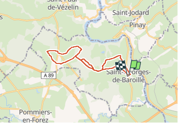
Randonnée Marche de 12,8 km à découvrir à Auvergne-Rhône-Alpes, Loire, Saint-Georges-de-Baroille. Cette randonnée est proposée par Jgar.
Description
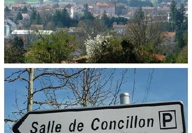
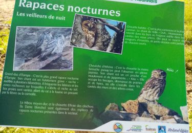
Parking devant la mairie. Eviter d'emprunter ce tracé par temps humide : le sol argileux des chemins forestiers retiennent l'eau, il justifie par ailleurs le passé de potiers de la commune.
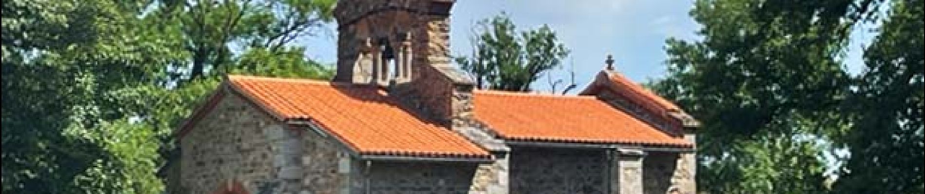
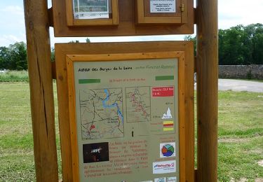
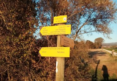
Cette boucle utilise en partie la PR 16 (topoguide Les Vals d'Aix et Isable...à pied). Elle traverse le bois des Ardilliers pour atteindre la chapelle de Baroille.
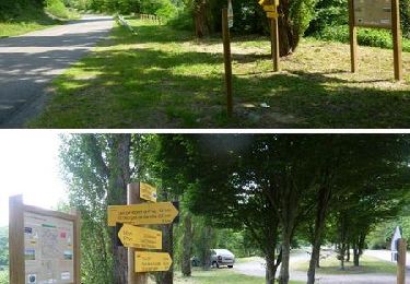
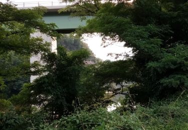
On rejoint ensuite le GRP-Sentier des Gorges de la Loire et l'on passe de nouveau par la partie forestière..
Le retour se fait par le château d'eau.
Localisation
Commentaires
Randonnées à proximité
![Randonnée Marche Balbigny - Autour des Gorges de la Loire - PR N° 2 : Le Funiculaire de Biesse - Les Chessieux - Photo](https://media.geolcdn.com/t/375/260/ext.jpg?maxdim=2&url=https%3A%2F%2Fservices.sitytrail.com%2FGeolivesWS%2FDownloadMedia.ashx%3FTrailID%3D215160%26Media%3D15762_6.jpg)
![Marche Marche](https://static1.geolcdn.com/sitytour/trail-icons/101.png)
Marche
![](/images/other/stat-length.png)
![](https://static1.geolcdn.com/siteimages/upload/files/16400158638029165_repeat_loop_refresh_sync_direction_icon.png)
![Randonnée Marche Pinay - Autour des Gorges de la Loire - GR Pays N° 5 : De la Digue à La Vourdiat - La Digue de Pinay - Photo](https://media.geolcdn.com/t/375/260/ext.jpg?maxdim=2&url=https%3A%2F%2Fservices.sitytrail.com%2FGeolivesWS%2FDownloadMedia.ashx%3FTrailID%3D215012%26Media%3D15578_6.jpg)
![Marche Marche](https://static1.geolcdn.com/sitytour/trail-icons/101.png)
Marche
![](/images/other/stat-length.png)
![](https://static1.geolcdn.com/siteimages/upload/files/16400158638029165_repeat_loop_refresh_sync_direction_icon.png)
![Randonnée Marche Pommiers-en-Forez - Autour des Gorges de la Loire - GR de Pays N° 3 : le prieuré et la forêt de Bas - Pommiers - Photo](https://media.geolcdn.com/t/375/260/ext.jpg?maxdim=2&url=https%3A%2F%2Fservices.sitytrail.com%2FGeolivesWS%2FDownloadMedia.ashx%3FTrailID%3D215008%26Media%3D15576_6.jpg)
![Marche Marche](https://static1.geolcdn.com/sitytour/trail-icons/101.png)
Marche
![](/images/other/stat-length.png)
![](https://static1.geolcdn.com/siteimages/upload/files/16400158638029165_repeat_loop_refresh_sync_direction_icon.png)
![Randonnée V.T.T. Balbigny - B6 - VTT Montagnes du Matin - Balbigny - Photo](https://media.geolcdn.com/t/375/260/ext.jpg?maxdim=2&url=https%3A%2F%2Fservices.sitytrail.com%2FGeolivesWS%2FDownloadMedia.ashx%3FTrailID%3D172328%26Media%3D13651_6.jpg)
![V.T.T. V.T.T.](https://static1.geolcdn.com/sitytour/trail-icons/202.png)
V.T.T.
![](/images/other/stat-length.png)
![](https://static1.geolcdn.com/siteimages/upload/files/16400158638029165_repeat_loop_refresh_sync_direction_icon.png)
![Randonnée Marche Balbigny - rando au départ de Balbigny, viaduc Chessieu, St Georges de Barolles, les Sigauds, Grenieux, Nervieux, Pont de Balbigny - Photo](https://media.geolcdn.com/t/375/260/5db3212e-40b4-459c-9353-6a43c13d12c3.jpg&format=jpg&maxdim=2)
![Marche Marche](https://static1.geolcdn.com/sitytour/trail-icons/101.png)
Marche
![](/images/other/stat-length.png)
![](https://static1.geolcdn.com/siteimages/upload/files/16400158638029165_repeat_loop_refresh_sync_direction_icon.png)
![Randonnée Marche Saint-Marcel-de-Félines - rando à partir de St Marcel les Felines - Photo](https://media.geolcdn.com/t/375/260/25de8710-609c-4277-bb5d-14bd81d5616d.jpg&format=jpg&maxdim=2)
![Marche Marche](https://static1.geolcdn.com/sitytour/trail-icons/101.png)
Marche
![](/images/other/stat-length.png)
![](https://static1.geolcdn.com/siteimages/upload/files/16400158638029165_repeat_loop_refresh_sync_direction_icon.png)
![Randonnée Marche Balbigny - départ de carrefour market Balbigny, les Chessieu, le Chatelard, la digue de Pinay, retour sur Balbigny - Photo](https://media.geolcdn.com/t/375/260/471fef2b-1bad-4105-ac34-0aa84a5add34.jpg&format=jpg&maxdim=2)
![Marche Marche](https://static1.geolcdn.com/sitytour/trail-icons/101.png)
Marche
![](/images/other/stat-length.png)
![](https://static1.geolcdn.com/siteimages/upload/files/16400158638029165_repeat_loop_refresh_sync_direction_icon.png)
![Randonnée Marche Balbigny - un morceau des bord de la Loire - Photo](https://media.geolcdn.com/t/375/260/9677bd9d-6e2b-48be-82b7-26f48bf52e76.jpg&format=jpg&maxdim=2)
![Marche Marche](https://static1.geolcdn.com/sitytour/trail-icons/101.png)
Marche
![](/images/other/stat-length.png)
![](https://static1.geolcdn.com/siteimages/upload/files/16400158638029165_repeat_loop_refresh_sync_direction_icon.png)
![Randonnée Marche Balbigny - Départ de Chessieu, PR2. funiculaire - Photo](https://media.geolcdn.com/t/375/260/57b0fbfe-9088-4ef9-b2c4-fddcd14b4b5d.jpg&format=jpg&maxdim=2)
![Marche Marche](https://static1.geolcdn.com/sitytour/trail-icons/101.png)
Marche
![](/images/other/stat-length.png)
![](https://static1.geolcdn.com/siteimages/upload/files/16400158638029165_repeat_loop_refresh_sync_direction_icon.png)