15,9 km | 19,1 km-effort
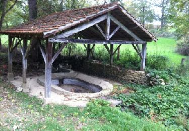
découverte des lavoirs
phissel
Utilisateur
Longueur
8,8 km
Altitude max
382 m
Dénivelé positif
127 m
Km-Effort
10,5 km
Altitude min
312 m
Dénivelé négatif
127 m
Boucle
Oui
Date de création :
2014-12-10 00:00:00.0
Dernière modification :
2014-12-10 00:00:00.0
2h41
Difficulté : Facile
Application GPS de randonnée GRATUITE
À propos
Randonnée Marche de 8,8 km à découvrir à Occitanie, Lot, Reyrevignes. Cette randonnée est proposée par phissel.
Localisation
Pays :
France
Région :
Occitanie
Département/Province :
Lot
Commune :
Reyrevignes
Localité :
Unknown
Départ:(Dec)
Départ:(UTM)
414203 ; 4945202 (31T) N.
Commentaires
Randonnées à proximité
Rando VTT 17km autour de Reyrevignes
Marche
Très difficile
(1)
Reyrevignes,
Occitanie,
Lot,
France
4h 20min
Oui
Reyrevignes et ses lavoirs
Marche
Facile
(1)
Reyrevignes,
Occitanie,
Lot,
France
7,9 km | 9,4 km-effort
2h 3min
Oui
balade Trezebens emmanuel
Moto-cross
Moyen
Le Bourg,
Occitanie,
Lot,
France
15,7 km | 21 km-effort
54min
Oui
Belinac rs G
Marche
Très difficile
Livernon,
Occitanie,
Lot,
France
25 km | 30 km-effort
2h 48min
Non
randos cancer Reyrevigne.
Marche
Difficile
Reyrevignes,
Occitanie,
Lot,
France
11,2 km | 13,3 km-effort
2h 41min
Oui