


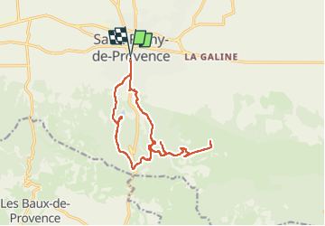

19,2 km | 27 km-effort


Utilisateur GUIDE


Application GPS de randonnée GRATUITE
 SityTrail
IGN / Instituts géographiques
SityTrail World
Le monde est à vous
Randonnée V.T.T. de 16 km à découvrir à Provence-Alpes-Côte d'Azur, Bouches-du-Rhône, Saint-Rémy-de-Provence. Cette randonnée est proposée par pascalou73.
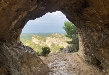
Voilà une randonnée VTT sur la région des Alpilles au départ du village de Saint -Remy pour aller voir les lunettes de Van Gogh qui également appelé la rocher des 2 tous


Marche
Marche

Marche
V.T.T.
Marche

Marche
Marche
Marche
Marche