![](/images/other/stat-length.png)
![Randonnée Marche Saint-Étienne-de-Tinée - Pas de Morgon - Photo](https://media.geolcdn.com/t/1900/400/aae40860-ba43-402f-93f9-6afed7fd1310.jpg&format=pjpeg&maxdim=2)
Pas de Morgon
bozo1970
Utilisateur
![Longueur](/images/other/stat-length.png)
![Altitude max](https://static1.geolcdn.com/siteimages/upload/files/1508320355ic_sort_altitude_max_24dp.png)
![Dénivelé positif](https://static1.geolcdn.com/siteimages/upload/files/1508320355ic_sort_den_pos_24dp.png)
![Km-Effort](/images/other/stat-length.png)
![Altitude min](https://static1.geolcdn.com/siteimages/upload/files/1508320355ic_sort_altitude_min_24dp.png)
![Dénivelé négatif](https://static1.geolcdn.com/siteimages/upload/files/1508320355ic_sort_den_neg_24dp.png)
![Boucle](https://static1.geolcdn.com/siteimages/upload/files/16400158638029165_repeat_loop_refresh_sync_direction_icon.png)
![Marche](https://static1.geolcdn.com/sitytour/trail-icons/101.png)
5h22
Difficulté : Très difficile
![Scannez ce code QR pour ouvrir la randonnée dans l'application SityTrail](https://capi.geolives.com/qq0zvz2zws4bq2lad0pu/sitytour/trails/3267586/qr.png?size=200)
Application GPS de randonnée GRATUITE
À propos
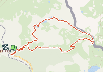
Randonnée Marche de 16 km à découvrir à Provence-Alpes-Côte d'Azur, Alpes-Maritimes, Saint-Étienne-de-Tinée. Cette randonnée est proposée par bozo1970.
Description
Départ du hameau de Pra
Passage par le plateau de Morgon
Balise 33 en 1h
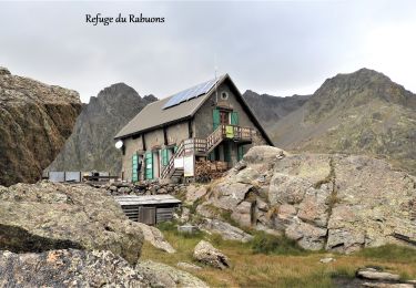
Maison forestière de Tortisse, Féerique !!
Col du Fer en 2h13’, altitude 2584m
D 962m en 7km340
Pas de Morgon en 2h57’, altitude 2714m et 8,9km
D 1129m
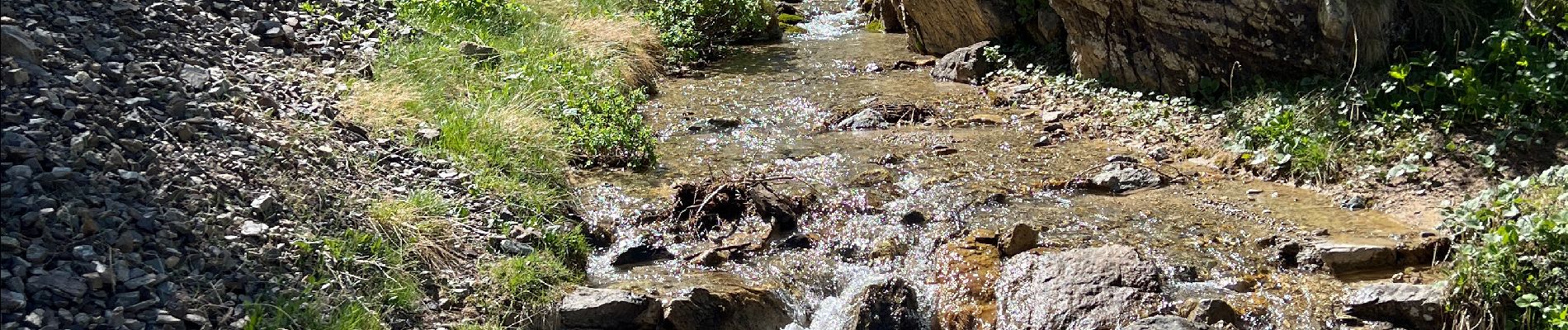
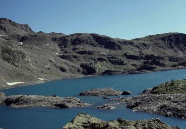
Descente par les lacs de Morgon en boucle par le plateau de Morgon
Très belle vue sur l’Enchastraye, les cîmes de Vens et la chaîne du vallon de Gialor
A/R en 5h25’ , 1130m de D et 16km
Localisation
Commentaires
Randonnées à proximité
![Randonnée Marche Saint-Étienne-de-Tinée - Les Praz lacs de morgon pas de morgon col de fer - Photo](https://media.geolcdn.com/t/375/260/b305c453-9657-41de-ab22-a223a802df42.jpg&format=jpg&maxdim=2)
![Marche Marche](https://static1.geolcdn.com/sitytour/trail-icons/101.png)
Marche
![](/images/other/stat-length.png)
![](https://static1.geolcdn.com/siteimages/upload/files/16400158638029165_repeat_loop_refresh_sync_direction_icon.png)
![Marche Marche](https://static1.geolcdn.com/sitytour/trail-icons/101.png)
Marche
![](/images/other/stat-length.png)
![](https://static1.geolcdn.com/siteimages/upload/files/16400158638029165_repeat_loop_refresh_sync_direction_icon.png)
![Randonnée Marche Saint-Étienne-de-Tinée - Refuge de Vens par le Col du Fer - Photo](https://media.geolcdn.com/t/375/260/07f7f5f4-c466-4163-95bf-638647005431.jpg&format=jpg&maxdim=2)
![Marche Marche](https://static1.geolcdn.com/sitytour/trail-icons/101.png)
Marche
![](/images/other/stat-length.png)
![](https://static1.geolcdn.com/siteimages/upload/files/16400158638029165_repeat_loop_refresh_sync_direction_icon.png)
![Randonnée Marche Saint-Étienne-de-Tinée - Reel Col du Fer lac refuge de Vens Cabane de Tortisse - Photo](https://media.geolcdn.com/t/375/260/43a881a4-8325-4e36-a280-d71b36c99c78.jpg&format=jpg&maxdim=2)
![Marche Marche](https://static1.geolcdn.com/sitytour/trail-icons/101.png)
Marche
![](/images/other/stat-length.png)
![](https://static1.geolcdn.com/siteimages/upload/files/16400158638029165_repeat_loop_refresh_sync_direction_icon.png)
![Randonnée A pied Saint-Dalmas-le-Selvage - Crête de la Blanche - Photo](https://media.geolcdn.com/t/375/260/8fef9bcd-e2c1-4a5f-8511-8141c69ceadb.jpeg&format=jpg&maxdim=2)
![A pied A pied](https://static1.geolcdn.com/sitytour/trail-icons/100.png)
A pied
![](/images/other/stat-length.png)
![](https://static1.geolcdn.com/siteimages/upload/files/16400158638029165_repeat_loop_refresh_sync_direction_icon.png)
![Randonnée A pied Saint-Étienne-de-Tinée - Chemin de l'Energie - Photo](https://media.geolcdn.com/t/375/260/45dc2ef9-a27b-439a-8012-c03ab217c2f9.jpeg&format=jpg&maxdim=2)
![A pied A pied](https://static1.geolcdn.com/sitytour/trail-icons/100.png)
A pied
![](/images/other/stat-length.png)
![](https://static1.geolcdn.com/siteimages/upload/files/16400158638029165_repeat_loop_refresh_sync_direction_icon.png)
![Randonnée A pied Saint-Étienne-de-Tinée - Chemin de l'Energie - Etape 1 - Photo](https://media.geolcdn.com/t/375/260/0794a3d0-3fdc-40ed-a80f-245b620bf282.jpeg&format=jpg&maxdim=2)
![A pied A pied](https://static1.geolcdn.com/sitytour/trail-icons/100.png)
A pied
![](/images/other/stat-length.png)
![](https://static1.geolcdn.com/siteimages/upload/files/16400158638029165_repeat_loop_refresh_sync_direction_icon.png)
![Randonnée A pied Saint-Étienne-de-Tinée - Chemin de l'Energie - Etape 2 - Photo](https://media.geolcdn.com/t/375/260/0ae9acc1-b5e7-475c-ba30-b123ec5f057b.jpeg&format=jpg&maxdim=2)
![A pied A pied](https://static1.geolcdn.com/sitytour/trail-icons/100.png)
A pied
![](/images/other/stat-length.png)
![](https://static1.geolcdn.com/siteimages/upload/files/16400158638029165_repeat_loop_refresh_sync_direction_icon.png)
![Randonnée Marche Saint-Dalmas-le-Selvage - crete de la blanche (sens inverse des aiguilles de la montre) - Photo](https://media.geolcdn.com/t/375/260/8277ee34-7f4f-4605-8ad8-3f70e64ea507.jpg&format=jpg&maxdim=2)
![Marche Marche](https://static1.geolcdn.com/sitytour/trail-icons/101.png)
Marche
![](/images/other/stat-length.png)
![](https://static1.geolcdn.com/siteimages/upload/files/16400158638029165_repeat_loop_refresh_sync_direction_icon.png)