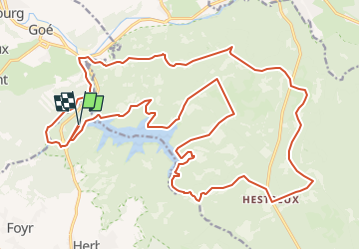
![](/images/other/stat-length.png)
![Randonnée V.T.T. Jalhay - Trou Malbrouck au lac de la Gileppe - Photo](https://media.geolcdn.com/t/1900/400/7cbfcfd3-ffdf-4fcd-9c52-9b11c16248d3.jpeg&format=pjpeg&maxdim=2)
Trou Malbrouck au lac de la Gileppe
Le lac de la Gileppe
Découvrez un site d'exception et vivez des expériences qui vous ressemblent !
![Longueur](/images/other/stat-length.png)
![Altitude max](https://static1.geolcdn.com/siteimages/upload/files/1508320355ic_sort_altitude_max_24dp.png)
![Dénivelé positif](https://static1.geolcdn.com/siteimages/upload/files/1508320355ic_sort_den_pos_24dp.png)
![Km-Effort](/images/other/stat-length.png)
![Altitude min](https://static1.geolcdn.com/siteimages/upload/files/1508320355ic_sort_altitude_min_24dp.png)
![Dénivelé négatif](https://static1.geolcdn.com/siteimages/upload/files/1508320355ic_sort_den_neg_24dp.png)
![Boucle](https://static1.geolcdn.com/siteimages/upload/files/16400158638029165_repeat_loop_refresh_sync_direction_icon.png)
![V.T.T.](https://static1.geolcdn.com/sitytour/trail-icons/202.png)
2h30
Difficulté : Difficile
![Scannez ce code QR pour ouvrir la randonnée dans l'application SityTrail](https://capi.geolives.com/qq0zvz2zws4bq2lad0pu/sitytour/trails/3263346/qr.png?size=200)
Application GPS de randonnée GRATUITE
À propos
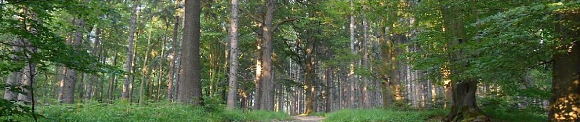
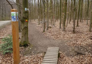
Randonnée V.T.T. de 28 km à découvrir à Wallonie, Liège, Jalhay. Cette randonnée est proposée par Le lac de la Gileppe.
Description
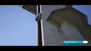
Pour les vététistes, emprunter la route du parking et après 350m, prendre à gauche la voie de service vers le barrage. Après avoir traversé le barrage, suivre le chemin le long du lac. Dans la première anse, monter à gauche pour atteindre l’allée de «Pierreuse».
L’emprunter à droite sur 550m jusqu’à l’allée du « Petit Lys », puis redescendre à droite le long du lac. Après l’anse du Petit Lys, remonter à gauche et traverser la route du «Chêne du Rendez-vous».
Prendre la route du « Trou du Loup » sur 800m et remonter à droite pour atteindre « la Route de Courte », puis reprendre de nouveau à droite le chemin qui vous amènera à la « Croix Grisard ».
Ensuite, traverser et descendre vers le lac pour, à gauche, le longer jusqu’au fond. Prendre à gauche et remonter 200m le long du ruisseau « la Gileppe », prendre à gauche le chemin technique « des Charbonniers », qui d’abord en pente sévère, s’élargit et s’adoucit pour rejoindre la grand-route qui relie Eupen à Malmedy. Bifurquer à droite jusqu’à la maison forestière de Hestreux et quitter la nationale au premier chemin à gauche. (Prudence !)
Enfin, descendre vers la Helle sur 1,1km et avant le « S », tourner à gauche pour parcourir le chemin parallèle à la rivière jusqu’à la grand-route que l’on traverse prudemment. Longue descente pour atteindre à gauche, l’allée empierrée « des Quatre Chênes ».
Arrivé au chemin asphalté de « Henseberg », remonter un peu vers la gauche, puis bifurquer à droite vers le chemin forestier. Atteindre Béthane et ses usines par l’allée « de Brand » et la route goudronnée.
Après le pont sur « la Gileppe », remonter la route de la carrière « Envemat » vers le bois de la Borchêne, pour terminer le circuit par une pente ardue à gauche, qui nous ramène au parking.
Localisation
Commentaires
Randonnées à proximité
![Randonnée Marche Limbourg - RB-Lg-28_Limbourg - Photo](https://media.geolcdn.com/t/375/260/ext.jpg?maxdim=2&url=https%3A%2F%2Fservices.sitytrail.com%2FGeolivesWS%2FDownloadMedia.ashx%3FTrailID%3D402093%26Media%3D979895a6-f139-4f7a-8335-2e926c1b89c7.jpg)
![Marche Marche](https://static1.geolcdn.com/sitytour/trail-icons/101.png)
Marche
![](/images/other/stat-length.png)
![](https://static1.geolcdn.com/siteimages/upload/files/16400158638029165_repeat_loop_refresh_sync_direction_icon.png)
![Randonnée Marche Jalhay - La Gileppe - Bois de la Borchêne - Photo](https://media.geolcdn.com/t/375/260/e6c1c191-9060-48ef-8a65-d77cc5b69a34.jpg&format=jpg&maxdim=2)
![Marche Marche](https://static1.geolcdn.com/sitytour/trail-icons/101.png)
Marche
![](/images/other/stat-length.png)
![](https://static1.geolcdn.com/siteimages/upload/files/16400158638029165_repeat_loop_refresh_sync_direction_icon.png)
![Randonnée Marche Baelen - Baelen - Eupen 🎄🎅 - Membach - Photo](https://media.geolcdn.com/t/375/260/d50227a7-424d-470e-90d5-87ebd384de36.jpg&format=jpg&maxdim=2)
![Marche Marche](https://static1.geolcdn.com/sitytour/trail-icons/101.png)
Marche
![](/images/other/stat-length.png)
![](https://static1.geolcdn.com/siteimages/upload/files/16400158638029165_repeat_loop_refresh_sync_direction_icon.png)
![Randonnée Marche Eupen - Autour d'Eupen - Photo](https://media.geolcdn.com/t/375/260/2e56e8e4-4348-489f-86b5-c8ca8af64230.jpg&format=jpg&maxdim=2)
![Marche Marche](https://static1.geolcdn.com/sitytour/trail-icons/101.png)
Marche
![](/images/other/stat-length.png)
![](https://static1.geolcdn.com/siteimages/upload/files/16400158638029165_repeat_loop_refresh_sync_direction_icon.png)
![Randonnée Marche Jalhay - Jalhay-Royompré_-_Balade 47 - Photo](https://media.geolcdn.com/t/375/260/94c262e0-20e7-4ae2-8b45-01b4c31da73b.jpg&format=jpg&maxdim=2)
![Marche Marche](https://static1.geolcdn.com/sitytour/trail-icons/101.png)
Marche
![](/images/other/stat-length.png)
![](https://static1.geolcdn.com/siteimages/upload/files/16400158638029165_repeat_loop_refresh_sync_direction_icon.png)
![Randonnée Marche Eupen - Eupen - Photo](https://media.geolcdn.com/t/375/260/d87483d2-4d3d-461a-a9c9-ec45b2516003.jpg&format=jpg&maxdim=2)
![Marche Marche](https://static1.geolcdn.com/sitytour/trail-icons/101.png)
![Randonnée Marche Baelen - La Montagne du Dragon - Photo](https://media.geolcdn.com/t/375/260/3a1bc634-7bf5-4748-bbb3-513b265a48b5.jpg&format=jpg&maxdim=2)
![Marche Marche](https://static1.geolcdn.com/sitytour/trail-icons/101.png)
Marche
![](/images/other/stat-length.png)
![](https://static1.geolcdn.com/siteimages/upload/files/16400158638029165_repeat_loop_refresh_sync_direction_icon.png)
![Marche Marche](https://static1.geolcdn.com/sitytour/trail-icons/101.png)
Marche
![](/images/other/stat-length.png)
![](https://static1.geolcdn.com/siteimages/upload/files/16400158638029165_repeat_loop_refresh_sync_direction_icon.png)
![Randonnée Marche Limbourg - RL-GG-11_Dolhain-Gileppe_Pepinster - Photo](https://media.geolcdn.com/t/375/260/9cf2c240-5913-4088-b4f6-6c0e1fae0233.jpg&format=jpg&maxdim=2)
![Marche Marche](https://static1.geolcdn.com/sitytour/trail-icons/101.png)
Marche
![](/images/other/stat-length.png)
![](https://static1.geolcdn.com/siteimages/upload/files/16400158638029165_repeat_loop_refresh_sync_direction_icon.png)