Randonnée Marche Randa - Pont Suspendu Randa - Photo

Pont Suspendu Randa

 Muriel74
Muriel74

Utilisateur

© OpenStreetMap contributors
Longueur
Longueur
9,1 km
Altitude max
Altitude max
2343 m
Dénivelé positif
Dénivelé positif
1039 m
Km-Effort
Km-Effort  
23 km
Altitude min
Altitude min
1411 m
Dénivelé négatif
Dénivelé négatif
955 m
Boucle
Boucle
Non
Date de création :
2022-05-26 20:50:09.291
Dernière modification :
2022-05-26 20:50:59.332

(0 Avis)

Marche
Marche
5h08
Difficulté : Très difficile

Scannez ce code QR pour ouvrir la randonnée dans l'application SityTrail

Application GPS de randonnée GRATUITE

Logo SityTrail SityTrail

IGN / Instituts géographiques

Télécharger SityTrail sur l'App Store Télécharger SityTrail sur Google Play

Logo SityTrail SityTrail World

Le monde est à vous

Télécharger SityTrail sur l'App Store Télécharger SityTrail sur Google Play Télécharger SityTrail sur Huawei AppGallery

À propos

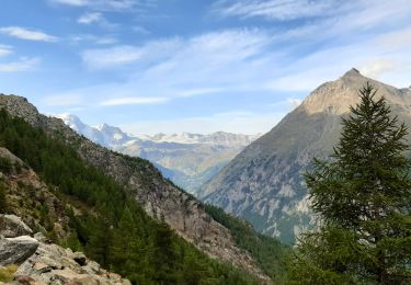
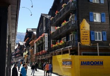
Randonnée Marche de 9,1 km à découvrir à Valais, Viège, Randa. Cette randonnée est proposée par Muriel74.

Profil altimétrique

Points d'intérêt

Point d'intérêt Randa - Europahütte (2264 m) - Photo
Muriel74
Point d'intérêt Randa - Chüebodmen (1767 m) - Photo
Muriel74

Localisation

Pays :
Suisse
Région :
Valais
Département/Province :
Viège
Commune :
Randa
Localité :
Unknown
Départ:(UTM)
405853 ; 5105864 (32T) N.

Randonnées à proximité

Randonnée Marche Randa - La Haute Route : J11 - Photo
Marche
Greg813

Marche

Difficile
Randa, Valais, Viège, Suisse
18,8 km | 34 km-effort
5h 7min
Non
Randonnée Marche Randa - CHX ZRMT Étape 10 de Rwanda à Zermatt  - Photo
Marche
jeff2

Marche

Moyen
Randa, Valais, Viège, Suisse
18,5 km | 37 km-effort
6h 9min
Non
Randonnée Marche Randa - st_ny0915 - Photo
Marche
GUIDE+

Marche

Très facile
Randa, Valais, Viège, Suisse
15,1 km | 31 km-effort
5h 9min
Non
Randonnée Marche Randa - randa  - Photo
Marche
stouf07

Marche

Difficile
Randa, Valais, Viège, Suisse
7,9 km | 19,2 km-effort
5h 46min
Non
Randonnée Marche Täsch - Täsch, Ober Sattla - Photo
Marche
rpf

Marche

Très facile
Täsch, Valais, Viège, Suisse
9 km | 17,6 km-effort
5h 30min
Oui
Randonnée Autre activité Randa - Dom - Photo
Autre activité
rohrh

Autre activité

Très facile
Randa, Valais, Viège, Suisse
9,9 km | 44 km-effort
Inconnu
Non
Randonnée Autre activité Täsch - Täschhütte, Weingartensattel [loop/boucle/Rundwand.] - Photo
Autre activité
pnoth

Autre activité

Très facile
Täsch, Valais, Viège, Suisse
9 km | 22 km-effort
Inconnu
Oui
Randonnée sport Täsch - 2024-09-03_14h09m17_t8979743_arigscheis (nr. 41) - Photo
sport
jeta1

sport

Très facile
Täsch, Valais, Viège, Suisse
9,4 km | 21 km-effort
Inconnu
Oui
Randonnée Marche Randa - Randa - Pont suspendu Charles Kuonen - Photo
Marche
mich06

Marche

Difficile
Randa, Valais, Viège, Suisse
8,4 km | 19,2 km-effort
5h 21min
Oui


Fermer
Mes abonnements