![](/images/other/stat-length.png)
![Randonnée Marche Blanquefort - Blanquefort/ Le Pian-Medoc - Photo](https://media.geolcdn.com/t/1900/400/661631f6-1335-49e9-a8c6-69d8a45a6939.jpg&format=pjpeg&maxdim=2)
Blanquefort/ Le Pian-Medoc
bedous
Utilisateur
![Longueur](/images/other/stat-length.png)
![Altitude max](https://static1.geolcdn.com/siteimages/upload/files/1508320355ic_sort_altitude_max_24dp.png)
![Dénivelé positif](https://static1.geolcdn.com/siteimages/upload/files/1508320355ic_sort_den_pos_24dp.png)
![Km-Effort](/images/other/stat-length.png)
![Altitude min](https://static1.geolcdn.com/siteimages/upload/files/1508320355ic_sort_altitude_min_24dp.png)
![Dénivelé négatif](https://static1.geolcdn.com/siteimages/upload/files/1508320355ic_sort_den_neg_24dp.png)
![Boucle](https://static1.geolcdn.com/siteimages/upload/files/16400158638029165_repeat_loop_refresh_sync_direction_icon.png)
![Marche](https://static1.geolcdn.com/sitytour/trail-icons/101.png)
4h00
Difficulté : Moyen
![Scannez ce code QR pour ouvrir la randonnée dans l'application SityTrail](https://capi.geolives.com/qq0zvz2zws4bq2lad0pu/sitytour/trails/3248771/qr.png?size=200)
Application GPS de randonnée GRATUITE
À propos
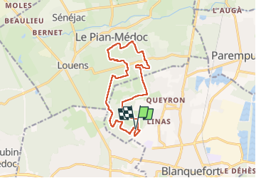
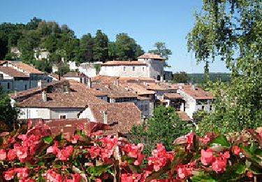
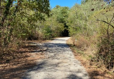
Randonnée Marche de 14,6 km à découvrir à Nouvelle-Aquitaine, Gironde, Blanquefort. Cette randonnée est proposée par bedous.
Description
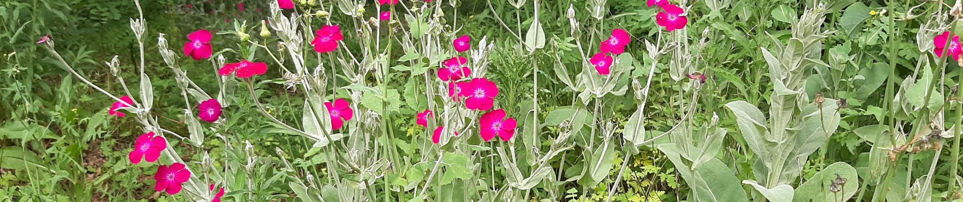
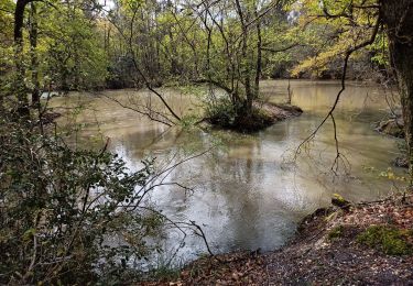
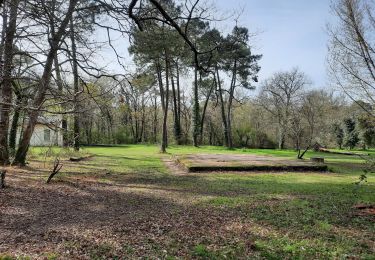
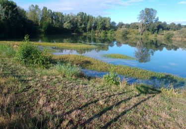
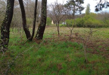
Magnifique randonnée à faire de préférence au printemps, début d'été pour profiter de la flore. Eviter les temps pluvieux. Puis, en période estivale car la plus grande partie du parcours s'effectue en sous bois par sentiers ou pistes. Le pique nique en bord d'étang est des plus .....plus.
Rando. à ne pas manquer !
Localisation
Commentaires
Randonnées à proximité
![Randonnée Marche Blanquefort - Pnl Tanais - Photo](https://media.geolcdn.com/t/375/260/d5d98c98-c615-4cb3-9bf4-916690b17932.jpg&format=jpg&maxdim=2)
![Marche Marche](https://static1.geolcdn.com/sitytour/trail-icons/101.png)
Marche
![](/images/other/stat-length.png)
![](https://static1.geolcdn.com/siteimages/upload/files/16400158638029165_repeat_loop_refresh_sync_direction_icon.png)
![Randonnée Marche Blanquefort - Circuit autour de Blanquefort - Photo](https://media.geolcdn.com/t/375/260/e929d0b7-3df3-414f-8052-5790c33dbb56.jpg&format=jpg&maxdim=2)
![Marche Marche](https://static1.geolcdn.com/sitytour/trail-icons/101.png)
Marche
![](/images/other/stat-length.png)
![](https://static1.geolcdn.com/siteimages/upload/files/16400158638029165_repeat_loop_refresh_sync_direction_icon.png)
![Randonnée Marche Blanquefort - Tanais finalisé - Photo](https://media.geolcdn.com/t/375/260/65129eed-45b3-4fa6-9c6a-476d886a3a2f.jpg&format=jpg&maxdim=2)
![Marche Marche](https://static1.geolcdn.com/sitytour/trail-icons/101.png)
Marche
![](/images/other/stat-length.png)
![](https://static1.geolcdn.com/siteimages/upload/files/16400158638029165_repeat_loop_refresh_sync_direction_icon.png)
![Randonnée Marche Bruges - JFT YB ETAPE 15 13-5-2014 - Photo](https://media.geolcdn.com/t/375/260/ext.jpg?maxdim=2&url=https%3A%2F%2Fservices.sitytrail.com%2FGeolivesWS%2FDownloadMedia.ashx%3FTrailID%3D301267%26Media%3Dfix__20140513144815.jpg)
![Marche Marche](https://static1.geolcdn.com/sitytour/trail-icons/101.png)
Marche
![](/images/other/stat-length.png)
![](https://static1.geolcdn.com/siteimages/upload/files/16400158638029165_repeat_loop_refresh_sync_direction_icon.png)
![Randonnée Moteur Bruges - Escapade en Charente 2012 - Photo](https://media.geolcdn.com/t/375/260/ext.jpg?maxdim=2&url=https%3A%2F%2Fservices.sitytrail.com%2FGeolivesWS%2FDownloadMedia.ashx%3FTrailID%3D141858%26Media%3D52823fb7-1ddd-4b13-b35d-27ae7b597f4d.jpg)
![Moteur Moteur](https://static1.geolcdn.com/sitytour/trail-icons/400.png)
Moteur
![](/images/other/stat-length.png)
![](https://static1.geolcdn.com/siteimages/upload/files/16400158638029165_repeat_loop_refresh_sync_direction_icon.png)
![Randonnée Marche Le Taillan-Médoc - 2010-09-02 - 19h41m27 - Photo](https://media.geolcdn.com/t/375/260/ext.jpg?maxdim=2&url=https%3A%2F%2Fservices.sitytrail.com%2FGeolivesWS%2FDownloadMedia.ashx%3FTrailID%3D45181%26Media%3Dimage2.jpg)
![Marche Marche](https://static1.geolcdn.com/sitytour/trail-icons/101.png)
Marche
![](/images/other/stat-length.png)
![](https://static1.geolcdn.com/siteimages/upload/files/16400158638029165_repeat_loop_refresh_sync_direction_icon.png)
![Randonnée Marche Eysines - GR Bordeaux Métropole. EYSINES MAGUDAS. - Photo](https://media.geolcdn.com/t/375/260/91b4e53c-8028-4e29-8bf2-0ff221a4fcc2.jpeg&format=jpg&maxdim=2)
![Marche Marche](https://static1.geolcdn.com/sitytour/trail-icons/101.png)
Marche
![](/images/other/stat-length.png)
![](https://static1.geolcdn.com/siteimages/upload/files/16400158638029165_repeat_loop_refresh_sync_direction_icon.png)
![Randonnée Marche Parempuyre - Parempuyre - Photo](https://media.geolcdn.com/t/375/260/8cb2d199-b7a3-43f1-af19-350714e7b319.jpg&format=jpg&maxdim=2)
![Marche Marche](https://static1.geolcdn.com/sitytour/trail-icons/101.png)
Marche
![](/images/other/stat-length.png)
![](https://static1.geolcdn.com/siteimages/upload/files/16400158638029165_repeat_loop_refresh_sync_direction_icon.png)
![Randonnée Marche Saint-Médard-en-Jalles - Dehes - Photo](https://media.geolcdn.com/t/375/260/e1c74e07-5af3-4c24-b4d0-3b4d9bd8c189.jpg&format=jpg&maxdim=2)
![Marche Marche](https://static1.geolcdn.com/sitytour/trail-icons/101.png)
Marche
![](/images/other/stat-length.png)
![](https://static1.geolcdn.com/siteimages/upload/files/16400158638029165_repeat_loop_refresh_sync_direction_icon.png)