![](/images/other/stat-length.png)
![Randonnée Marche nordique Saint-Jean-de-Vaulx - Alpage du Conest en traversée - Photo](https://media.geolcdn.com/t/1900/400/3b20f2c5-846f-479a-a83a-77deaede7ec9.jpg&format=pjpeg&maxdim=2)
Alpage du Conest en traversée
Emelle
Utilisateur
![Longueur](/images/other/stat-length.png)
![Altitude max](https://static1.geolcdn.com/siteimages/upload/files/1508320355ic_sort_altitude_max_24dp.png)
![Dénivelé positif](https://static1.geolcdn.com/siteimages/upload/files/1508320355ic_sort_den_pos_24dp.png)
![Km-Effort](/images/other/stat-length.png)
![Altitude min](https://static1.geolcdn.com/siteimages/upload/files/1508320355ic_sort_altitude_min_24dp.png)
![Dénivelé négatif](https://static1.geolcdn.com/siteimages/upload/files/1508320355ic_sort_den_neg_24dp.png)
![Boucle](https://static1.geolcdn.com/siteimages/upload/files/16400158638029165_repeat_loop_refresh_sync_direction_icon.png)
![Marche nordique](https://static1.geolcdn.com/sitytour/trail-icons/102.png)
5h41
Difficulté : Moyen
![Scannez ce code QR pour ouvrir la randonnée dans l'application SityTrail](https://capi.geolives.com/qq0zvz2zws4bq2lad0pu/sitytour/trails/3238205/qr.png?size=200)
Application GPS de randonnée GRATUITE
À propos
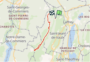
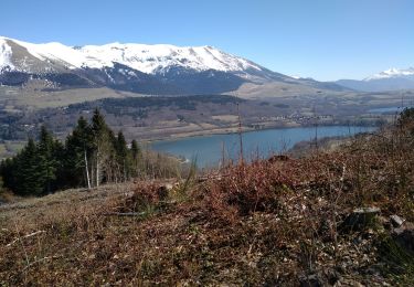
Randonnée Marche nordique de 14 km à découvrir à Auvergne-Rhône-Alpes, Isère, Saint-Jean-de-Vaulx. Cette randonnée est proposée par Emelle.
Description
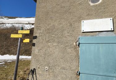
Des Arnauds : se garer au parking à l'entrée du village à droite dans un virage, le parking suivant étant réservé aux habitants.
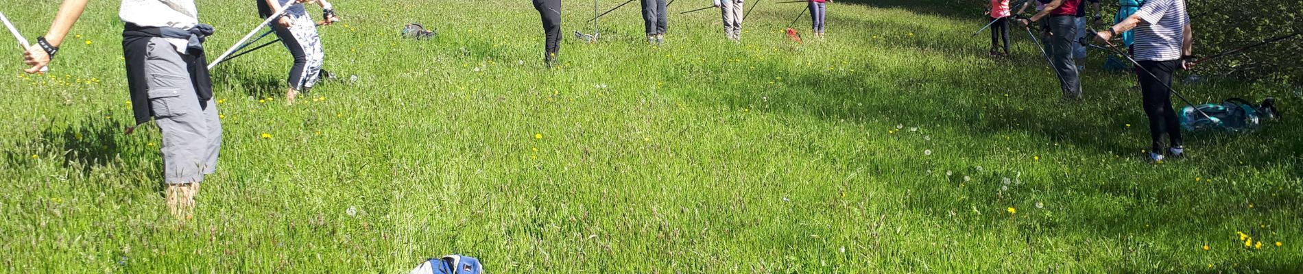
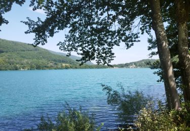
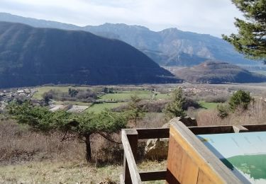
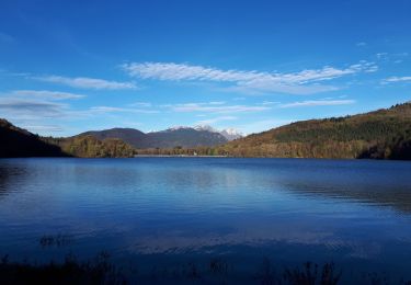
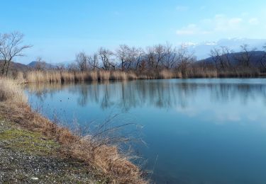
2 groupes constitué, G1 passera avec Elisabeth et Régine au sommet de Beauregard. G2 avec Cécile et Michèle contournera Beauregard par la gauche. Du petit lac, montée plus ou moins ensemble au Grand lac où nous pique-niquerons tout ensemble (17 participants). Table d'orientation à Beauregard. Itinéraire parfaitement adapté à la MN avec une météo exceptionnelle et un panorama à couper le souffle de toute part.
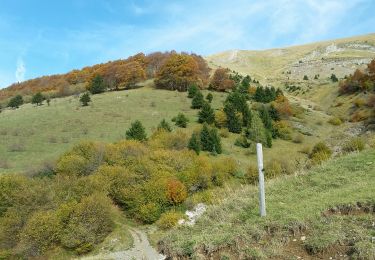
Attention, la montée des bêtes en alpage débute en juin jusqu'au 15 octobre environ. Mieux vaut faire cette MN avant la montée des bêtes en alpage.
Localisation
Commentaires
Randonnées à proximité
![Randonnée Course à pied Vizille - Echappée Belle 2013 - Photo](https://media.geolcdn.com/t/375/260/ext.jpg?maxdim=2&url=https%3A%2F%2Fstatic1.geolcdn.com%2Fsiteimages%2Fupload%2Ffiles%2F1524743154running.jpg)
![Course à pied Course à pied](https://static1.geolcdn.com/sitytour/trail-icons/103.png)
Course à pied
![](/images/other/stat-length.png)
![](https://static1.geolcdn.com/siteimages/upload/files/16400158638029165_repeat_loop_refresh_sync_direction_icon.png)
![Randonnée Marche Champ-sur-Drac - 38 Couvent St Michel Champ / drac - Photo](https://media.geolcdn.com/t/375/260/2541c209-e2b9-4fc5-ac0c-29659bf67ee5.jpg&format=jpg&maxdim=2)
![Marche Marche](https://static1.geolcdn.com/sitytour/trail-icons/101.png)
Marche
![](/images/other/stat-length.png)
![](https://static1.geolcdn.com/siteimages/upload/files/16400158638029165_repeat_loop_refresh_sync_direction_icon.png)
![Randonnée Marche Laffrey - tour du lac de la laffrey - Photo](https://media.geolcdn.com/t/375/260/912e7b86-88b6-42fd-9652-ced4f1ef2e80.jpg&format=jpg&maxdim=2)
![Marche Marche](https://static1.geolcdn.com/sitytour/trail-icons/101.png)
Marche
![](/images/other/stat-length.png)
![](https://static1.geolcdn.com/siteimages/upload/files/16400158638029165_repeat_loop_refresh_sync_direction_icon.png)
![Randonnée Marche Saint-Georges-de-Commiers - Boucle autour de Saint Georges de Commiers - Photo](https://media.geolcdn.com/t/375/260/0bfddc52-e2d2-4332-a925-7e71f6c56a54.jpg&format=jpg&maxdim=2)
![Marche Marche](https://static1.geolcdn.com/sitytour/trail-icons/101.png)
Marche
![](/images/other/stat-length.png)
![](https://static1.geolcdn.com/siteimages/upload/files/16400158638029165_repeat_loop_refresh_sync_direction_icon.png)
![Randonnée Marche Saint-Jean-de-Vaulx - Beauregard - Photo](https://media.geolcdn.com/t/375/260/8654abbb-ac45-4c31-9816-ec7c55c81e78.jpg&format=jpg&maxdim=2)
![Marche Marche](https://static1.geolcdn.com/sitytour/trail-icons/101.png)
Marche
![](/images/other/stat-length.png)
![](https://static1.geolcdn.com/siteimages/upload/files/16400158638029165_repeat_loop_refresh_sync_direction_icon.png)
![Randonnée Marche Laffrey - Tour du Grand Lac de Laffrey en circuit - Photo](https://media.geolcdn.com/t/375/260/65f962d6-a7cb-4b2b-b08e-faf212febe11.jpg&format=jpg&maxdim=2)
![Marche Marche](https://static1.geolcdn.com/sitytour/trail-icons/101.png)
Marche
![](/images/other/stat-length.png)
![](https://static1.geolcdn.com/siteimages/upload/files/16400158638029165_repeat_loop_refresh_sync_direction_icon.png)
![Randonnée Marche nordique Varces-Allières-et-Risset - Circuit en 8 dans la plaine de Reymure - Photo](https://media.geolcdn.com/t/375/260/ac7e2a92-5c9f-475d-bfbf-6f26685b3f42.jpg&format=jpg&maxdim=2)
![Marche nordique Marche nordique](https://static1.geolcdn.com/sitytour/trail-icons/102.png)
Marche nordique
![](/images/other/stat-length.png)
![](https://static1.geolcdn.com/siteimages/upload/files/16400158638029165_repeat_loop_refresh_sync_direction_icon.png)
![Randonnée Marche Saint-Théoffrey - chollonge villard saint Christophe - Photo](https://media.geolcdn.com/t/375/260/4c83fc93-ac7b-485c-8c7d-9b643fe8ae0f.jpg&format=jpg&maxdim=2)
![Marche Marche](https://static1.geolcdn.com/sitytour/trail-icons/101.png)
Marche
![](/images/other/stat-length.png)
![](https://static1.geolcdn.com/siteimages/upload/files/16400158638029165_repeat_loop_refresh_sync_direction_icon.png)
![Randonnée Marche Saint-Jean-de-Vaulx - PIERRE PERCÉE - Photo](https://media.geolcdn.com/t/375/260/f3d96059-afb1-4b63-9d22-a18edd184646.jpg&format=jpg&maxdim=2)
![Marche Marche](https://static1.geolcdn.com/sitytour/trail-icons/101.png)
Marche
![](/images/other/stat-length.png)
![](https://static1.geolcdn.com/siteimages/upload/files/16400158638029165_repeat_loop_refresh_sync_direction_icon.png)