Randonnée Marche La Forêt-de-Tessé - La rando des Châtaignés centenaires - Photo

La rando des Châtaignés centenaires

 alainjoseph6
alainjoseph6

Utilisateur

© OpenStreetMap contributors
Longueur
Longueur
11,8 km
Altitude max
Altitude max
152 m
Dénivelé positif
Dénivelé positif
110 m
Km-Effort
Km-Effort  
13,2 km
Altitude min
Altitude min
125 m
Dénivelé négatif
Dénivelé négatif
110 m
Boucle
Boucle
Oui
Date de création :
2014-12-10 00:00:00.0
Dernière modification :
2014-12-10 00:00:00.0

(1 Avis)

Marche
Marche
3h21
Difficulté : Facile

Scannez ce code QR pour ouvrir la randonnée dans l'application SityTrail

Application GPS de randonnée GRATUITE

Logo SityTrail SityTrail

IGN / Instituts géographiques

Télécharger SityTrail sur l'App Store Télécharger SityTrail sur Google Play

Logo SityTrail SityTrail World

Le monde est à vous

Télécharger SityTrail sur l'App Store Télécharger SityTrail sur Google Play Télécharger SityTrail sur Huawei AppGallery

À propos

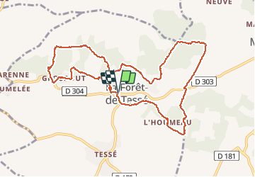
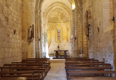
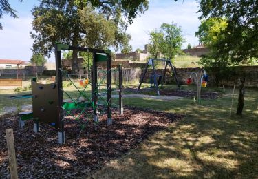
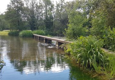
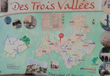
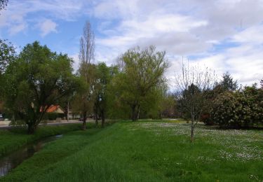
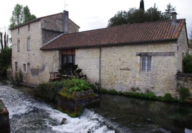
Randonnée Marche de 11,8 km à découvrir à Nouvelle-Aquitaine, Charente, La Forêt-de-Tessé. Cette randonnée est proposée par alainjoseph6.

Description

Facile , trés ombragé

Profil altimétrique

Photos

Localisation

Pays :
France
Région :
Nouvelle-Aquitaine
Département/Province :
Charente
Commune :
La Forêt-de-Tessé
Localité :
Unknown
Départ:(Dec)
Départ:(UTM)
274420 ; 5107122 (31T) N.

Commentaires

Veuillez vous connecter pour laisser un commentaire ou une note


Randonnées à proximité

Randonnée Marche Tusson - La randonnée de Tusson - Photo
Marche
alainjoseph6

Marche

Facile
Tusson, Nouvelle-Aquitaine, Charente, France
8,4 km | 9,5 km-effort
3h 12min
Oui
Randonnée Marche Lichères - 16 - LICHERES - Photo
Marche
AndreLACOMBE

Marche

Très facile
Lichères, Nouvelle-Aquitaine, Charente, France
8,8 km | 9,9 km-effort
4h 18min
Oui
Randonnée Marche Saint-Georges - La rando de St GEORGES 16700 - Photo
Marche
alainjoseph6

Marche

Facile
Saint-Georges, Nouvelle-Aquitaine, Charente, France
7,9 km | 8,9 km-effort
2h 28min
Oui
Randonnée Marche Ruffec - Ruffec_Logis - Photo
Marche
neoroll44

Marche

Moyen
Ruffec, Nouvelle-Aquitaine, Charente, France
17,3 km | 19,7 km-effort
4h 20min
Oui
Randonnée Marche Condac - Condac - Photo
Marche
neoroll44

Marche

Moyen
Condac, Nouvelle-Aquitaine, Charente, France
11,2 km | 13,1 km-effort
3h 0min
Oui
Randonnée Marche Ruffec - Ruffec_Forêt - Photo
Marche
neoroll44

Marche

Facile
Ruffec, Nouvelle-Aquitaine, Charente, France
8,5 km | 10 km-effort
2h 20min
Oui
Randonnée Marche Condac - Condac_Bioussac_Barro - Photo
Marche
neoroll44

Marche

Moyen
Condac, Nouvelle-Aquitaine, Charente, France
26 km | 31 km-effort
6h 40min
Oui
Randonnée Marche Verteuil-sur-Charente - Verteuil sur Charente - Photo
Marche
neoroll44

Marche

Facile
Verteuil-sur-Charente, Nouvelle-Aquitaine, Charente, France
6,6 km | 7,4 km-effort
1h 40min
Oui
Randonnée Marche Nanteuil-en-Vallée - Nanteuil_Condac - Photo
Marche
neoroll44

Marche

Moyen
Nanteuil-en-Vallée, Nouvelle-Aquitaine, Charente, France
26 km | 31 km-effort
7h 0min
Oui


Fermer
Mes abonnements