Randonnée Marche Meix-devant-Virton - Meix devant Virton - Photo
 Airelle
Airelle

Utilisateur

© OpenStreetMap contributors
Longueur
Longueur
12,6 km
Altitude max
Altitude max
356 m
Dénivelé positif
Dénivelé positif
298 m
Km-Effort
Km-Effort  
16,6 km
Altitude min
Altitude min
228 m
Dénivelé négatif
Dénivelé négatif
302 m
Boucle
Boucle
Oui
Date de création :
2022-04-18 09:18:59.0
Dernière modification :
2022-05-14 19:59:49.397

(0 Avis)

Marche
Marche
3h03
Difficulté : Très facile

Scannez ce code QR pour ouvrir la randonnée dans l'application SityTrail

Application GPS de randonnée GRATUITE

Logo SityTrail SityTrail

IGN / Instituts géographiques

Télécharger SityTrail sur l'App Store Télécharger SityTrail sur Google Play

Logo SityTrail SityTrail World

Le monde est à vous

Télécharger SityTrail sur l'App Store Télécharger SityTrail sur Google Play Télécharger SityTrail sur Huawei AppGallery

À propos

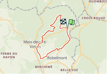
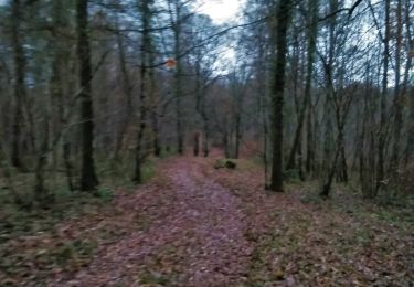
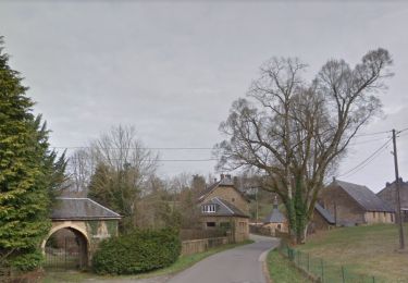
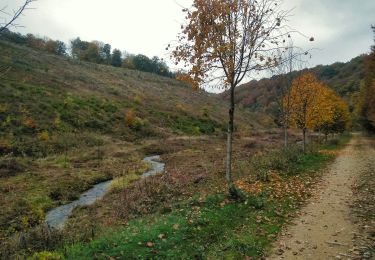
Randonnée Marche de 12,6 km à découvrir à Wallonie, Luxembourg, Meix-devant-Virton. Cette randonnée est proposée par Airelle.

Profil altimétrique

Localisation

Pays :
Belgique
Région :
Wallonie
Département/Province :
Luxembourg
Commune :
Meix-devant-Virton
Localité :
Unknown
Départ:(Dec)
Départ:(UTM)
681977 ; 5499129 (31U) N.

Randonnées à proximité

Randonnée Marche Virton - RB-Lu-17_Ethe_via-var-1-et-2-et-3 - Photo
Marche
PRO

Marche

Très facile
(3)
Virton, Wallonie, Luxembourg, Belgique
29 km | 35 km-effort
7h 33min
Oui
Randonnée Marche Virton - RB-Lu-17_Ethe_via-racc - Photo
Marche
PRO

Marche

Très facile
Virton, Wallonie, Luxembourg, Belgique
15,6 km | 19,3 km-effort
4h 8min
Oui
Randonnée Marche Virton - RB-Lu-17_Ethe - Photo
Marche
PRO

Marche

Très facile
Virton, Wallonie, Luxembourg, Belgique
22 km | 28 km-effort
5h 55min
Oui
Randonnée V.T.T. Virton - Autour de Tintigny  -  Balade_VTT_54Kms - Photo
V.T.T.
Pascal L

V.T.T.

Très difficile
Virton, Wallonie, Luxembourg, Belgique
54 km | 64 km-effort
4h 25min
Oui
Randonnée V.T.T. Virton - Monquintin  -  Balade_VTT_22Kms - Photo
V.T.T.
Pascal L

V.T.T.

Moyen
Virton, Wallonie, Luxembourg, Belgique
22 km | 26 km-effort
1h 48min
Oui
Randonnée V.T.T. Virton - Orval  -  Balade_VTT_50Kms - Photo
V.T.T.
Pascal L

V.T.T.

Très difficile
Virton, Wallonie, Luxembourg, Belgique
50 km | 61 km-effort
4h 15min
Non
Randonnée V.T.T. Virton - Bois du Bonlieu  -  Balade_VTT_24kms - Photo
V.T.T.
Pascal L

V.T.T.

Moyen
Virton, Wallonie, Luxembourg, Belgique
23 km | 28 km-effort
2h 1min
Oui
Randonnée V.T.T. Virton - Berchiwé  -  Balade_VTT_15kms - Photo
V.T.T.
Pascal L

V.T.T.

Facile
Virton, Wallonie, Luxembourg, Belgique
13,7 km | 17,2 km-effort
1h 13min
Oui
Randonnée V.T.T. Virton - La chaussée romaine entre Etalle et Sampont  -  Balade_VTT_53kms - Photo
V.T.T.
Pascal L

V.T.T.

Très difficile
Virton, Wallonie, Luxembourg, Belgique
53 km | 64 km-effort
4h 24min
Oui


Fermer
Mes abonnements