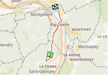
![](/images/other/stat-length.png)
![Randonnée Marche Saint-Georges-d'Hurtières - la lechere/plan du bourg- Val d'arc - Photo](https://media.geolcdn.com/t/1900/400/6b5589cc-1116-407d-9f87-08d7001f11fb.jpg&format=pjpeg&maxdim=2)
la lechere/plan du bourg- Val d'arc
jibebouvier
Utilisateur
![Longueur](/images/other/stat-length.png)
![Altitude max](https://static1.geolcdn.com/siteimages/upload/files/1508320355ic_sort_altitude_max_24dp.png)
![Dénivelé positif](https://static1.geolcdn.com/siteimages/upload/files/1508320355ic_sort_den_pos_24dp.png)
![Km-Effort](/images/other/stat-length.png)
![Altitude min](https://static1.geolcdn.com/siteimages/upload/files/1508320355ic_sort_altitude_min_24dp.png)
![Dénivelé négatif](https://static1.geolcdn.com/siteimages/upload/files/1508320355ic_sort_den_neg_24dp.png)
![Boucle](https://static1.geolcdn.com/siteimages/upload/files/16400158638029165_repeat_loop_refresh_sync_direction_icon.png)
![Marche](https://static1.geolcdn.com/sitytour/trail-icons/101.png)
1h19
Difficulté : Moyen
![Scannez ce code QR pour ouvrir la randonnée dans l'application SityTrail](https://capi.geolives.com/qq0zvz2zws4bq2lad0pu/sitytour/trails/3208306/qr.png?size=200)
Application GPS de randonnée GRATUITE
À propos
Randonnée Marche de 5,7 km à découvrir à Auvergne-Rhône-Alpes, Savoie, Saint-Georges-d'Hurtières. Cette randonnée est proposée par jibebouvier.
Description
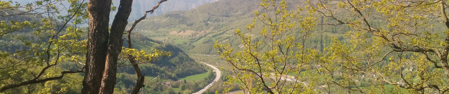
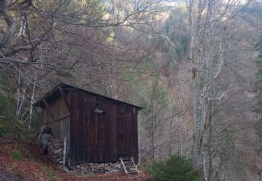
entretien du chemin bofbof... mais ravages cet hiver.
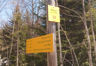
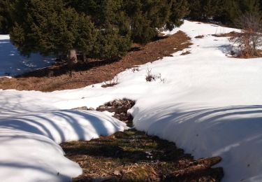
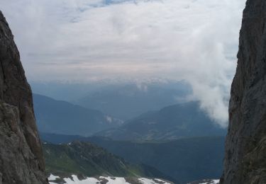
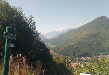
descente tout droit, bug du GPS sous la ligne haute tension, la deuxième photo est après la ligne, sur le chemin du haut en fait... puis descendre sur la gauche puis au panneau montgilbert/Aiguebelle, prendre tout droit en bas /- le long de la ligne de crête, essayer de garder les traces quand il y en a, ça évite 2/3 falaises...
Localisation
Commentaires
Randonnées à proximité
![Randonnée Marche Val-d'Arc - Grand Arc - Photo](https://media.geolcdn.com/t/375/260/ext.jpg?maxdim=2&url=https%3A%2F%2Fstatic1.geolcdn.com%2Fsiteimages%2Fupload%2Ffiles%2F1553511878bg_sport_marche.png)
![Marche Marche](https://static1.geolcdn.com/sitytour/trail-icons/101.png)
Marche
![](/images/other/stat-length.png)
![](https://static1.geolcdn.com/siteimages/upload/files/16400158638029165_repeat_loop_refresh_sync_direction_icon.png)
![Randonnée Marche Montgilbert - les batteries par Montgilbert - Photo](https://media.geolcdn.com/t/375/260/f104cb28-96a4-49e7-af5f-60f831324464.jpg&format=jpg&maxdim=2)
![Marche Marche](https://static1.geolcdn.com/sitytour/trail-icons/101.png)
Marche
![](/images/other/stat-length.png)
![](https://static1.geolcdn.com/siteimages/upload/files/16400158638029165_repeat_loop_refresh_sync_direction_icon.png)
![Randonnée Marche Montsapey - petit arc par bataille dessus printemps - Photo](https://media.geolcdn.com/t/375/260/3bc7f631-fc7c-488f-b081-67d83a0e2dae.jpg&format=jpg&maxdim=2)
![Marche Marche](https://static1.geolcdn.com/sitytour/trail-icons/101.png)
Marche
![](/images/other/stat-length.png)
![](https://static1.geolcdn.com/siteimages/upload/files/16400158638029165_repeat_loop_refresh_sync_direction_icon.png)
![Randonnée Marche Val-d'Arc - tour du haut de Randens - Photo](https://media.geolcdn.com/t/375/260/aa8a7963-0ce0-4bad-bb6f-4b975d8a3b5b.jpg&format=jpg&maxdim=2)
![Marche Marche](https://static1.geolcdn.com/sitytour/trail-icons/101.png)
Marche
![](/images/other/stat-length.png)
![](https://static1.geolcdn.com/siteimages/upload/files/16400158638029165_repeat_loop_refresh_sync_direction_icon.png)
![Randonnée Marche Montsapey - la chapelle de montsap' lac noir - Photo](https://media.geolcdn.com/t/375/260/d1b6e184-6050-487d-bf66-654bd3da97db.jpg&format=jpg&maxdim=2)
![Marche Marche](https://static1.geolcdn.com/sitytour/trail-icons/101.png)
Marche
![](/images/other/stat-length.png)
![](https://static1.geolcdn.com/siteimages/upload/files/16400158638029165_repeat_loop_refresh_sync_direction_icon.png)
![Randonnée Marche Val-d'Arc - les Mauilles - Photo](https://media.geolcdn.com/t/375/260/99262bd5-4b71-4afc-aeb9-3a185909dc30.jpg&format=jpg&maxdim=2)
![Marche Marche](https://static1.geolcdn.com/sitytour/trail-icons/101.png)
Marche
![](/images/other/stat-length.png)
![](https://static1.geolcdn.com/siteimages/upload/files/16400158638029165_repeat_loop_refresh_sync_direction_icon.png)
![Randonnée Marche Argentine - pointe st jacques de l place du dîner - Photo](https://media.geolcdn.com/t/375/260/e608d394-84c7-4d0a-affb-164df67ae720.jpg&format=jpg&maxdim=2)
![Marche Marche](https://static1.geolcdn.com/sitytour/trail-icons/101.png)
Marche
![](/images/other/stat-length.png)
![](https://static1.geolcdn.com/siteimages/upload/files/16400158638029165_repeat_loop_refresh_sync_direction_icon.png)
![Randonnée Marche Argentine - le coup de hache - Photo](https://media.geolcdn.com/t/375/260/16257b65-e2ab-4d8c-af93-e93ae270dd4b.jpg&format=jpg&maxdim=2)
![Marche Marche](https://static1.geolcdn.com/sitytour/trail-icons/101.png)
Marche
![](/images/other/stat-length.png)
![](https://static1.geolcdn.com/siteimages/upload/files/16400158638029165_repeat_loop_refresh_sync_direction_icon.png)
![Randonnée Marche Val-d'Arc - les Mauilles via la chapelle de Montsapey - Photo](https://media.geolcdn.com/t/375/260/dab65706-9867-4143-bb5d-ccf09635fe4e.jpg&format=jpg&maxdim=2)
![Marche Marche](https://static1.geolcdn.com/sitytour/trail-icons/101.png)
Marche
![](/images/other/stat-length.png)
![](https://static1.geolcdn.com/siteimages/upload/files/16400158638029165_repeat_loop_refresh_sync_direction_icon.png)