![](/images/other/stat-length.png)
![Randonnée Marche Bertrix - More et pire - Mortehan - Photo](https://media.geolcdn.com/t/1900/400/ext.pjpeg?maxdim=2&url=https%3A%2F%2Fmedia.geolcdn.com%2Ff%2F8e1f7469-1019-4c62-ab14-35adf05b0cc9.jpg)
More et pire - Mortehan
BrigitteBertrand
Utilisateur
![Longueur](/images/other/stat-length.png)
Longueur
13,7 km
![Altitude max](https://static1.geolcdn.com/siteimages/upload/files/1508320355ic_sort_altitude_max_24dp.png)
Altitude max
401 m
![Dénivelé positif](https://static1.geolcdn.com/siteimages/upload/files/1508320355ic_sort_den_pos_24dp.png)
Dénivelé positif
395 m
![Km-Effort](/images/other/stat-length.png)
Km-Effort
19 km
![Altitude min](https://static1.geolcdn.com/siteimages/upload/files/1508320355ic_sort_altitude_min_24dp.png)
Altitude min
240 m
![Dénivelé négatif](https://static1.geolcdn.com/siteimages/upload/files/1508320355ic_sort_den_neg_24dp.png)
Dénivelé négatif
394 m
![Boucle](https://static1.geolcdn.com/siteimages/upload/files/16400158638029165_repeat_loop_refresh_sync_direction_icon.png)
Boucle
Oui
Date de création :
2022-04-16 08:42:09.0
Dernière modification :
2022-04-16 17:14:49.732
![Marche](https://static1.geolcdn.com/sitytour/trail-icons/101.png)
4h34
Difficulté : Très difficile
![Scannez ce code QR pour ouvrir la randonnée dans l'application SityTrail](https://capi.geolives.com/qq0zvz2zws4bq2lad0pu/sitytour/trails/3207141/qr.png?size=200)
Application GPS de randonnée GRATUITE
À propos
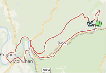
Randonnée Marche de 13,7 km à découvrir à Wallonie, Luxembourg, Bertrix. Cette randonnée est proposée par BrigitteBertrand.
Description
Depuis ka chapelle Sainte Barbe jusqu‘au vieux cimetière de Mortehan et retour par Cugnon
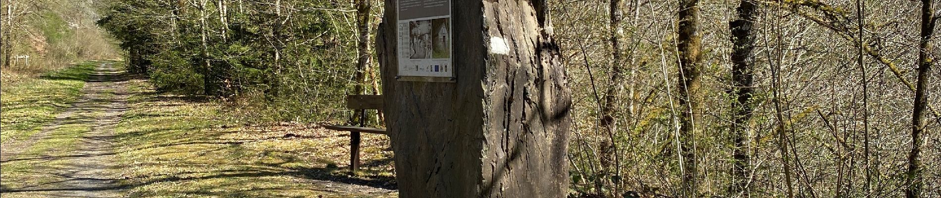
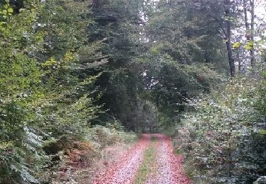
Localisation
Pays :
Belgique
Région :
Wallonie
Département/Province :
Luxembourg
Commune :
Bertrix
Localité :
Unknown
Départ:(Dec)
Départ:(UTM)
662155 ; 5520085 (31U) N.
Commentaires
Randonnées à proximité
![Randonnée Autre activité Bertrix - BX08 - Photo](https://media.geolcdn.com/t/375/260/ext.jpg?maxdim=2&url=https%3A%2F%2Fstatic1.geolcdn.com%2Fsiteimages%2Fupload%2Ffiles%2F1545311037marcheuse_200dpi.jpg)
![Autre activité Autre activité](https://static1.geolcdn.com/sitytour/trail-icons/900.png)
BX08
Autre activité
Très facile
(8)
Bertrix,
Wallonie,
Luxembourg,
Belgique
![](/images/other/stat-length.png)
7,3 km | 10 km-effort
2h 30min
![](https://static1.geolcdn.com/siteimages/upload/files/16400158638029165_repeat_loop_refresh_sync_direction_icon.png)
Oui
![Randonnée Autre activité Bertrix - BX12 - Photo](https://media.geolcdn.com/t/375/260/ext.jpg?maxdim=2&url=https%3A%2F%2Fstatic1.geolcdn.com%2Fsiteimages%2Fupload%2Ffiles%2F1545311037marcheuse_200dpi.jpg)
![Autre activité Autre activité](https://static1.geolcdn.com/sitytour/trail-icons/900.png)
BX12
Autre activité
Facile
(15)
Bertrix,
Wallonie,
Luxembourg,
Belgique
![](/images/other/stat-length.png)
6,2 km | 7,9 km-effort
2h 0min
![](https://static1.geolcdn.com/siteimages/upload/files/16400158638029165_repeat_loop_refresh_sync_direction_icon.png)
Oui
![Randonnée Marche Herbeumont - RB-Lu-23_Herbeumont_via-racc-1-et-var - Photo](https://media.geolcdn.com/t/375/260/ext.jpg?maxdim=2&url=https%3A%2F%2Fmedia.geolcdn.com%2Ff%2Fc1667125-e527-4cc4-8453-c74fbd68c241.JPG)
![Marche Marche](https://static1.geolcdn.com/sitytour/trail-icons/101.png)
RB-Lu-23_Herbeumont_via-racc-1-et-var
Marche
Très difficile
(4)
Herbeumont,
Wallonie,
Luxembourg,
Belgique
![](/images/other/stat-length.png)
18,6 km | 25 km-effort
5h 44min
![](https://static1.geolcdn.com/siteimages/upload/files/16400158638029165_repeat_loop_refresh_sync_direction_icon.png)
Oui
![Randonnée Marche Herbeumont - RB-Lu-23_Herbeumont - Photo](https://media.geolcdn.com/t/375/260/ext.jpg?maxdim=2&url=https%3A%2F%2Fmedia.geolcdn.com%2Ff%2Fe83456c6-39b8-46b6-a3cd-0a6663e7b9ef.JPG)
![Marche Marche](https://static1.geolcdn.com/sitytour/trail-icons/101.png)
RB-Lu-23_Herbeumont
Marche
Difficile
(2)
Herbeumont,
Wallonie,
Luxembourg,
Belgique
![](/images/other/stat-length.png)
26 km | 35 km-effort
7h 26min
![](https://static1.geolcdn.com/siteimages/upload/files/16400158638029165_repeat_loop_refresh_sync_direction_icon.png)
Oui
![Randonnée Marche Herbeumont - Marche Adeps 10 km - Photo](https://media.geolcdn.com/t/375/260/ext.jpg?maxdim=2&url=https%3A%2F%2Fmedia.geolcdn.com%2Ff%2F11449747-1df2-4772-8052-46b8846528c2.JPG)
![Marche Marche](https://static1.geolcdn.com/sitytour/trail-icons/101.png)
Marche Adeps 10 km
Marche
Difficile
(2)
Herbeumont,
Wallonie,
Luxembourg,
Belgique
![](/images/other/stat-length.png)
9,1 km | 12,6 km-effort
2h 51min
![](https://static1.geolcdn.com/siteimages/upload/files/16400158638029165_repeat_loop_refresh_sync_direction_icon.png)
Oui
![Randonnée Marche Herbeumont - RSIH - Herbeumont - Les Épioux - Photo](https://media.geolcdn.com/t/375/260/ext.jpg?maxdim=2&url=https%3A%2F%2Fmedia.geolcdn.com%2Ff%2Fca0e741e-0f45-4c3d-9414-5f2e5834b9ce.jpg)
![Marche Marche](https://static1.geolcdn.com/sitytour/trail-icons/101.png)
RSIH - Herbeumont - Les Épioux
Marche
Difficile
(1)
Herbeumont,
Wallonie,
Luxembourg,
Belgique
![](/images/other/stat-length.png)
14,8 km | 19,2 km-effort
4h 21min
![](https://static1.geolcdn.com/siteimages/upload/files/16400158638029165_repeat_loop_refresh_sync_direction_icon.png)
Oui
![Randonnée Marche Herbeumont - Les Burzais - départ du gite Le bout des bois - Photo](https://media.geolcdn.com/t/375/260/ext.jpg?maxdim=2&url=https%3A%2F%2Fservices.sitytrail.com%2FGeolivesWS%2FDownloadMedia.ashx%3FTrailID%3D419104%26Media%3Dfix__20140609121902.jpg)
![Marche Marche](https://static1.geolcdn.com/sitytour/trail-icons/101.png)
Les Burzais - départ du gite Le bout des bois
Marche
Moyen
(2)
Herbeumont,
Wallonie,
Luxembourg,
Belgique
![](/images/other/stat-length.png)
4,2 km | 5,9 km-effort
1h 30min
![](https://static1.geolcdn.com/siteimages/upload/files/16400158638029165_repeat_loop_refresh_sync_direction_icon.png)
Oui
![Randonnée Course à pied Herbeumont - herbeumont libaipire - Photo](https://media.geolcdn.com/t/375/260/ext.jpg?maxdim=2&url=https%3A%2F%2Fservices.sitytrail.com%2FGeolivesWS%2FDownloadMedia.ashx%3FTrailID%3D356345%26Media%3Dfix__20141022103733.jpg)
![Course à pied Course à pied](https://static1.geolcdn.com/sitytour/trail-icons/103.png)
herbeumont libaipire
Course à pied
Moyen
(1)
Herbeumont,
Wallonie,
Luxembourg,
Belgique
![](/images/other/stat-length.png)
15,5 km | 22 km-effort
1h 46min
![](https://static1.geolcdn.com/siteimages/upload/files/16400158638029165_repeat_loop_refresh_sync_direction_icon.png)
Non
![Randonnée Marche Bertrix - cornichai 02 - Photo](https://media.geolcdn.com/t/375/260/ext.jpg?maxdim=2&url=https%3A%2F%2Fservices.sitytrail.com%2FGeolivesWS%2FDownloadMedia.ashx%3FTrailID%3D344278%26Media%3Dfix__20140911103800.jpg)
![Marche Marche](https://static1.geolcdn.com/sitytour/trail-icons/101.png)
cornichai 02
Marche
Moyen
(3)
Bertrix,
Wallonie,
Luxembourg,
Belgique
![](/images/other/stat-length.png)
10,5 km | 13,7 km-effort
2h 5min
![](https://static1.geolcdn.com/siteimages/upload/files/16400158638029165_repeat_loop_refresh_sync_direction_icon.png)
Oui