![](/images/other/stat-length.png)
![Randonnée Marche Saint-Désert - St-Désert Saint-Denis-de-Vaux en boucle - Photo](https://media.geolcdn.com/t/1900/400/ext.pjpeg?maxdim=2&url=https%3A%2F%2Fstatic1.geolcdn.com%2Fsiteimages%2Fupload%2Ffiles%2F1553511878bg_sport_marche.png)
St-Désert Saint-Denis-de-Vaux en boucle
Papé TB
Utilisateur
![Longueur](/images/other/stat-length.png)
Longueur
12,9 km
![Altitude max](https://static1.geolcdn.com/siteimages/upload/files/1508320355ic_sort_altitude_max_24dp.png)
Altitude max
436 m
![Dénivelé positif](https://static1.geolcdn.com/siteimages/upload/files/1508320355ic_sort_den_pos_24dp.png)
Dénivelé positif
512 m
![Km-Effort](/images/other/stat-length.png)
Km-Effort
19,8 km
![Altitude min](https://static1.geolcdn.com/siteimages/upload/files/1508320355ic_sort_altitude_min_24dp.png)
Altitude min
234 m
![Dénivelé négatif](https://static1.geolcdn.com/siteimages/upload/files/1508320355ic_sort_den_neg_24dp.png)
Dénivelé négatif
514 m
![Boucle](https://static1.geolcdn.com/siteimages/upload/files/16400158638029165_repeat_loop_refresh_sync_direction_icon.png)
Boucle
Oui
Date de création :
2022-04-13 11:30:33.0
Dernière modification :
2022-04-15 07:20:28.117
![Marche](https://static1.geolcdn.com/sitytour/trail-icons/101.png)
3h22
Difficulté : Moyen
![Scannez ce code QR pour ouvrir la randonnée dans l'application SityTrail](https://capi.geolives.com/qq0zvz2zws4bq2lad0pu/sitytour/trails/3203339/qr.png?size=200)
Application GPS de randonnée GRATUITE
À propos
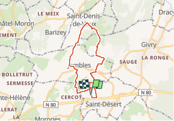
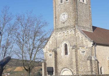
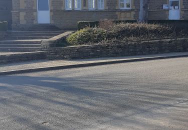
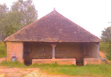
Randonnée Marche de 12,9 km à découvrir à Bourgogne-Franche-Comté, Saône-et-Loire, Saint-Désert. Cette randonnée est proposée par Papé TB.
Description
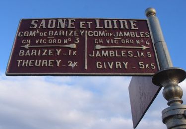
St-Désert, Montbogre, Mont-Avril, Jambles, Saint-Denis-de-Vaux, Russilly, Charnailles, Mont-Pouroux, Montbogre, St-Désert
Localisation
Pays :
France
Région :
Bourgogne-Franche-Comté
Département/Province :
Saône-et-Loire
Commune :
Saint-Désert
Localité :
Unknown
Départ:(Dec)
Départ:(UTM)
629985 ; 5179744 (31T) N.
Commentaires
Randonnées à proximité
![Randonnée Marche Bissey-sous-Cruchaud - Bissey sous Cruchaud 09/2023 Grs - Photo](https://media.geolcdn.com/t/375/260/ext.jpg?maxdim=2&url=https%3A%2F%2Fstatic1.geolcdn.com%2Fsiteimages%2Fupload%2Ffiles%2F1553511878bg_sport_marche.png)
![Marche Marche](https://static1.geolcdn.com/sitytour/trail-icons/101.png)
Bissey sous Cruchaud 09/2023 Grs
Marche
Moyen
(2)
Bissey-sous-Cruchaud,
Bourgogne-Franche-Comté,
Saône-et-Loire,
France
![](/images/other/stat-length.png)
7,6 km | 10,2 km-effort
2h 18min
![](https://static1.geolcdn.com/siteimages/upload/files/16400158638029165_repeat_loop_refresh_sync_direction_icon.png)
Oui
![Randonnée A pied Givry - Jambles d'un Versant - Photo](https://media.geolcdn.com/t/375/260/722afda8-d8a8-405c-9983-89cb9c7463ce.jpeg&format=jpg&maxdim=2)
![A pied A pied](https://static1.geolcdn.com/sitytour/trail-icons/100.png)
Jambles d'un Versant
A pied
Facile
Givry,
Bourgogne-Franche-Comté,
Saône-et-Loire,
France
![](/images/other/stat-length.png)
7,3 km | 9,1 km-effort
2h 4min
![](https://static1.geolcdn.com/siteimages/upload/files/16400158638029165_repeat_loop_refresh_sync_direction_icon.png)
Non
![Randonnée Marche Châtel-Moron - Chatel Moron - Photo](https://media.geolcdn.com/t/375/260/ext.jpg?maxdim=2&url=https%3A%2F%2Fstatic1.geolcdn.com%2Fsiteimages%2Fupload%2Ffiles%2F1553511878bg_sport_marche.png)
![Marche Marche](https://static1.geolcdn.com/sitytour/trail-icons/101.png)
Chatel Moron
Marche
Facile
(1)
Châtel-Moron,
Bourgogne-Franche-Comté,
Saône-et-Loire,
France
![](/images/other/stat-length.png)
9 km | 12,3 km-effort
Inconnu
![](https://static1.geolcdn.com/siteimages/upload/files/16400158638029165_repeat_loop_refresh_sync_direction_icon.png)
Oui
![Randonnée Marche Saint-Désert - Saint-Désert - Photo](https://media.geolcdn.com/t/375/260/2fc36186-c709-42cd-b8f7-4e87a0f7289f.jpg&format=jpg&maxdim=2)
![Marche Marche](https://static1.geolcdn.com/sitytour/trail-icons/101.png)
Saint-Désert
Marche
Moyen
Saint-Désert,
Bourgogne-Franche-Comté,
Saône-et-Loire,
France
![](/images/other/stat-length.png)
10,6 km | 14,7 km-effort
3h 6min
![](https://static1.geolcdn.com/siteimages/upload/files/16400158638029165_repeat_loop_refresh_sync_direction_icon.png)
Oui
![Randonnée Marche Sainte-Hélène - Sainte Hélène - Photo](https://media.geolcdn.com/t/375/260/1301789a-52fc-4f51-93d7-c9f04eaa753b.jpg&format=jpg&maxdim=2)
![Marche Marche](https://static1.geolcdn.com/sitytour/trail-icons/101.png)
Sainte Hélène
Marche
Difficile
Sainte-Hélène,
Bourgogne-Franche-Comté,
Saône-et-Loire,
France
![](/images/other/stat-length.png)
21 km | 28 km-effort
4h 16min
![](https://static1.geolcdn.com/siteimages/upload/files/16400158638029165_repeat_loop_refresh_sync_direction_icon.png)
Oui
![Randonnée Marche Saint-Désert - Saint-Désert - Photo](https://media.geolcdn.com/t/375/260/8aae808d-b51c-4bea-82c6-d4ca0a14ed68.jpg&format=jpg&maxdim=2)
![Marche Marche](https://static1.geolcdn.com/sitytour/trail-icons/101.png)
Saint-Désert
Marche
Difficile
Saint-Désert,
Bourgogne-Franche-Comté,
Saône-et-Loire,
France
![](/images/other/stat-length.png)
22 km | 30 km-effort
4h 50min
![](https://static1.geolcdn.com/siteimages/upload/files/16400158638029165_repeat_loop_refresh_sync_direction_icon.png)
Oui
![Randonnée Marche Sainte-Hélène - Sainte Hélène - Photo](https://media.geolcdn.com/t/375/260/f4d812b5-676e-40c4-8eb4-d5a387c756f4.jpg&format=jpg&maxdim=2)
![Marche Marche](https://static1.geolcdn.com/sitytour/trail-icons/101.png)
Sainte Hélène
Marche
Moyen
Sainte-Hélène,
Bourgogne-Franche-Comté,
Saône-et-Loire,
France
![](/images/other/stat-length.png)
14,6 km | 20 km-effort
2h 53min
![](https://static1.geolcdn.com/siteimages/upload/files/16400158638029165_repeat_loop_refresh_sync_direction_icon.png)
Non
![Randonnée Marche Moroges - Moroges - Photo](https://media.geolcdn.com/t/375/260/515cb75a-87c8-483f-8f22-a82a869338c1.jpg&format=jpg&maxdim=2)
![Marche Marche](https://static1.geolcdn.com/sitytour/trail-icons/101.png)
Moroges
Marche
Très facile
Moroges,
Bourgogne-Franche-Comté,
Saône-et-Loire,
France
![](/images/other/stat-length.png)
6 km | 8,7 km-effort
1h 43min
![](https://static1.geolcdn.com/siteimages/upload/files/16400158638029165_repeat_loop_refresh_sync_direction_icon.png)
Oui
![Randonnée A pied Rosey - Les 4 Lavoirs - Photo](https://media.geolcdn.com/t/375/260/dda8e7a1-a6d1-4113-876e-0589fcd4b822.jpeg&format=jpg&maxdim=2)
![A pied A pied](https://static1.geolcdn.com/sitytour/trail-icons/100.png)
Les 4 Lavoirs
A pied
Facile
Rosey,
Bourgogne-Franche-Comté,
Saône-et-Loire,
France
![](/images/other/stat-length.png)
6,6 km | 8,5 km-effort
1h 55min
![](https://static1.geolcdn.com/siteimages/upload/files/16400158638029165_repeat_loop_refresh_sync_direction_icon.png)
Non