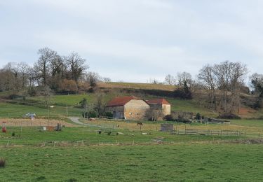
11,3 km | 13,5 km-effort
G4 OgenneComptort fait
LouisROGER
Utilisateur GUIDE
Longueur
11,4 km
Altitude max
282 m
Dénivelé positif
159 m
Km-Effort
13,5 km
Altitude min
163 m
Dénivelé négatif
159 m
Boucle
Oui
Date de création :
2022-04-08 07:56:50.485
Dernière modification :
2022-04-08 13:07:02.405
3h02
Difficulté : Difficile
Application GPS de randonnée GRATUITE
À propos
Randonnée Marche de 11,4 km à découvrir à Nouvelle-Aquitaine, Pyrénées-Atlantiques, Ogenne-Camptort. Cette randonnée est proposée par LouisROGER.
Localisation
Pays :
France
Région :
Nouvelle-Aquitaine
Département/Province :
Pyrénées-Atlantiques
Commune :
Ogenne-Camptort
Localité :
Unknown
Départ:(Dec)
Départ:(UTM)
686479 ; 4799905 (30T) N.
Commentaires
Randonnées à proximité
Ogenne - Camptort
Marche
Moyen
Vielleségure,
Nouvelle-Aquitaine,
Pyrénées-Atlantiques,
France
2h 45min
Non
LUCQ de BEARN- Le Vallon du LAYOUS- G4- Reco du 30 oct 2024-MD
Marche
Difficile
Lucq-de-Béarn,
Nouvelle-Aquitaine,
Pyrénées-Atlantiques,
France
9,2 km | 12 km-effort
5h 0min
Oui
Camino 1 étape 29
Marche
Moyen
Navarrenx,
Nouvelle-Aquitaine,
Pyrénées-Atlantiques,
France
21 km | 25 km-effort
7h 4min
Non
Laus Creek Ranch ---> Les Petits Sabots
Randonnée équestre
Facile
Lay-Lamidou,
Nouvelle-Aquitaine,
Pyrénées-Atlantiques,
France
13 km | 17,5 km-effort
2h 17min
Non
g4gurs fait
Marche
Très facile
Gurs,
Nouvelle-Aquitaine,
Pyrénées-Atlantiques,
France
10,8 km | 13,7 km-effort
4h 57min
Oui
St Jacques Etape 34
Marche
Facile
Navarrenx,
Nouvelle-Aquitaine,
Pyrénées-Atlantiques,
France
18,7 km | 23 km-effort
4h 57min
Non
Navarrenx-Saint-Palais (Aroue)
Marche
Moyen
Navarrenx,
Nouvelle-Aquitaine,
Pyrénées-Atlantiques,
France
22 km | 26 km-effort
5h 38min
Non
navarenx/lichos
Marche
Facile
Navarrenx,
Nouvelle-Aquitaine,
Pyrénées-Atlantiques,
France
17,6 km | 21 km-effort
4h 35min
Non
Navarrrenx - Béarn des gaves
Cyclotourisme
Moyen
Navarrenx,
Nouvelle-Aquitaine,
Pyrénées-Atlantiques,
France
67 km | 81 km-effort
Inconnu
Oui