


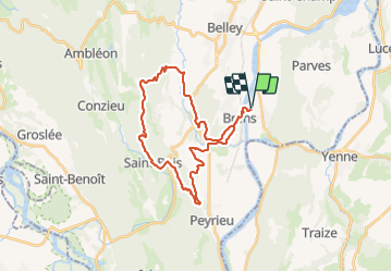

39 km | 54 km-effort


Utilisateur


Application GPS de randonnée GRATUITE
 SityTrail
IGN / Instituts géographiques
SityTrail World
Le monde est à vous
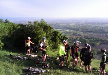
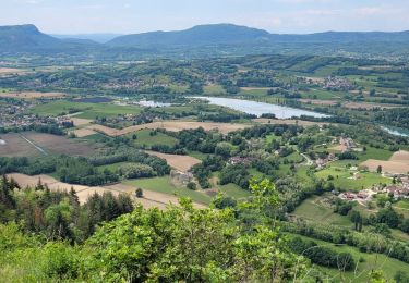
Randonnée V.T.T. de 30 km à découvrir à Auvergne-Rhône-Alpes, Ain, Virignin. Cette randonnée est proposée par jeannot01.
Un beau parcourt bien vallonné.
De bonnes grimpettes qui font un peu mal aux jambes en début de saison et de belles descentes.

V.T.T.
V.T.T.

Marche

V.T.T.
V.T.T.
V.T.T.
Marche

Vélo de route
V.T.T.