Randonnée Marche Simmerath - Einrhur 23 km - Photo
 rvapeldo
rvapeldo

Utilisateur GUIDE

© OpenStreetMap contributors
Longueur
Longueur
23 km
Altitude max
Altitude max
525 m
Dénivelé positif
Dénivelé positif
477 m
Km-Effort
Km-Effort  
29 km
Altitude min
Altitude min
280 m
Dénivelé négatif
Dénivelé négatif
476 m
Boucle
Boucle
Oui
Date de création :
2022-04-03 08:17:10.0
Dernière modification :
2022-04-03 18:03:19.075

(0 Avis)

Marche
Marche
7h51
Difficulté : Moyen

Scannez ce code QR pour ouvrir la randonnée dans l'application SityTrail

Application GPS de randonnée GRATUITE

Logo SityTrail SityTrail

IGN / Instituts géographiques

Télécharger SityTrail sur l'App Store Télécharger SityTrail sur Google Play

Logo SityTrail SityTrail World

Le monde est à vous

Télécharger SityTrail sur l'App Store Télécharger SityTrail sur Google Play Télécharger SityTrail sur Huawei AppGallery

À propos

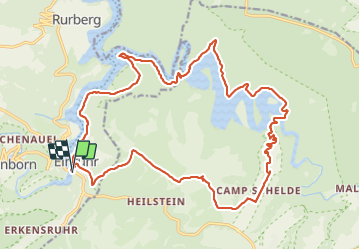
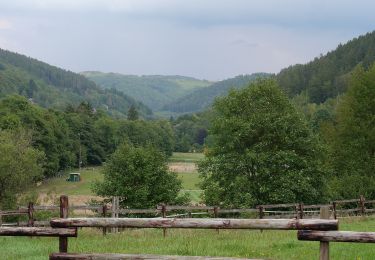
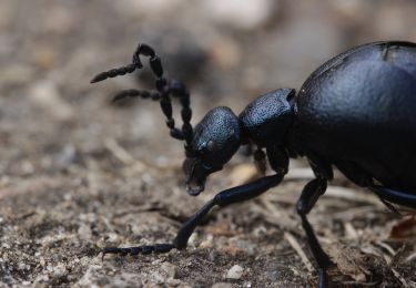
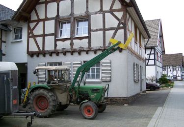
Randonnée Marche de 23 km à découvrir à Rhénanie-du-Nord-Westphalie, Région urbaine d'Aix-la-Chapelle, Simmerath. Cette randonnée est proposée par rvapeldo.

Profil altimétrique

Photos

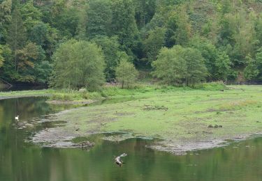
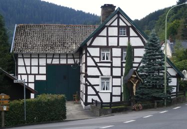
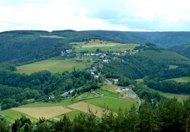
24 photos au total. Cliquez sur une photo pour les afficher toutes dans la galerie.

Localisation

Pays :
Allemagne
Région :
Rhénanie-du-Nord-Westphalie
Département/Province :
Région urbaine d'Aix-la-Chapelle
Commune :
Simmerath
Localité :
Unknown
Départ:(Dec)
Départ:(UTM)
314504 ; 5606509 (32U) N.

Randonnées à proximité

Randonnée A pied Simmerath - Rur-Panoramaweg - Photo
A pied
GUIDE+

A pied

Facile
Simmerath, Rhénanie-du-Nord-Westphalie, Région urbaine d'Aix-la-Chapelle, Allemagne
6,5 km | 8,8 km-effort
1h 59min
Oui
Randonnée A pied Simmerath - DE-66 - Photo
A pied
GUIDE+

A pied

Facile
Simmerath, Rhénanie-du-Nord-Westphalie, Région urbaine d'Aix-la-Chapelle, Allemagne
5,8 km | 7,8 km-effort
1h 46min
Oui
Randonnée A pied Simmerath - Eifelverein OG Eicherscheid - Weg 26 - Photo
A pied
GUIDE+

A pied

Facile
Simmerath, Rhénanie-du-Nord-Westphalie, Région urbaine d'Aix-la-Chapelle, Allemagne
7,2 km | 9,4 km-effort
2h 8min
Oui
Randonnée A pied Simmerath - Eichheck-Runde - Photo
A pied
GUIDE+

A pied

Facile
Simmerath, Rhénanie-du-Nord-Westphalie, Région urbaine d'Aix-la-Chapelle, Allemagne
8,1 km | 11,5 km-effort
2h 37min
Oui
Randonnée A pied Simmerath - DE-75 - Photo
A pied
GUIDE+

A pied

Moyen
Simmerath, Rhénanie-du-Nord-Westphalie, Région urbaine d'Aix-la-Chapelle, Allemagne
14,9 km | 20 km-effort
4h 35min
Oui
Randonnée A pied Simmerath - Rursee-Höhenweg - Photo
A pied
GUIDE+

A pied

Facile
Simmerath, Rhénanie-du-Nord-Westphalie, Région urbaine d'Aix-la-Chapelle, Allemagne
11,7 km | 15,6 km-effort
3h 33min
Oui
Randonnée A pied Simmerath - Dorfrundgang Rurberg - Photo
A pied
GUIDE+

A pied

Facile
Simmerath, Rhénanie-du-Nord-Westphalie, Région urbaine d'Aix-la-Chapelle, Allemagne
4,2 km | 5,4 km-effort
1h 13min
Oui
Randonnée A pied Simmerath - Dorfrundgang Erkensruhr - Photo
A pied
GUIDE+

A pied

Facile
Simmerath, Rhénanie-du-Nord-Westphalie, Région urbaine d'Aix-la-Chapelle, Allemagne
6,9 km | 9,3 km-effort
2h 6min
Oui
Randonnée A pied Simmerath - Einruhr - Sauermühle - Photo
A pied
GUIDE+

A pied

Facile
Simmerath, Rhénanie-du-Nord-Westphalie, Région urbaine d'Aix-la-Chapelle, Allemagne
8,4 km | 12 km-effort
2h 43min
Oui


Fermer
Mes abonnements