![](/images/other/stat-length.png)
![Randonnée Marche Saint-Sauveur-de-Montagut - LE Moulinon St Michel de Chabrillanoux - Photo](https://media.geolcdn.com/t/1900/400/ext.pjpeg?maxdim=2&url=https%3A%2F%2Fstatic1.geolcdn.com%2Fsiteimages%2Fupload%2Ffiles%2F1553511878bg_sport_marche.png)
LE Moulinon St Michel de Chabrillanoux
TOULAUDIN
Utilisateur
![Longueur](/images/other/stat-length.png)
![Altitude max](https://static1.geolcdn.com/siteimages/upload/files/1508320355ic_sort_altitude_max_24dp.png)
![Dénivelé positif](https://static1.geolcdn.com/siteimages/upload/files/1508320355ic_sort_den_pos_24dp.png)
![Km-Effort](/images/other/stat-length.png)
![Altitude min](https://static1.geolcdn.com/siteimages/upload/files/1508320355ic_sort_altitude_min_24dp.png)
![Dénivelé négatif](https://static1.geolcdn.com/siteimages/upload/files/1508320355ic_sort_den_neg_24dp.png)
![Boucle](https://static1.geolcdn.com/siteimages/upload/files/16400158638029165_repeat_loop_refresh_sync_direction_icon.png)
![Marche](https://static1.geolcdn.com/sitytour/trail-icons/101.png)
3h20
Difficulté : Facile
![Scannez ce code QR pour ouvrir la randonnée dans l'application SityTrail](https://capi.geolives.com/qq0zvz2zws4bq2lad0pu/sitytour/trails/3190817/qr.png?size=200)
Application GPS de randonnée GRATUITE
À propos
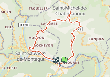
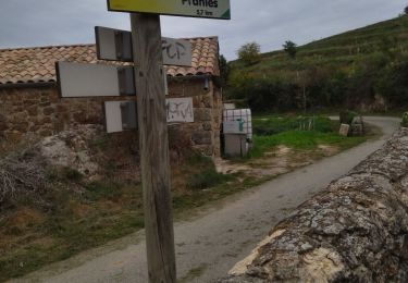
Randonnée Marche de 10,5 km à découvrir à Auvergne-Rhône-Alpes, Ardèche, Saint-Sauveur-de-Montagut. Cette randonnée est proposée par TOULAUDIN.
Description
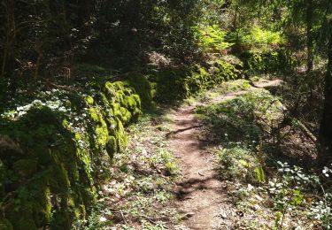
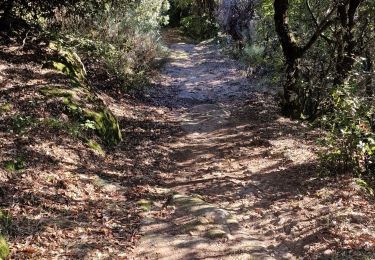
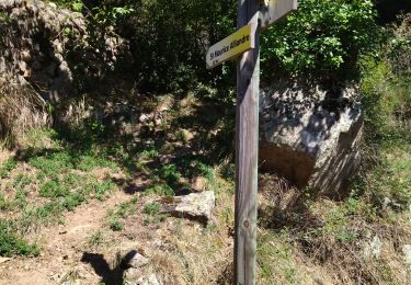
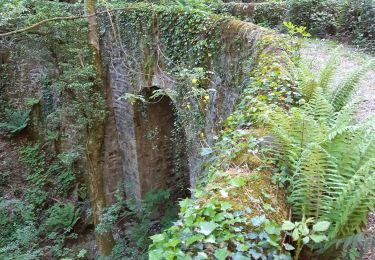
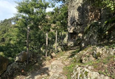
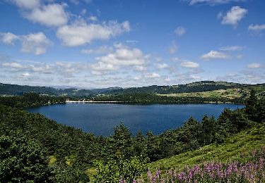
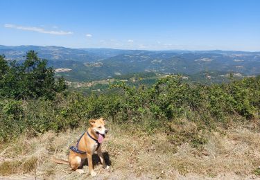
trace réelle : beau parcours toute la montée progressive sur St Michel est sur un chemin ombragé genre chemin de muletier très marchant .à St Michel ,ne pas manquer d'aller voir un de plus vieux maronier de france.à la descente belle vue sur la vallée de l'Eyrieux et se moulinages
Localisation
Commentaires
Randonnées à proximité
![Randonnée Marche Saint-Michel-de-Chabrillanoux - 07 st Michel de chabrillanoux 19.05.24 - Photo](https://media.geolcdn.com/t/375/260/9f01ef04-ea67-4f25-9a7e-6220ab4ae4e0.jpg&format=jpg&maxdim=2)
![Marche Marche](https://static1.geolcdn.com/sitytour/trail-icons/101.png)
Marche
![](/images/other/stat-length.png)
![](https://static1.geolcdn.com/siteimages/upload/files/16400158638029165_repeat_loop_refresh_sync_direction_icon.png)
![Randonnée Marche Pranles - 07 chirouze prandes - Photo](https://media.geolcdn.com/t/375/260/410f3c87-d596-4d9a-9969-d749769d3ba9.jpg&format=jpg&maxdim=2)
![Marche Marche](https://static1.geolcdn.com/sitytour/trail-icons/101.png)
Marche
![](/images/other/stat-length.png)
![](https://static1.geolcdn.com/siteimages/upload/files/16400158638029165_repeat_loop_refresh_sync_direction_icon.png)
![Randonnée Marche Saint-Maurice-en-Chalencon - 07 gliuras n2 suite - Photo](https://media.geolcdn.com/t/375/260/4e001e65-168a-4ab8-956f-e7607f24ba30.jpg&format=jpg&maxdim=2)
![Marche Marche](https://static1.geolcdn.com/sitytour/trail-icons/101.png)
Marche
![](/images/other/stat-length.png)
![](https://static1.geolcdn.com/siteimages/upload/files/16400158638029165_repeat_loop_refresh_sync_direction_icon.png)
![Randonnée Marche Saint-Maurice-en-Chalencon - 07 gliuras n1 - Photo](https://media.geolcdn.com/t/375/260/89d96e21-3521-4570-85bc-f20549dde965.jpg&format=jpg&maxdim=2)
![Marche Marche](https://static1.geolcdn.com/sitytour/trail-icons/101.png)
Marche
![](/images/other/stat-length.png)
![](https://static1.geolcdn.com/siteimages/upload/files/16400158638029165_repeat_loop_refresh_sync_direction_icon.png)
![Randonnée Marche Les Ollières-sur-Eyrieux - 07 ollieres sur eyrieux Gruas - Photo](https://media.geolcdn.com/t/375/260/9ffda187-d312-43bf-86a6-ea773d0d4ffe.jpg&format=jpg&maxdim=2)
![Marche Marche](https://static1.geolcdn.com/sitytour/trail-icons/101.png)
Marche
![](/images/other/stat-length.png)
![](https://static1.geolcdn.com/siteimages/upload/files/16400158638029165_repeat_loop_refresh_sync_direction_icon.png)
![Randonnée sport Pranles - Volcan des Chirouses - Azur - Photo](https://media.geolcdn.com/t/375/260/e60b1bfd-acf1-4756-a1be-a13c787b6ba0.jpg&format=jpg&maxdim=2)
sport
![](/images/other/stat-length.png)
![](https://static1.geolcdn.com/siteimages/upload/files/16400158638029165_repeat_loop_refresh_sync_direction_icon.png)
![Randonnée Marche Saint-Sauveur-de-Montagut - photos de Saint-Sauveur Montagut - Photo](https://media.geolcdn.com/t/375/260/6f802caa-1bc0-44fb-aa94-5404077a498d.jpg&format=jpg&maxdim=2)
![Marche Marche](https://static1.geolcdn.com/sitytour/trail-icons/101.png)
Marche
![](/images/other/stat-length.png)
![](https://static1.geolcdn.com/siteimages/upload/files/16400158638029165_repeat_loop_refresh_sync_direction_icon.png)
![Randonnée Marche Pranles - Volcan de Chirouse 14 km. - Photo](https://media.geolcdn.com/t/375/260/aa0a374f-85d6-48cb-ab24-139c041e256a.jpeg&format=jpg&maxdim=2)
![Marche Marche](https://static1.geolcdn.com/sitytour/trail-icons/101.png)
Marche
![](/images/other/stat-length.png)
![](https://static1.geolcdn.com/siteimages/upload/files/16400158638029165_repeat_loop_refresh_sync_direction_icon.png)
![Randonnée Marche Saint-Vincent-de-Durfort - croix de grua - Photo](https://media.geolcdn.com/t/375/260/8757bbe0-ad12-42b9-b0e8-88a1f3bf1001.jpg&format=jpg&maxdim=2)
![Marche Marche](https://static1.geolcdn.com/sitytour/trail-icons/101.png)
Marche
![](/images/other/stat-length.png)
![](https://static1.geolcdn.com/siteimages/upload/files/16400158638029165_repeat_loop_refresh_sync_direction_icon.png)