![](/images/other/stat-length.png)
![Randonnée Marche Sisteron - Trou de l'argent - Photo](https://media.geolcdn.com/t/1900/400/efd53f67-e8d5-4c71-be71-21c3c1bbbb50.jpg&format=pjpeg&maxdim=2)
Trou de l'argent
Marco05
Utilisateur GUIDE
![Longueur](/images/other/stat-length.png)
Longueur
9,2 km
![Altitude max](https://static1.geolcdn.com/siteimages/upload/files/1508320355ic_sort_altitude_max_24dp.png)
Altitude max
1111 m
![Dénivelé positif](https://static1.geolcdn.com/siteimages/upload/files/1508320355ic_sort_den_pos_24dp.png)
Dénivelé positif
669 m
![Km-Effort](/images/other/stat-length.png)
Km-Effort
18,1 km
![Altitude min](https://static1.geolcdn.com/siteimages/upload/files/1508320355ic_sort_altitude_min_24dp.png)
Altitude min
474 m
![Dénivelé négatif](https://static1.geolcdn.com/siteimages/upload/files/1508320355ic_sort_den_neg_24dp.png)
Dénivelé négatif
666 m
![Boucle](https://static1.geolcdn.com/siteimages/upload/files/16400158638029165_repeat_loop_refresh_sync_direction_icon.png)
Boucle
Oui
Date de création :
2022-04-01 12:05:13.116
Dernière modification :
2022-12-17 16:19:56.271
![Marche](https://static1.geolcdn.com/sitytour/trail-icons/101.png)
4h07
Difficulté : Difficile
![Scannez ce code QR pour ouvrir la randonnée dans l'application SityTrail](https://capi.geolives.com/qq0zvz2zws4bq2lad0pu/sitytour/trails/3188275/qr.png?size=200)
Application GPS de randonnée GRATUITE
À propos
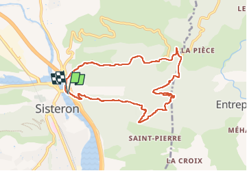
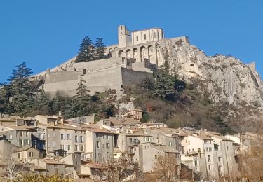
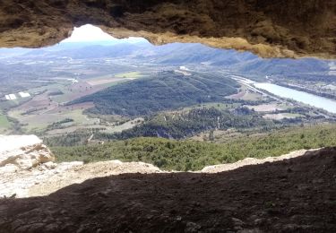
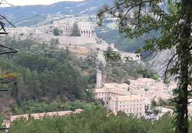
Randonnée Marche de 9,2 km à découvrir à Provence-Alpes-Côte d'Azur, Alpes-de-Haute-Provence, Sisteron. Cette randonnée est proposée par Marco05.
Description
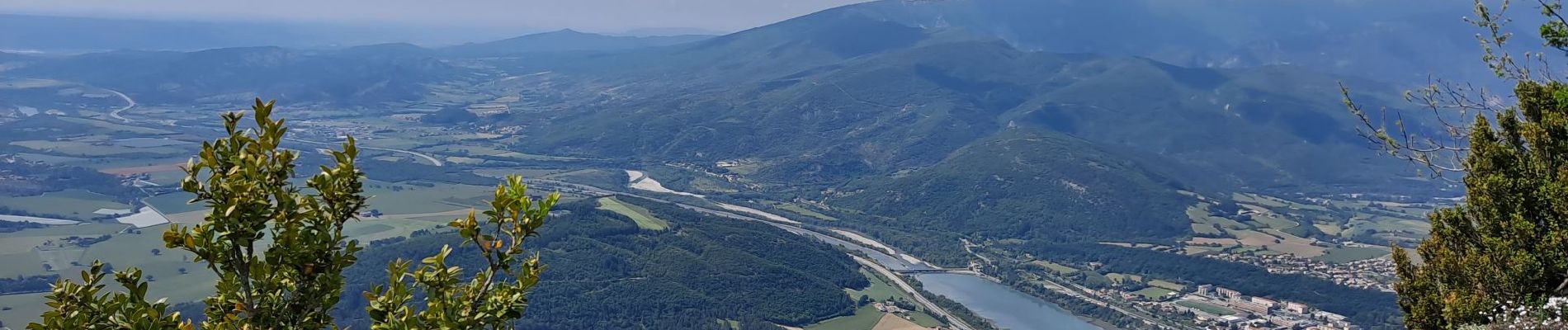
Départ à Sisteron, au pied du rocher de La Baume.
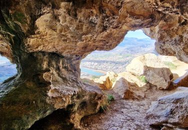
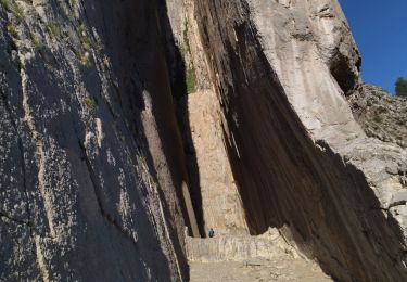
Attention, escalade et passage vertigineux.
Réservé à des randonneurs expérimentés dans les itinéraires et non sujet au vertige.
Localisation
Pays :
France
Région :
Provence-Alpes-Côte d'Azur
Département/Province :
Alpes-de-Haute-Provence
Commune :
Sisteron
Localité :
Unknown
Départ:(Dec)
Départ:(UTM)
735501 ; 4898185 (31T) N.
Commentaires
Randonnées à proximité
![Randonnée Marche Sisteron - SISTERON . CHAMP BRANCOU . LA COLLE . LE MOLLARD O L S - Photo](https://media.geolcdn.com/t/375/260/cecdacbf-083e-4c48-a080-b152844df49c.jpg&format=jpg&maxdim=2)
![Marche Marche](https://static1.geolcdn.com/sitytour/trail-icons/101.png)
SISTERON . CHAMP BRANCOU . LA COLLE . LE MOLLARD O L S
Marche
Difficile
(1)
Sisteron,
Provence-Alpes-Côte d'Azur,
Alpes-de-Haute-Provence,
France
![](/images/other/stat-length.png)
13,1 km | 20 km-effort
3h 46min
![](https://static1.geolcdn.com/siteimages/upload/files/16400158638029165_repeat_loop_refresh_sync_direction_icon.png)
Oui
![Randonnée Marche Sisteron - Le Trou de l'Argent Via Sisteron - Photo](https://media.geolcdn.com/t/375/260/bfa6b4fb-8efb-4bbe-ae9d-f38ed475646a.jpg&format=jpg&maxdim=2)
![Marche Marche](https://static1.geolcdn.com/sitytour/trail-icons/101.png)
Le Trou de l'Argent Via Sisteron
Marche
Difficile
(1)
Sisteron,
Provence-Alpes-Côte d'Azur,
Alpes-de-Haute-Provence,
France
![](/images/other/stat-length.png)
9,1 km | 17,9 km-effort
4h 4min
![](https://static1.geolcdn.com/siteimages/upload/files/16400158638029165_repeat_loop_refresh_sync_direction_icon.png)
Oui
![Randonnée Marche Saint-Geniez - Pierre écrite et montagne de Gache - Photo](https://media.geolcdn.com/t/375/260/7a1ca822-6c04-425e-94b9-5be1080d03a0.jpg&format=jpg&maxdim=2)
![Marche Marche](https://static1.geolcdn.com/sitytour/trail-icons/101.png)
Pierre écrite et montagne de Gache
Marche
Facile
Saint-Geniez,
Provence-Alpes-Côte d'Azur,
Alpes-de-Haute-Provence,
France
![](/images/other/stat-length.png)
7,4 km | 12,3 km-effort
2h 38min
![](https://static1.geolcdn.com/siteimages/upload/files/16400158638029165_repeat_loop_refresh_sync_direction_icon.png)
Oui
![Randonnée Marche Entrepierres - SAINT GENIEZ . LE MOURRE DE GACHE PAR LA FONT DE MEGE N - Photo](https://media.geolcdn.com/t/375/260/5d853fdd-5713-4858-a535-57b1bf5db08d.jpg&format=jpg&maxdim=2)
![Marche Marche](https://static1.geolcdn.com/sitytour/trail-icons/101.png)
SAINT GENIEZ . LE MOURRE DE GACHE PAR LA FONT DE MEGE N
Marche
Moyen
Entrepierres,
Provence-Alpes-Côte d'Azur,
Alpes-de-Haute-Provence,
France
![](/images/other/stat-length.png)
10,9 km | 17,4 km-effort
3h 8min
![](https://static1.geolcdn.com/siteimages/upload/files/16400158638029165_repeat_loop_refresh_sync_direction_icon.png)
Oui
![Randonnée Marche Sisteron - 05 trop argent 02.08.23 - Photo](https://media.geolcdn.com/t/375/260/2f52f635-2a11-4916-a9f5-f3227f3b1529.jpg&format=jpg&maxdim=2)
![Marche Marche](https://static1.geolcdn.com/sitytour/trail-icons/101.png)
05 trop argent 02.08.23
Marche
Moyen
Sisteron,
Provence-Alpes-Côte d'Azur,
Alpes-de-Haute-Provence,
France
![](/images/other/stat-length.png)
9,2 km | 18,1 km-effort
4h 30min
![](https://static1.geolcdn.com/siteimages/upload/files/16400158638029165_repeat_loop_refresh_sync_direction_icon.png)
Oui
![Randonnée Marche Sisteron - SISTERON. SUR LA ROUTE DU TEMPS 2. O L M S - Photo](https://media.geolcdn.com/t/375/260/20c8aa54-ba97-4a73-8287-049a48bb92a8.jpg&format=jpg&maxdim=2)
![Marche Marche](https://static1.geolcdn.com/sitytour/trail-icons/101.png)
SISTERON. SUR LA ROUTE DU TEMPS 2. O L M S
Marche
Moyen
(1)
Sisteron,
Provence-Alpes-Côte d'Azur,
Alpes-de-Haute-Provence,
France
![](/images/other/stat-length.png)
12 km | 16,5 km-effort
3h 36min
![](https://static1.geolcdn.com/siteimages/upload/files/16400158638029165_repeat_loop_refresh_sync_direction_icon.png)
Oui
![Randonnée Marche Sisteron - BEVONS crêtes de Chapage o l s m - Photo](https://media.geolcdn.com/t/375/260/06496741-537d-4e32-9a57-13673b07b6c5.jpg&format=jpg&maxdim=2)
![Marche Marche](https://static1.geolcdn.com/sitytour/trail-icons/101.png)
BEVONS crêtes de Chapage o l s m
Marche
Moyen
Sisteron,
Provence-Alpes-Côte d'Azur,
Alpes-de-Haute-Provence,
France
![](/images/other/stat-length.png)
8,2 km | 15 km-effort
2h 37min
![](https://static1.geolcdn.com/siteimages/upload/files/16400158638029165_repeat_loop_refresh_sync_direction_icon.png)
Oui
![Randonnée Marche Sisteron - Rocher de Baume - Photo](https://media.geolcdn.com/t/375/260/749307ec-c35c-4209-a01b-d1a95a3c6fd6.jpg&format=jpg&maxdim=2)
![Marche Marche](https://static1.geolcdn.com/sitytour/trail-icons/101.png)
Rocher de Baume
Marche
Moyen
Sisteron,
Provence-Alpes-Côte d'Azur,
Alpes-de-Haute-Provence,
France
![](/images/other/stat-length.png)
6,3 km | 14,4 km-effort
3h 8min
![](https://static1.geolcdn.com/siteimages/upload/files/16400158638029165_repeat_loop_refresh_sync_direction_icon.png)
Oui
![Randonnée Marche Sisteron - SISTERON. Le Mollard . Col S Pierre o n - Photo](https://media.geolcdn.com/t/375/260/439b9630-cce8-40a1-b207-cf2467f89777.jpg&format=jpg&maxdim=2)
![Marche Marche](https://static1.geolcdn.com/sitytour/trail-icons/101.png)
SISTERON. Le Mollard . Col S Pierre o n
Marche
Moyen
Sisteron,
Provence-Alpes-Côte d'Azur,
Alpes-de-Haute-Provence,
France
![](/images/other/stat-length.png)
11,9 km | 18,7 km-effort
2h 58min
![](https://static1.geolcdn.com/siteimages/upload/files/16400158638029165_repeat_loop_refresh_sync_direction_icon.png)
Oui