![](/images/other/stat-length.png)
![Randonnée Marche Saint-Paul-le-Jeune - Du Viaduc de Doulovy au Fort de Banne - Saint Paul le Jeune - Photo](https://media.geolcdn.com/t/1900/400/ext.pjpeg?maxdim=2&url=https%3A%2F%2Fservices.sitytrail.com%2FGeolivesWS%2FDownloadMedia.ashx%3FTrailID%3D317552%26Media%3D16802_6.jpg)
Du Viaduc de Doulovy au Fort de Banne - Saint Paul le Jeune
tracegps
Utilisateur
![Longueur](/images/other/stat-length.png)
![Altitude max](https://static1.geolcdn.com/siteimages/upload/files/1508320355ic_sort_altitude_max_24dp.png)
![Dénivelé positif](https://static1.geolcdn.com/siteimages/upload/files/1508320355ic_sort_den_pos_24dp.png)
![Km-Effort](/images/other/stat-length.png)
![Altitude min](https://static1.geolcdn.com/siteimages/upload/files/1508320355ic_sort_altitude_min_24dp.png)
![Dénivelé négatif](https://static1.geolcdn.com/siteimages/upload/files/1508320355ic_sort_den_neg_24dp.png)
![Boucle](https://static1.geolcdn.com/siteimages/upload/files/16400158638029165_repeat_loop_refresh_sync_direction_icon.png)
![Marche](https://static1.geolcdn.com/sitytour/trail-icons/101.png)
5h00
Difficulté : Difficile
![Scannez ce code QR pour ouvrir la randonnée dans l'application SityTrail](https://capi.geolives.com/qq0zvz2zws4bq2lad0pu/sitytour/trails/317552/qr.png?size=200)
Application GPS de randonnée GRATUITE
À propos
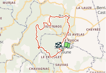
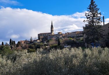
Randonnée Marche de 16,1 km à découvrir à Auvergne-Rhône-Alpes, Ardèche, Saint-Paul-le-Jeune. Cette randonnée est proposée par tracegps.
Description
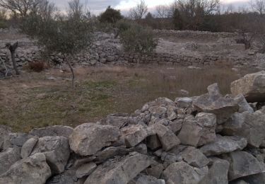
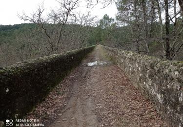
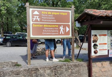
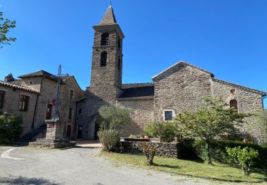
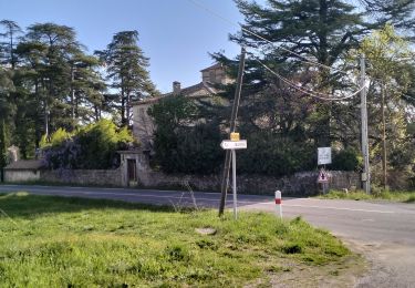
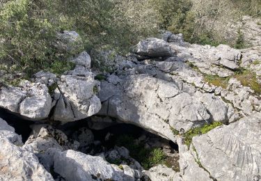
Un ancien viaduc perdu dans la forêt de pins, des hameaux charmants et le village de Banne. Du parking proche des tennis de St Paul le Jeune, remonter la rue du Procureur puis à gauche la rue Raymond Cregut et enfin à droite dans la Brousse .Quitter le goudron pour un sentier sur la droite qui chemine en forêt .Traverser le hameau Le Frigolet puis à gauche une ancienne voie caladée (rue en pente pavée) qui descend progressivement vers le viaduc de Doulovy. Parcourir le panneau explicatif, puis traverser le Viaduc et passer dessous. Passer à guet et se diriger vers le Bois Noir puis Montgros pour suivre le GR vers Le Mazel et Banne .Visiter le fort avant de descendre vers Le Ranquet et remonter au cimetière de Banne. Passer au Petit Brahic puis les Rousses et enfin les Sagnes avant de retrouver le parking. Bonne randonnée.
Localisation
Commentaires
Randonnées à proximité
![Randonnée Marche Saint-Paul-le-Jeune - 07 Résurgence de cotepatiere ( cocalhere) 17-04-18 - Photo](https://media.geolcdn.com/t/375/260/ext.jpg?maxdim=2&url=https%3A%2F%2Fservices.sitytrail.com%2FGeolivesWS%2FDownloadMedia.ashx%3FTrailID%3D897616%26Media%3D20170509140453.jpg)
![Marche Marche](https://static1.geolcdn.com/sitytour/trail-icons/101.png)
Marche
![](/images/other/stat-length.png)
![](https://static1.geolcdn.com/siteimages/upload/files/16400158638029165_repeat_loop_refresh_sync_direction_icon.png)
![Randonnée Marche Berrias-et-Casteljau - ARDÈCHE. BERRIAS. GORGES DE CHASSEZAC O - Photo](https://media.geolcdn.com/t/375/260/57afbf73-5c77-4144-bf42-14d64b3b569f.jpg&format=jpg&maxdim=2)
![Marche Marche](https://static1.geolcdn.com/sitytour/trail-icons/101.png)
Marche
![](/images/other/stat-length.png)
![](https://static1.geolcdn.com/siteimages/upload/files/16400158638029165_repeat_loop_refresh_sync_direction_icon.png)
![Randonnée Marche Banne - Autour de Banne - Photo](https://media.geolcdn.com/t/375/260/0d756104-e1b5-4f2e-b3d0-c252da0f965f.jpg&format=jpg&maxdim=2)
![Marche Marche](https://static1.geolcdn.com/sitytour/trail-icons/101.png)
Marche
![](/images/other/stat-length.png)
![](https://static1.geolcdn.com/siteimages/upload/files/16400158638029165_repeat_loop_refresh_sync_direction_icon.png)
![Randonnée Marche Saint-André-de-Cruzières - 07 chandouillet grotte cotepatiere sauvas peyrejol - Photo](https://media.geolcdn.com/t/375/260/f87b5d53-f27e-44e1-a082-e539e9102b98.jpg&format=jpg&maxdim=2)
![Marche Marche](https://static1.geolcdn.com/sitytour/trail-icons/101.png)
Marche
![](/images/other/stat-length.png)
![](https://static1.geolcdn.com/siteimages/upload/files/16400158638029165_repeat_loop_refresh_sync_direction_icon.png)
![Randonnée Marche Saint-Paul-le-Jeune - 07 les passages de voûtes au pont Doulovy 2 /02/25 - Photo](https://media.geolcdn.com/t/375/260/82fa3a1c-3766-4d3c-9be6-6015db6e1d7e.jpg&format=jpg&maxdim=2)
![Marche Marche](https://static1.geolcdn.com/sitytour/trail-icons/101.png)
Marche
![](/images/other/stat-length.png)
![](https://static1.geolcdn.com/siteimages/upload/files/16400158638029165_repeat_loop_refresh_sync_direction_icon.png)
![Randonnée Marche Courry - ARDECHE/GARD COURY Grotte de la cocaliere sentier de decouvertegrotte de la cocaliere - Photo](https://media.geolcdn.com/t/375/260/e5a0d0f9-58ff-4a07-a2b3-c16e7f6eaab2.jpg&format=jpg&maxdim=2)
![Marche Marche](https://static1.geolcdn.com/sitytour/trail-icons/101.png)
Marche
![](/images/other/stat-length.png)
![](https://static1.geolcdn.com/siteimages/upload/files/16400158638029165_repeat_loop_refresh_sync_direction_icon.png)
![Randonnée Marche Bessèges - Besseges Aujac GR pays - Photo](https://media.geolcdn.com/t/375/260/8e000c02-b340-43fb-bfed-599b5d224f4b.jpg&format=jpg&maxdim=2)
![Marche Marche](https://static1.geolcdn.com/sitytour/trail-icons/101.png)
Marche
![](/images/other/stat-length.png)
![](https://static1.geolcdn.com/siteimages/upload/files/16400158638029165_repeat_loop_refresh_sync_direction_icon.png)
![Randonnée Marche Banne - 07_Banne_8km290m - Photo](https://media.geolcdn.com/t/375/260/cc4349b5-bd6c-4fd5-b4f7-03cbd86b8a3c.jpg&format=jpg&maxdim=2)
![Marche Marche](https://static1.geolcdn.com/sitytour/trail-icons/101.png)
Marche
![](/images/other/stat-length.png)
![](https://static1.geolcdn.com/siteimages/upload/files/16400158638029165_repeat_loop_refresh_sync_direction_icon.png)
![Randonnée Marche Saint-André-de-Cruzières - CHADOUILLET - Photo](https://media.geolcdn.com/t/375/260/772623f8-cb56-4d04-9b3d-145b33c03c4b.jpeg&format=jpg&maxdim=2)
![Marche Marche](https://static1.geolcdn.com/sitytour/trail-icons/101.png)
Marche
![](/images/other/stat-length.png)
![](https://static1.geolcdn.com/siteimages/upload/files/16400158638029165_repeat_loop_refresh_sync_direction_icon.png)
Bien mais il faut en profiter pour visiter le reste du site minier.