


7,3 km | 10,1 km-effort


Randonnez sur et autour des GR ® wallons (Sentiers de Grande Randonnée). PRO


Application GPS de randonnée GRATUITE
 SityTrail
IGN / Instituts géographiques
SityTrail World
Le monde est à vous
Randonnée Marche de 10,2 km à découvrir à Wallonie, Liège, Stavelot. Cette randonnée est proposée par GR Rando.
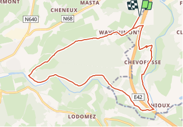
RF-Lg-13_Wavreumont_Grande-Boucle
Dans quel type de paysage randonnons-nous ?
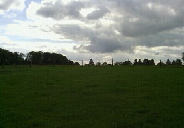
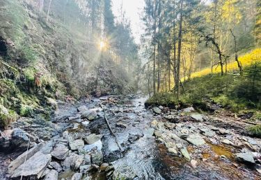
La balade se déroule alternativement sur les crêtes et dans les vallées de la Warche et de l’Amblève, au sud du haut plateau des Fagnes.
Quelle est la difficulté ?
Quasi aucune, hormis une bonne grimpée sur la petite boucle.
Sur quel GR randonnons-nous ?
La rando suit un tronçon des GR® 56 « Routes de l’Est de la Belgique », GR® 14 « Sentiers de l’Ardenne – De l’Eifel aux Ardennes françaises » et du S.M.A.® « Sentier GRT des Monts d’Ardenne » qui font un bout de route ensemble.
Où démarrons-nous ?
Au monastère Saint-Remacle de Wavreumont, rue de Wavreumont – 4970 Stavelot.
Coordonnées : 50°24'26.2"N 5°59'10.1"E
Comment y arriver ?
En voiture Sortie 11 (Malmedy) de l’autoroute E42.
Au rond-point, suivre la N664 en direction de l’autoroute et de Wavreumont. Après 800 mètres (en ignorant l’entrée d’autoroute), tourner à gauche dans la rue de Wavreumont et, après 200 mètres, parking le long de la route à hauteur du monastère.
Avec les bus TEC Trois lignes de bus TEC desservent l’arrêt « Route de Wavreumont », situé à environ un kilomètre du départ de la randonnée. Il s’agit des lignes : 395 Verviers - Malmedy - Reuland ; 745 Trois-Ponts - Waimes - Büllingen et 845 Stavelot - Malmedy - Butgenbach.
Que découvrons-nous aujourd’hui ?
Le musée de Baugnez qui perpétue la mémoire de 84 GI assassinés par des SS allemands pendant la « bataille des Ardennes » en décembre 1944. Il retrace les principaux événements de ce triste épisode de la Seconde Guerre mondiale.
Nous pourrons également visiter le musée du Papier et du Cwarmê (carnaval de Malmedy) à Malmedy.
Quelle est la carte IGN de référence ?
Carte IGN au 1:20 000 : « Malmedy – Stavelot », 50/5-6.

Marche

Marche

Marche

Marche

Marche
Marche

Marche
Marche

Marche