![](/images/other/stat-length.png)
![Randonnée Cheval Hennebont - D'Hennebont à l'Abbaye de Bon Repos - Photo](https://media.geolcdn.com/t/1900/400/ext.pjpeg?maxdim=2&url=https%3A%2F%2Fservices.sitytrail.com%2FGeolivesWS%2FDownloadMedia.ashx%3FTrailID%3D317365%26Media%3D16585_6.jpg)
D'Hennebont à l'Abbaye de Bon Repos
tracegps
Utilisateur
![Longueur](/images/other/stat-length.png)
![Altitude max](https://static1.geolcdn.com/siteimages/upload/files/1508320355ic_sort_altitude_max_24dp.png)
![Dénivelé positif](https://static1.geolcdn.com/siteimages/upload/files/1508320355ic_sort_den_pos_24dp.png)
![Km-Effort](/images/other/stat-length.png)
![Altitude min](https://static1.geolcdn.com/siteimages/upload/files/1508320355ic_sort_altitude_min_24dp.png)
![Dénivelé négatif](https://static1.geolcdn.com/siteimages/upload/files/1508320355ic_sort_den_neg_24dp.png)
![Boucle](https://static1.geolcdn.com/siteimages/upload/files/16400158638029165_repeat_loop_refresh_sync_direction_icon.png)
![Cheval](https://static1.geolcdn.com/sitytour/trail-icons/300.png)
24h00
Difficulté : Moyen
![Scannez ce code QR pour ouvrir la randonnée dans l'application SityTrail](https://capi.geolives.com/qq0zvz2zws4bq2lad0pu/sitytour/trails/317365/qr.png?size=200)
Application GPS de randonnée GRATUITE
À propos
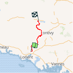
Randonnée Cheval de 107 km à découvrir à Bretagne, Morbihan, Hennebont. Cette randonnée est proposée par tracegps.
Description
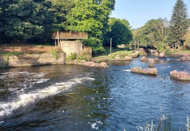
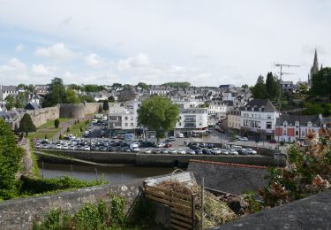
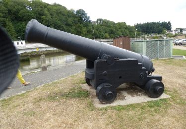
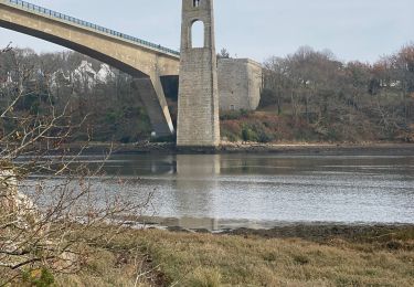
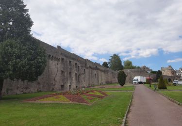
Superbe circuit du raid 2013 qui s'est déroulé dans le Morbihan. Il s'agit d'un raid équestre de 100km sur 24h, en 4 étapes d'environ 25 à 30 km chacune. Ce circuit permet de joindre les Forges des Salles près de Guerlédan à partir des anciennes Forges de Hennebont. Il permet de traverser les magnifiques vallées du Blavet, de la Sarre et des Forges des Salles avec des sites remarquables Lanvaudan et ses longères en pierres, Guern et sa célèbre basilique haute de 75m de Qelven, la forêt de Quénécan .... A faire et refaire avec de très beaux chemins et paysages en terre bretonne.
Localisation
Commentaires
Randonnées à proximité
![Randonnée V.T.T. Inzinzac-Lochrist - Espace VTT FFC La vallée du Blavet - Le circuit du Lavoir - Photo](https://media.geolcdn.com/t/375/260/ext.jpg?maxdim=2&url=https%3A%2F%2Fservices.sitytrail.com%2FGeolivesWS%2FDownloadMedia.ashx%3FTrailID%3D101721%26Media%3D1966_1.jpg)
![V.T.T. V.T.T.](https://static1.geolcdn.com/sitytour/trail-icons/202.png)
V.T.T.
![](/images/other/stat-length.png)
![](https://static1.geolcdn.com/siteimages/upload/files/16400158638029165_repeat_loop_refresh_sync_direction_icon.png)
![Randonnée Marche Inzinzac-Lochrist - PR_56_Inzinzac-Lochrist_BA_02_Circuit1b_De-Tremelin-Et-Du-Ty-Mat_20241030 - Photo](https://media.geolcdn.com/t/375/260/d4fd5af4-f06f-4548-8f5d-ec5b437b2550.jpg&format=jpg&maxdim=2)
![Marche Marche](https://static1.geolcdn.com/sitytour/trail-icons/101.png)
Marche
![](/images/other/stat-length.png)
![](https://static1.geolcdn.com/siteimages/upload/files/16400158638029165_repeat_loop_refresh_sync_direction_icon.png)
![Randonnée Marche Inzinzac-Lochrist - PR_56_Inzinzac-Lochrist_AA_01_Circuit1b_Des-Forgerons_20240828 - Photo](https://media.geolcdn.com/t/375/260/26b832f1-39b4-491b-ab11-65da255924a6.jpg&format=jpg&maxdim=2)
![Marche Marche](https://static1.geolcdn.com/sitytour/trail-icons/101.png)
Marche
![](/images/other/stat-length.png)
![](https://static1.geolcdn.com/siteimages/upload/files/16400158638029165_repeat_loop_refresh_sync_direction_icon.png)
![Randonnée Marche Caudan - PR_56_Caudan_AA_01_Circuit1b_Tro-Glas-Kaodan_20231112 - Photo](https://media.geolcdn.com/t/375/260/1d1da296-767a-4064-84ae-549fed7a2699.jpg&format=jpg&maxdim=2)
![Marche Marche](https://static1.geolcdn.com/sitytour/trail-icons/101.png)
Marche
![](/images/other/stat-length.png)
![](https://static1.geolcdn.com/siteimages/upload/files/16400158638029165_repeat_loop_refresh_sync_direction_icon.png)
![Randonnée Marche Lanester - PR_56_Lanester_AA_01_Circuit1b_Cimetiere-Bateaux-Kerhervy_20230314 - Photo](https://media.geolcdn.com/t/375/260/55788eb3-1fb1-458b-917d-7928a0a8a8f3.jpg&format=jpg&maxdim=2)
![Marche Marche](https://static1.geolcdn.com/sitytour/trail-icons/101.png)
Marche
![](/images/other/stat-length.png)
![](https://static1.geolcdn.com/siteimages/upload/files/16400158638029165_repeat_loop_refresh_sync_direction_icon.png)
![Marche Marche](https://static1.geolcdn.com/sitytour/trail-icons/101.png)
Marche
![](/images/other/stat-length.png)
![](https://static1.geolcdn.com/siteimages/upload/files/16400158638029165_repeat_loop_refresh_sync_direction_icon.png)
![Randonnée A pied Hennebont - Circuit du Hingair - Photo](https://media.geolcdn.com/t/375/260/b11697b8-6105-49c9-a404-503ca62238dd.jpeg&format=jpg&maxdim=2)
![A pied A pied](https://static1.geolcdn.com/sitytour/trail-icons/100.png)
A pied
![](/images/other/stat-length.png)
![](https://static1.geolcdn.com/siteimages/upload/files/16400158638029165_repeat_loop_refresh_sync_direction_icon.png)
![Randonnée Marche Lanester - Lanester cimetière bateaux 14,2 km - Photo](https://media.geolcdn.com/t/375/260/665410bf-b65d-41eb-8afc-98e55b355e55.jpg&format=jpg&maxdim=2)
![Marche Marche](https://static1.geolcdn.com/sitytour/trail-icons/101.png)
Marche
![](/images/other/stat-length.png)
![](https://static1.geolcdn.com/siteimages/upload/files/16400158638029165_repeat_loop_refresh_sync_direction_icon.png)
![Randonnée Marche Hennebont - PR_56_Hennebont_AA_01_Circuit4a_St-Caradec-La-Montagne_20210530 - Photo](https://media.geolcdn.com/t/375/260/c8ffb8fe-5310-427a-b75e-1f5816c093bd.jpg&format=jpg&maxdim=2)
![Marche Marche](https://static1.geolcdn.com/sitytour/trail-icons/101.png)
Marche
![](/images/other/stat-length.png)
![](https://static1.geolcdn.com/siteimages/upload/files/16400158638029165_repeat_loop_refresh_sync_direction_icon.png)