![](/images/other/stat-length.png)
![Randonnée Marche Saint-Martin-en-Haut - St Martin En Haut 2013 - Photo](https://media.geolcdn.com/t/1900/400/ext.pjpeg?maxdim=2&url=https%3A%2F%2Fservices.sitytrail.com%2FGeolivesWS%2FDownloadMedia.ashx%3FTrailID%3D317158%26Media%3D16309_4.jpg)
St Martin En Haut 2013
tracegps
Utilisateur
![Longueur](/images/other/stat-length.png)
Longueur
22 km
![Altitude max](https://static1.geolcdn.com/siteimages/upload/files/1508320355ic_sort_altitude_max_24dp.png)
Altitude max
769 m
![Dénivelé positif](https://static1.geolcdn.com/siteimages/upload/files/1508320355ic_sort_den_pos_24dp.png)
Dénivelé positif
596 m
![Km-Effort](/images/other/stat-length.png)
Km-Effort
29 km
![Altitude min](https://static1.geolcdn.com/siteimages/upload/files/1508320355ic_sort_altitude_min_24dp.png)
Altitude min
556 m
![Dénivelé négatif](https://static1.geolcdn.com/siteimages/upload/files/1508320355ic_sort_den_neg_24dp.png)
Dénivelé négatif
596 m
![Boucle](https://static1.geolcdn.com/siteimages/upload/files/16400158638029165_repeat_loop_refresh_sync_direction_icon.png)
Boucle
Oui
Date de création :
2014-12-10 00:00:00.0
Dernière modification :
2014-12-10 00:00:00.0
![Marche](https://static1.geolcdn.com/sitytour/trail-icons/101.png)
5h00
Difficulté : Moyen
![Scannez ce code QR pour ouvrir la randonnée dans l'application SityTrail](https://capi.geolives.com/qq0zvz2zws4bq2lad0pu/sitytour/trails/317158/qr.png?size=200)
Application GPS de randonnée GRATUITE
À propos
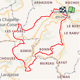
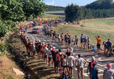
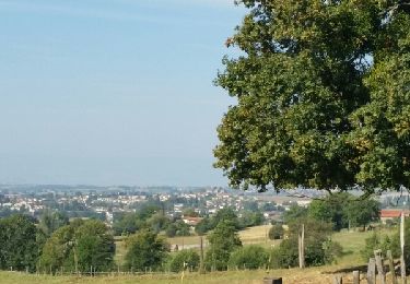
Randonnée Marche de 22 km à découvrir à Auvergne-Rhône-Alpes, Rhône, Saint-Martin-en-Haut. Cette randonnée est proposée par tracegps.
Description
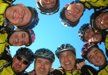
Randonnée organisée par le club de cyclo St Martinois. Circuit aux alentours de St Martin le Haut dans les Monts du Lyonnais.
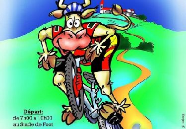
Localisation
Pays :
France
Région :
Auvergne-Rhône-Alpes
Département/Province :
Rhône
Commune :
Saint-Martin-en-Haut
Localité :
Unknown
Départ:(Dec)
Départ:(UTM)
621866 ; 5057267 (31T) N.
Commentaires
Randonnées à proximité
![Randonnée V.T.T. Saint-Martin-en-Haut - 19ème Croisée des Monts du Lyonnais (2012-VTT-25km) / Saint-Martin-en-Haut - Photo](https://media.geolcdn.com/t/375/260/ext.jpg?maxdim=2&url=https%3A%2F%2Fservices.sitytrail.com%2FGeolivesWS%2FDownloadMedia.ashx%3FTrailID%3D129837%26Media%3D13390_6.jpg)
![V.T.T. V.T.T.](https://static1.geolcdn.com/sitytour/trail-icons/202.png)
19ème Croisée des Monts du Lyonnais (2012-VTT-25km) / Saint-Martin-en-Haut
V.T.T.
Moyen
(1)
Saint-Martin-en-Haut,
Auvergne-Rhône-Alpes,
Rhône,
France
![](/images/other/stat-length.png)
25 km | 35 km-effort
2h 45min
![](https://static1.geolcdn.com/siteimages/upload/files/16400158638029165_repeat_loop_refresh_sync_direction_icon.png)
Oui
![Randonnée Marche Thurins - tour du bois du baron - Photo](https://media.geolcdn.com/t/375/260/ext.jpg?maxdim=2&url=https%3A%2F%2Fservices.sitytrail.com%2FGeolivesWS%2FDownloadMedia.ashx%3FTrailID%3D548394%26Media%3Dfix__20160403153341.jpg)
![Marche Marche](https://static1.geolcdn.com/sitytour/trail-icons/101.png)
tour du bois du baron
Marche
Facile
(3)
Thurins,
Auvergne-Rhône-Alpes,
Rhône,
France
![](/images/other/stat-length.png)
7,4 km | 11,5 km-effort
1h 40min
![](https://static1.geolcdn.com/siteimages/upload/files/16400158638029165_repeat_loop_refresh_sync_direction_icon.png)
Oui
![Randonnée Marche Duerne - Randonnée des collines autour de Duerne - Photo](https://media.geolcdn.com/t/375/260/56b3b5ff-8854-42cb-926b-a132b104089d.jpg&format=jpg&maxdim=2)
![Marche Marche](https://static1.geolcdn.com/sitytour/trail-icons/101.png)
Randonnée des collines autour de Duerne
Marche
Moyen
Duerne,
Auvergne-Rhône-Alpes,
Rhône,
France
![](/images/other/stat-length.png)
15,5 km | 22 km-effort
4h 2min
![](https://static1.geolcdn.com/siteimages/upload/files/16400158638029165_repeat_loop_refresh_sync_direction_icon.png)
Oui
![Randonnée Marche Saint-André-la-Côte - 69-st-andre-la cote-mattiole-20km-640m-mai22 - Photo](https://media.geolcdn.com/t/375/260/7a464e9e-07ad-49d2-9fc0-eab7bce1d3e5.jpg&format=jpg&maxdim=2)
![Marche Marche](https://static1.geolcdn.com/sitytour/trail-icons/101.png)
69-st-andre-la cote-mattiole-20km-640m-mai22
Marche
Moyen
Saint-André-la-Côte,
Auvergne-Rhône-Alpes,
Rhône,
France
![](/images/other/stat-length.png)
20 km | 29 km-effort
5h 56min
![](https://static1.geolcdn.com/siteimages/upload/files/16400158638029165_repeat_loop_refresh_sync_direction_icon.png)
Oui
![Randonnée Marche Saint-André-la-Côte - 69-St-andre-la-cote-Ste-catherine-14km-453m - Photo](https://media.geolcdn.com/t/375/260/06cb0992-8e16-4e77-b851-837722622855.jpg&format=jpg&maxdim=2)
![Marche Marche](https://static1.geolcdn.com/sitytour/trail-icons/101.png)
69-St-andre-la-cote-Ste-catherine-14km-453m
Marche
Moyen
Saint-André-la-Côte,
Auvergne-Rhône-Alpes,
Rhône,
France
![](/images/other/stat-length.png)
14,2 km | 20 km-effort
3h 48min
![](https://static1.geolcdn.com/siteimages/upload/files/16400158638029165_repeat_loop_refresh_sync_direction_icon.png)
Oui
![Randonnée A pied Saint-Martin-en-Haut - Circuit des Sources du Garon - Photo](https://media.geolcdn.com/t/375/260/fe014065-bc06-4e54-b660-6900e183f331.jpeg&format=jpg&maxdim=2)
![A pied A pied](https://static1.geolcdn.com/sitytour/trail-icons/100.png)
Circuit des Sources du Garon
A pied
Moyen
Saint-Martin-en-Haut,
Auvergne-Rhône-Alpes,
Rhône,
France
![](/images/other/stat-length.png)
15,7 km | 22 km-effort
5h 3min
![](https://static1.geolcdn.com/siteimages/upload/files/16400158638029165_repeat_loop_refresh_sync_direction_icon.png)
Oui
![Randonnée Marche nordique Saint-Martin-en-Haut - Quéser à St Symphonie sur Croise - Photo](https://media.geolcdn.com/t/375/260/ext.jpg?maxdim=2&url=https%3A%2F%2Fservices.sitytrail.com%2FGeolivesWS%2FDownloadMedia.ashx%3FTrailID%3D631037%26Media%3Dfix__20160913104438.jpg)
![Marche nordique Marche nordique](https://static1.geolcdn.com/sitytour/trail-icons/102.png)
Quéser à St Symphonie sur Croise
Marche nordique
Facile
Saint-Martin-en-Haut,
Auvergne-Rhône-Alpes,
Rhône,
France
![](/images/other/stat-length.png)
8,7 km | 11,3 km-effort
2h 38min
![](https://static1.geolcdn.com/siteimages/upload/files/16400158638029165_repeat_loop_refresh_sync_direction_icon.png)
Non
![Randonnée Marche nordique Saint-Martin-en-Haut - St Martin en Haut à Duerne - Photo](https://media.geolcdn.com/t/375/260/ext.jpg?maxdim=2&url=https%3A%2F%2Fservices.sitytrail.com%2FGeolivesWS%2FDownloadMedia.ashx%3FTrailID%3D631033%26Media%3Dfix__20160914102310.jpg)
![Marche nordique Marche nordique](https://static1.geolcdn.com/sitytour/trail-icons/102.png)
St Martin en Haut à Duerne
Marche nordique
Facile
Saint-Martin-en-Haut,
Auvergne-Rhône-Alpes,
Rhône,
France
![](/images/other/stat-length.png)
14,8 km | 19,8 km-effort
5h 33min
![](https://static1.geolcdn.com/siteimages/upload/files/16400158638029165_repeat_loop_refresh_sync_direction_icon.png)
Oui
![Randonnée V.T.T. Saint-Martin-en-Haut - Balade VTT à St Martin En Haut - Photo](https://media.geolcdn.com/t/375/260/ext.jpg?maxdim=2&url=https%3A%2F%2Fservices.sitytrail.com%2FGeolivesWS%2FDownloadMedia.ashx%3FTrailID%3D317424%26Media%3D16653_3.jpg)
![V.T.T. V.T.T.](https://static1.geolcdn.com/sitytour/trail-icons/202.png)
Balade VTT à St Martin En Haut
V.T.T.
Difficile
Saint-Martin-en-Haut,
Auvergne-Rhône-Alpes,
Rhône,
France
![](/images/other/stat-length.png)
25 km | 35 km-effort
2h 30min
![](https://static1.geolcdn.com/siteimages/upload/files/16400158638029165_repeat_loop_refresh_sync_direction_icon.png)
Oui