![](/images/other/stat-length.png)
![Randonnée Randonnée équestre Hargnies - Givet Forêt dominiale de Hargnies-Laurier - Photo](https://media.geolcdn.com/t/1900/400/96592ff8-dc8a-48d7-b0d7-7a982426ee88.jpg&format=pjpeg&maxdim=2)
Givet Forêt dominiale de Hargnies-Laurier
eddyvermeulen1
Utilisateur
![Longueur](/images/other/stat-length.png)
Longueur
13,9 km
![Altitude max](https://static1.geolcdn.com/siteimages/upload/files/1508320355ic_sort_altitude_max_24dp.png)
Altitude max
361 m
![Dénivelé positif](https://static1.geolcdn.com/siteimages/upload/files/1508320355ic_sort_den_pos_24dp.png)
Dénivelé positif
364 m
![Km-Effort](/images/other/stat-length.png)
Km-Effort
18,7 km
![Altitude min](https://static1.geolcdn.com/siteimages/upload/files/1508320355ic_sort_altitude_min_24dp.png)
Altitude min
142 m
![Dénivelé négatif](https://static1.geolcdn.com/siteimages/upload/files/1508320355ic_sort_den_neg_24dp.png)
Dénivelé négatif
363 m
![Boucle](https://static1.geolcdn.com/siteimages/upload/files/16400158638029165_repeat_loop_refresh_sync_direction_icon.png)
Boucle
Oui
Date de création :
2021-04-29 04:52:16.0
Dernière modification :
2023-04-01 15:47:58.084
![Randonnée équestre](https://static1.geolcdn.com/sitytour/trail-icons/301.png)
2h27
Difficulté : Difficile
![Scannez ce code QR pour ouvrir la randonnée dans l'application SityTrail](https://capi.geolives.com/qq0zvz2zws4bq2lad0pu/sitytour/trails/3169633/qr.png?size=200)
Application GPS de randonnée GRATUITE
À propos
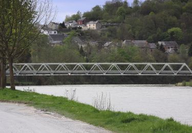
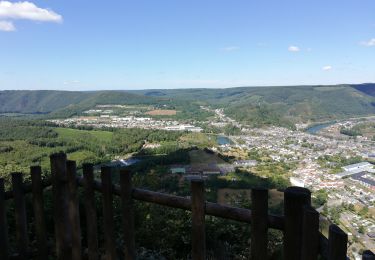
Randonnée Randonnée équestre de 13,9 km à découvrir à Grand Est, Ardennes, Hargnies. Cette randonnée est proposée par eddyvermeulen1.
Description
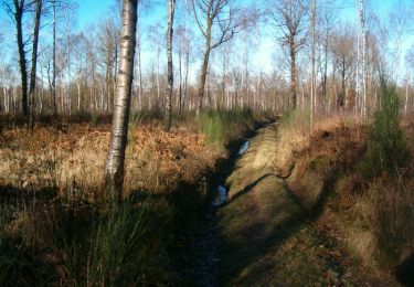
Gedaan in zeeeer nat weer
Nogal wat stenen
Mooie bossen en mooie galoppen
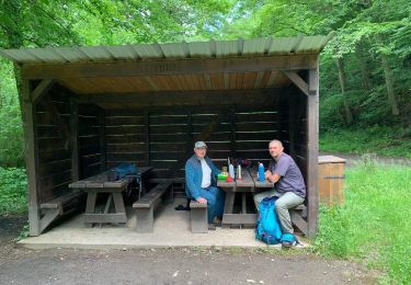
maar, een beetje "Marche"-gevoel.
Eventueel in te korten door aan dezelfde kant van de grote baan te blijven.
Grote startparking
Localisation
Pays :
France
Région :
Grand Est
Département/Province :
Ardennes
Commune :
Hargnies
Localité :
Unknown
Départ:(Dec)
Départ:(UTM)
627357 ; 5545538 (31U) N.
Commentaires
Randonnées à proximité
![Randonnée Marche Vireux-Molhain - Balade Franco-Belge - De Vireux-Molhain à Mazée - Photo](https://media.geolcdn.com/t/375/260/ext.jpg?maxdim=2&url=https%3A%2F%2Fservices.sitytrail.com%2FGeolivesWS%2FDownloadMedia.ashx%3FTrailID%3D191490%26Media%3D15083_5.jpg)
![Marche Marche](https://static1.geolcdn.com/sitytour/trail-icons/101.png)
Balade Franco-Belge - De Vireux-Molhain à Mazée
Marche
Moyen
(1)
Vireux-Molhain,
Grand Est,
Ardennes,
France
![](/images/other/stat-length.png)
14,4 km | 19,2 km-effort
3h 30min
![](https://static1.geolcdn.com/siteimages/upload/files/16400158638029165_repeat_loop_refresh_sync_direction_icon.png)
Oui
![Randonnée Marche Vireux-Molhain - Du Mont Vireux au château de Hierges - Photo](https://media.geolcdn.com/t/375/260/ext.jpg?maxdim=2&url=https%3A%2F%2Fservices.sitytrail.com%2FGeolivesWS%2FDownloadMedia.ashx%3FTrailID%3D108904%26Media%3D2563_6.jpg)
![Marche Marche](https://static1.geolcdn.com/sitytour/trail-icons/101.png)
Du Mont Vireux au château de Hierges
Marche
Difficile
(1)
Vireux-Molhain,
Grand Est,
Ardennes,
France
![](/images/other/stat-length.png)
12,3 km | 16,8 km-effort
4h 0min
![](https://static1.geolcdn.com/siteimages/upload/files/16400158638029165_repeat_loop_refresh_sync_direction_icon.png)
Oui
![Randonnée Marche Hargnies - De Hargnies au Point de vue de la Roche à Fépin par la vallée du Risdoux - Photo](https://media.geolcdn.com/t/375/260/ext.jpg?maxdim=2&url=https%3A%2F%2Fservices.sitytrail.com%2FGeolivesWS%2FDownloadMedia.ashx%3FTrailID%3D108901%26Media%3D2491_6.jpg)
![Marche Marche](https://static1.geolcdn.com/sitytour/trail-icons/101.png)
De Hargnies au Point de vue de la Roche à Fépin par la vallée du Risdoux
Marche
Difficile
(1)
Hargnies,
Grand Est,
Ardennes,
France
![](/images/other/stat-length.png)
13,9 km | 18 km-effort
4h 0min
![](https://static1.geolcdn.com/siteimages/upload/files/16400158638029165_repeat_loop_refresh_sync_direction_icon.png)
Oui
![Randonnée Marche Hargnies - De Hargnies au Point de vue de la Roche à Fépin par la vallée du Risdoux - Photo](https://media.geolcdn.com/t/375/260/ext.jpg?maxdim=2&url=https%3A%2F%2Fstatic1.geolcdn.com%2Fsiteimages%2Fupload%2Ffiles%2F1553511878bg_sport_marche.png)
![Marche Marche](https://static1.geolcdn.com/sitytour/trail-icons/101.png)
De Hargnies au Point de vue de la Roche à Fépin par la vallée du Risdoux
Marche
Moyen
(1)
Hargnies,
Grand Est,
Ardennes,
France
![](/images/other/stat-length.png)
13,9 km | 18 km-effort
3h 20min
![](https://static1.geolcdn.com/siteimages/upload/files/16400158638029165_repeat_loop_refresh_sync_direction_icon.png)
Oui
![Randonnée Marche Vireux-Molhain - Du Mont Vireux au château de Hierges - Photo](https://media.geolcdn.com/t/375/260/ext.jpg?maxdim=2&url=https%3A%2F%2Fstatic1.geolcdn.com%2Fsiteimages%2Fupload%2Ffiles%2F1553511878bg_sport_marche.png)
![Marche Marche](https://static1.geolcdn.com/sitytour/trail-icons/101.png)
Du Mont Vireux au château de Hierges
Marche
Facile
(1)
Vireux-Molhain,
Grand Est,
Ardennes,
France
![](/images/other/stat-length.png)
12,3 km | 16,8 km-effort
3h 0min
![](https://static1.geolcdn.com/siteimages/upload/files/16400158638029165_repeat_loop_refresh_sync_direction_icon.png)
Oui
![Randonnée Marche Beauraing - Balade à Felenne - Photo](https://media.geolcdn.com/t/375/260/bf427321-99ec-45e0-a570-b7aca0f64053.jpeg&format=jpg&maxdim=2)
![Marche Marche](https://static1.geolcdn.com/sitytour/trail-icons/101.png)
Balade à Felenne
Marche
Difficile
Beauraing,
Wallonie,
Namur,
Belgique
![](/images/other/stat-length.png)
11,5 km | 15,3 km-effort
3h 28min
![](https://static1.geolcdn.com/siteimages/upload/files/16400158638029165_repeat_loop_refresh_sync_direction_icon.png)
Oui
![Randonnée A pied Haybes - Les Sentiers des Crêtes - Photo](https://media.geolcdn.com/t/375/260/6b94c5c3-dc13-4c48-9664-900aed09082a.jpeg&format=jpg&maxdim=2)
![A pied A pied](https://static1.geolcdn.com/sitytour/trail-icons/100.png)
Les Sentiers des Crêtes
A pied
Facile
Haybes,
Grand Est,
Ardennes,
France
![](/images/other/stat-length.png)
14,1 km | 19,5 km-effort
4h 25min
![](https://static1.geolcdn.com/siteimages/upload/files/16400158638029165_repeat_loop_refresh_sync_direction_icon.png)
Non
![Randonnée A pied Haybes - La Roche de Madame de Cormont - Photo](https://media.geolcdn.com/t/375/260/84d10620-5baa-43f3-9d62-58a472020b42.jpeg&format=jpg&maxdim=2)
![A pied A pied](https://static1.geolcdn.com/sitytour/trail-icons/100.png)
La Roche de Madame de Cormont
A pied
Facile
Haybes,
Grand Est,
Ardennes,
France
![](/images/other/stat-length.png)
8,4 km | 11,8 km-effort
2h 41min
![](https://static1.geolcdn.com/siteimages/upload/files/16400158638029165_repeat_loop_refresh_sync_direction_icon.png)
Oui
![Randonnée Marche Haybes - Fumay - Photo](https://media.geolcdn.com/t/375/260/a9d23473-6fa3-4f4b-9c8d-944146d33ab8.jpg&format=jpg&maxdim=2)
![Marche Marche](https://static1.geolcdn.com/sitytour/trail-icons/101.png)
Fumay
Marche
Très facile
(1)
Haybes,
Grand Est,
Ardennes,
France
![](/images/other/stat-length.png)
12,3 km | 17,4 km-effort
3h 15min
![](https://static1.geolcdn.com/siteimages/upload/files/16400158638029165_repeat_loop_refresh_sync_direction_icon.png)
Oui