![](/images/other/stat-length.png)
![Randonnée Marche Sourdon - Autour d'Ainval - Sourdon - Photo](https://media.geolcdn.com/t/1900/400/ext.pjpeg?maxdim=2&url=https%3A%2F%2Fservices.sitytrail.com%2FGeolivesWS%2FDownloadMedia.ashx%3FTrailID%3D316957%26Media%3D16075_4.jpg)
Autour d'Ainval - Sourdon
tracegps
Utilisateur
![Longueur](/images/other/stat-length.png)
Longueur
10,4 km
![Altitude max](https://static1.geolcdn.com/siteimages/upload/files/1508320355ic_sort_altitude_max_24dp.png)
Altitude max
142 m
![Dénivelé positif](https://static1.geolcdn.com/siteimages/upload/files/1508320355ic_sort_den_pos_24dp.png)
Dénivelé positif
142 m
![Km-Effort](/images/other/stat-length.png)
Km-Effort
12,3 km
![Altitude min](https://static1.geolcdn.com/siteimages/upload/files/1508320355ic_sort_altitude_min_24dp.png)
Altitude min
75 m
![Dénivelé négatif](https://static1.geolcdn.com/siteimages/upload/files/1508320355ic_sort_den_neg_24dp.png)
Dénivelé négatif
142 m
![Boucle](https://static1.geolcdn.com/siteimages/upload/files/16400158638029165_repeat_loop_refresh_sync_direction_icon.png)
Boucle
Oui
Date de création :
2014-12-10 00:00:00.0
Dernière modification :
2014-12-10 00:00:00.0
![Marche](https://static1.geolcdn.com/sitytour/trail-icons/101.png)
3h00
Difficulté : Moyen
![Scannez ce code QR pour ouvrir la randonnée dans l'application SityTrail](https://capi.geolives.com/qq0zvz2zws4bq2lad0pu/sitytour/trails/316957/qr.png?size=200)
Application GPS de randonnée GRATUITE
À propos
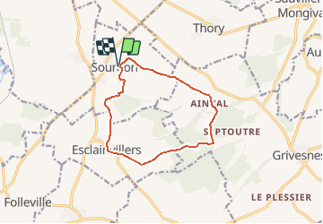
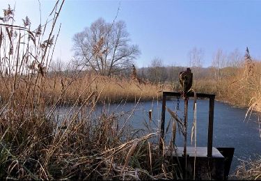
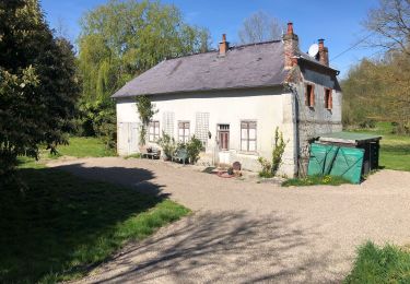
Randonnée Marche de 10,4 km à découvrir à Hauts-de-France, Somme, Sourdon. Cette randonnée est proposée par tracegps.
Description
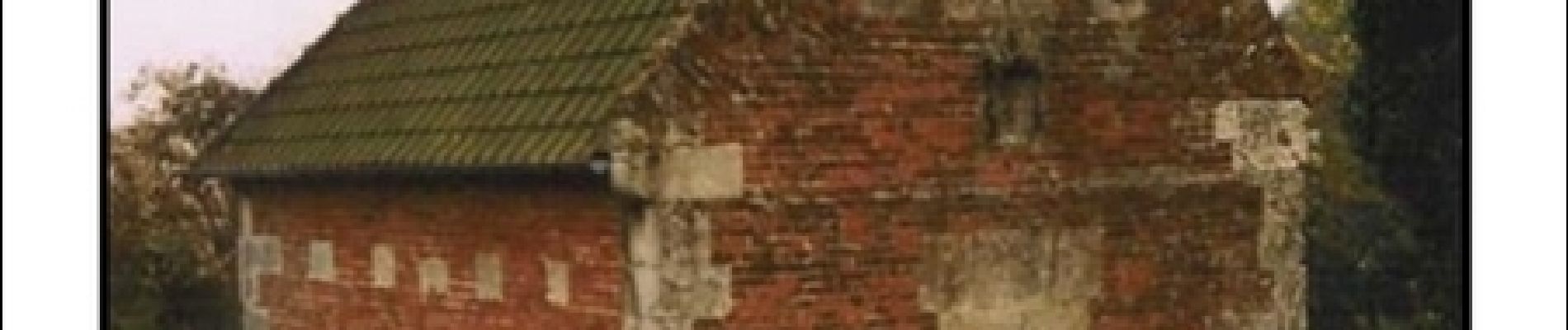
Départ de l'église de Sourdon vers Ainval. Le précieux bras reliquaire de saint Fiacre, vous indique le chemin du retour depuis l'église d'Esclainvillers. Retrouvez cette randonnée sur le site de l'Office de Tourisme de Val de Noye.
Localisation
Pays :
France
Région :
Hauts-de-France
Département/Province :
Somme
Commune :
Sourdon
Localité :
Unknown
Départ:(Dec)
Départ:(UTM)
456702 ; 5506554 (31U) N.
Commentaires
Randonnées à proximité
![Randonnée Marche Ailly-sur-Noye - Bois de Berny - Photo](https://media.geolcdn.com/t/375/260/ext.jpg?maxdim=2&url=https%3A%2F%2Fstatic1.geolcdn.com%2Fsiteimages%2Fupload%2Ffiles%2F1553511878bg_sport_marche.png)
![Marche Marche](https://static1.geolcdn.com/sitytour/trail-icons/101.png)
Bois de Berny
Marche
Moyen
(1)
Ailly-sur-Noye,
Hauts-de-France,
Somme,
France
![](/images/other/stat-length.png)
10,1 km | 12,1 km-effort
2h 38min
![](https://static1.geolcdn.com/siteimages/upload/files/16400158638029165_repeat_loop_refresh_sync_direction_icon.png)
Oui
![Randonnée Marche Grivesnes - Le Langueron - Grivesnes - Photo](https://media.geolcdn.com/t/375/260/ext.jpg?maxdim=2&url=https%3A%2F%2Fservices.sitytrail.com%2FGeolivesWS%2FDownloadMedia.ashx%3FTrailID%3D316906%26Media%3D16004_6.jpg)
![Marche Marche](https://static1.geolcdn.com/sitytour/trail-icons/101.png)
Le Langueron - Grivesnes
Marche
Moyen
Grivesnes,
Hauts-de-France,
Somme,
France
![](/images/other/stat-length.png)
13,2 km | 15,6 km-effort
2h 15min
![](https://static1.geolcdn.com/siteimages/upload/files/16400158638029165_repeat_loop_refresh_sync_direction_icon.png)
Oui
![Randonnée V.T.T. Ailly-sur-Noye - Circuit n° 4 VTT - Ailly-sur-Noye - Photo](https://media.geolcdn.com/t/375/260/ext.jpg?maxdim=2&url=https%3A%2F%2Fservices.sitytrail.com%2FGeolivesWS%2FDownloadMedia.ashx%3FTrailID%3D111125%26Media%3D6480_2.jpg)
![V.T.T. V.T.T.](https://static1.geolcdn.com/sitytour/trail-icons/202.png)
Circuit n° 4 VTT - Ailly-sur-Noye
V.T.T.
Difficile
Ailly-sur-Noye,
Hauts-de-France,
Somme,
France
![](/images/other/stat-length.png)
42 km | 50 km-effort
4h 0min
![](https://static1.geolcdn.com/siteimages/upload/files/16400158638029165_repeat_loop_refresh_sync_direction_icon.png)
Oui
![Randonnée Vélo Ailly-sur-Noye - Le Val de Noye - Boucle de Boves - Photo](https://media.geolcdn.com/t/375/260/ext.jpg?maxdim=2&url=https%3A%2F%2Fservices.sitytrail.com%2FGeolivesWS%2FDownloadMedia.ashx%3FTrailID%3D109972%26Media%3D5053_1.jpg)
![Vélo Vélo](https://static1.geolcdn.com/sitytour/trail-icons/200.png)
Le Val de Noye - Boucle de Boves
Vélo
Moyen
Ailly-sur-Noye,
Hauts-de-France,
Somme,
France
![](/images/other/stat-length.png)
27 km | 30 km-effort
1h 30min
![](https://static1.geolcdn.com/siteimages/upload/files/16400158638029165_repeat_loop_refresh_sync_direction_icon.png)
Oui
![Randonnée Vélo Ailly-sur-Noye - Le Val de Noye - Boucle de Coullemelle - Photo](https://media.geolcdn.com/t/375/260/ext.jpg?maxdim=2&url=https%3A%2F%2Fservices.sitytrail.com%2FGeolivesWS%2FDownloadMedia.ashx%3FTrailID%3D109971%26Media%3D5052_1.jpg)
![Vélo Vélo](https://static1.geolcdn.com/sitytour/trail-icons/200.png)
Le Val de Noye - Boucle de Coullemelle
Vélo
Moyen
Ailly-sur-Noye,
Hauts-de-France,
Somme,
France
![](/images/other/stat-length.png)
33 km | 38 km-effort
2h 0min
![](https://static1.geolcdn.com/siteimages/upload/files/16400158638029165_repeat_loop_refresh_sync_direction_icon.png)
Oui
![Randonnée Marche Folleville - Folleville - Photo](https://media.geolcdn.com/t/375/260/ext.jpg?maxdim=2&url=https%3A%2F%2Fstatic1.geolcdn.com%2Fsiteimages%2Fupload%2Ffiles%2F1553511878bg_sport_marche.png)
![Marche Marche](https://static1.geolcdn.com/sitytour/trail-icons/101.png)
Folleville
Marche
Très facile
Folleville,
Hauts-de-France,
Somme,
France
![](/images/other/stat-length.png)
6,1 km | 7,5 km-effort
1h 25min
![](https://static1.geolcdn.com/siteimages/upload/files/16400158638029165_repeat_loop_refresh_sync_direction_icon.png)
Oui
![Randonnée Marche Chirmont - Johnny - Photo](https://media.geolcdn.com/t/375/260/eb94b8e5-d772-4844-91a8-8dfb82f48b11.jpg&format=jpg&maxdim=2)
![Marche Marche](https://static1.geolcdn.com/sitytour/trail-icons/101.png)
![Randonnée sport Ailly-sur-Noye - Benny - Photo](https://media.geolcdn.com/t/375/260/ext.jpg?maxdim=2&url=https%3A%2F%2Fsecurestorage.geolives.com%2Fsitytour%2Ftrail-bg%2Fdefault.jpg)
Benny
sport
Très facile
Ailly-sur-Noye,
Hauts-de-France,
Somme,
France
![](/images/other/stat-length.png)
9,8 km | 11,7 km-effort
Inconnu
![](https://static1.geolcdn.com/siteimages/upload/files/16400158638029165_repeat_loop_refresh_sync_direction_icon.png)
Oui
![Randonnée Course à pied Sourdon - sourdon ainval - Photo](https://media.geolcdn.com/t/375/260/ext.jpg?maxdim=2&url=https%3A%2F%2Fstatic1.geolcdn.com%2Fsiteimages%2Fupload%2Ffiles%2F1524743154running.jpg)
![Course à pied Course à pied](https://static1.geolcdn.com/sitytour/trail-icons/103.png)
sourdon ainval
Course à pied
Très facile
Sourdon,
Hauts-de-France,
Somme,
France
![](/images/other/stat-length.png)
11,1 km | 13,6 km-effort
1h 20min
![](https://static1.geolcdn.com/siteimages/upload/files/16400158638029165_repeat_loop_refresh_sync_direction_icon.png)
Oui