![](/images/other/stat-length.png)
![Randonnée Marche Vitrolles - Grande Anse - Course de l ail - 3 - Photo](https://media.geolcdn.com/t/1900/400/ext.pjpeg?maxdim=2&url=https%3A%2F%2Fstatic1.geolcdn.com%2Fsiteimages%2Fupload%2Ffiles%2F1553511878bg_sport_marche.png)
Grande Anse - Course de l ail - 3
tracegps
Utilisateur
![Longueur](/images/other/stat-length.png)
Longueur
10,1 km
![Altitude max](https://static1.geolcdn.com/siteimages/upload/files/1508320355ic_sort_altitude_max_24dp.png)
Altitude max
191 m
![Dénivelé positif](https://static1.geolcdn.com/siteimages/upload/files/1508320355ic_sort_den_pos_24dp.png)
Dénivelé positif
154 m
![Km-Effort](/images/other/stat-length.png)
Km-Effort
12,2 km
![Altitude min](https://static1.geolcdn.com/siteimages/upload/files/1508320355ic_sort_altitude_min_24dp.png)
Altitude min
120 m
![Dénivelé négatif](https://static1.geolcdn.com/siteimages/upload/files/1508320355ic_sort_den_neg_24dp.png)
Dénivelé négatif
153 m
![Boucle](https://static1.geolcdn.com/siteimages/upload/files/16400158638029165_repeat_loop_refresh_sync_direction_icon.png)
Boucle
Oui
Date de création :
2014-12-10 00:00:00.0
Dernière modification :
2014-12-10 00:00:00.0
![Marche](https://static1.geolcdn.com/sitytour/trail-icons/101.png)
3h00
Difficulté : Moyen
![Scannez ce code QR pour ouvrir la randonnée dans l'application SityTrail](https://capi.geolives.com/qq0zvz2zws4bq2lad0pu/sitytour/trails/316814/qr.png?size=200)
Application GPS de randonnée GRATUITE
À propos
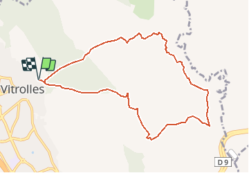
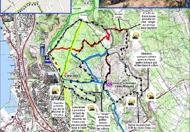
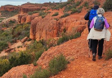
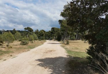
Randonnée Marche de 10,1 km à découvrir à Provence-Alpes-Côte d'Azur, Bouches-du-Rhône, Vitrolles. Cette randonnée est proposée par tracegps.
Description
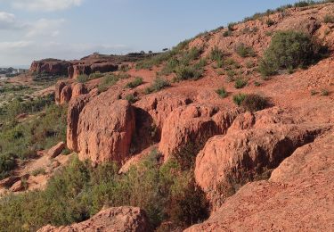
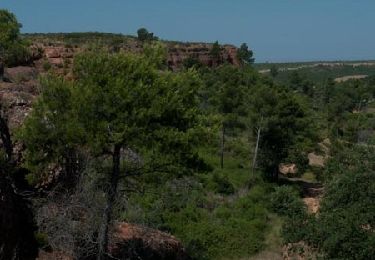
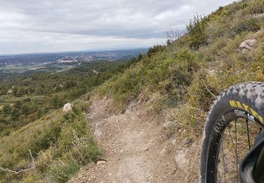
3iéme étape de la Course de l'Ail qui est normalement une course de montagne de 16km.Pour cette partie n'est pas très bien balisée. Mais nous avons de beaux points de vue.
Localisation
Pays :
France
Région :
Provence-Alpes-Côte d'Azur
Département/Province :
Bouches-du-Rhône
Commune :
Vitrolles
Localité :
Unknown
Départ:(Dec)
Départ:(UTM)
682221 ; 4814480 (31T) N.
Commentaires
Randonnées à proximité
![Randonnée V.T.T. Vitrolles - Vitrolles - les Collets Rouges - Photo](https://media.geolcdn.com/t/375/260/ext.jpg?maxdim=2&url=https%3A%2F%2Fservices.sitytrail.com%2FGeolivesWS%2FDownloadMedia.ashx%3FTrailID%3D104784%26Media%3D8243_1.jpg)
![V.T.T. V.T.T.](https://static1.geolcdn.com/sitytour/trail-icons/202.png)
Vitrolles - les Collets Rouges
V.T.T.
Moyen
(1)
Vitrolles,
Provence-Alpes-Côte d'Azur,
Bouches-du-Rhône,
France
![](/images/other/stat-length.png)
23 km | 27 km-effort
3h 0min
![](https://static1.geolcdn.com/siteimages/upload/files/16400158638029165_repeat_loop_refresh_sync_direction_icon.png)
Oui
![Randonnée Marche Les Pennes-Mirabeau - Source de l'Infernet - Photo](https://media.geolcdn.com/t/375/260/14ddab94-77f9-439f-858e-60deac1cee7d.jpg&format=jpg&maxdim=2)
![Marche Marche](https://static1.geolcdn.com/sitytour/trail-icons/101.png)
Source de l'Infernet
Marche
Facile
Les Pennes-Mirabeau,
Provence-Alpes-Côte d'Azur,
Bouches-du-Rhône,
France
![](/images/other/stat-length.png)
8,6 km | 10,1 km-effort
2h 31min
![](https://static1.geolcdn.com/siteimages/upload/files/16400158638029165_repeat_loop_refresh_sync_direction_icon.png)
Oui
![Randonnée sport Vitrolles - 2024-09-08_18h24m16_Carrefour Essai - Photo](https://media.geolcdn.com/t/375/260/ext.jpg?maxdim=2&url=https%3A%2F%2Fsecurestorage.geolives.com%2Fsitytour%2Ftrail-bg%2Fdefault.jpg)
2024-09-08_18h24m16_Carrefour Essai
sport
Très facile
(1)
Vitrolles,
Provence-Alpes-Côte d'Azur,
Bouches-du-Rhône,
France
![](/images/other/stat-length.png)
9 km | 10 km-effort
Inconnu
![](https://static1.geolcdn.com/siteimages/upload/files/16400158638029165_repeat_loop_refresh_sync_direction_icon.png)
Non
![Randonnée V.T.T. Vitrolles - Vitrolles - Terre Rouge - Photo](https://media.geolcdn.com/t/375/260/ext.jpg?maxdim=2&url=https%3A%2F%2Fservices.sitytrail.com%2FGeolivesWS%2FDownloadMedia.ashx%3FTrailID%3D105309%26Media%3D9001_5.jpg)
![V.T.T. V.T.T.](https://static1.geolcdn.com/sitytour/trail-icons/202.png)
Vitrolles - Terre Rouge
V.T.T.
Difficile
Vitrolles,
Provence-Alpes-Côte d'Azur,
Bouches-du-Rhône,
France
![](/images/other/stat-length.png)
5,7 km | 6,6 km-effort
1h 0min
![](https://static1.geolcdn.com/siteimages/upload/files/16400158638029165_repeat_loop_refresh_sync_direction_icon.png)
Oui
![Randonnée Marche Vitrolles - les infernets. pennes Mirabeau - Photo](https://media.geolcdn.com/t/375/260/c8443f35-a1e2-4305-a60d-615831194ba6.jpg&format=jpg&maxdim=2)
![Marche Marche](https://static1.geolcdn.com/sitytour/trail-icons/101.png)
les infernets. pennes Mirabeau
Marche
Moyen
Vitrolles,
Provence-Alpes-Côte d'Azur,
Bouches-du-Rhône,
France
![](/images/other/stat-length.png)
7,1 km | 8,5 km-effort
2h 3min
![](https://static1.geolcdn.com/siteimages/upload/files/16400158638029165_repeat_loop_refresh_sync_direction_icon.png)
Oui
![Randonnée Marche Vitrolles - 20lm du plateau - Photo](https://media.geolcdn.com/t/375/260/f5097310-3ef2-4a2d-922a-53e62d0266d1.jpg&format=jpg&maxdim=2)
![Marche Marche](https://static1.geolcdn.com/sitytour/trail-icons/101.png)
20lm du plateau
Marche
Très difficile
Vitrolles,
Provence-Alpes-Côte d'Azur,
Bouches-du-Rhône,
France
![](/images/other/stat-length.png)
18 km | 21 km-effort
2h 58min
![](https://static1.geolcdn.com/siteimages/upload/files/16400158638029165_repeat_loop_refresh_sync_direction_icon.png)
Oui
![Randonnée V.T.T. Vitrolles - dans le jardin - Photo](https://media.geolcdn.com/t/375/260/824627e2-9b46-46ce-b681-b4206f5f4695.jpg&format=jpg&maxdim=2)
![V.T.T. V.T.T.](https://static1.geolcdn.com/sitytour/trail-icons/202.png)
dans le jardin
V.T.T.
Très difficile
Vitrolles,
Provence-Alpes-Côte d'Azur,
Bouches-du-Rhône,
France
![](/images/other/stat-length.png)
43 km | 52 km-effort
2h 46min
![](https://static1.geolcdn.com/siteimages/upload/files/16400158638029165_repeat_loop_refresh_sync_direction_icon.png)
Oui
![Randonnée V.T.T. Vitrolles - Marathon Griffon-Roquefavour - Photo](https://media.geolcdn.com/t/375/260/b6c028fb-c358-4e48-a78f-0b26ded273e6.jpg&format=jpg&maxdim=2)
![V.T.T. V.T.T.](https://static1.geolcdn.com/sitytour/trail-icons/202.png)
Marathon Griffon-Roquefavour
V.T.T.
Très difficile
Vitrolles,
Provence-Alpes-Côte d'Azur,
Bouches-du-Rhône,
France
![](/images/other/stat-length.png)
38 km | 46 km-effort
2h 47min
![](https://static1.geolcdn.com/siteimages/upload/files/16400158638029165_repeat_loop_refresh_sync_direction_icon.png)
Oui
![Randonnée Marche Rognac - Vallon de Mion - Photo](https://media.geolcdn.com/t/375/260/02b7a81f-7cc4-4f03-96c2-caf1d5375314.jpg&format=jpg&maxdim=2)
![Marche Marche](https://static1.geolcdn.com/sitytour/trail-icons/101.png)
Vallon de Mion
Marche
Difficile
(1)
Rognac,
Provence-Alpes-Côte d'Azur,
Bouches-du-Rhône,
France
![](/images/other/stat-length.png)
11,3 km | 13,6 km-effort
1h 58min
![](https://static1.geolcdn.com/siteimages/upload/files/16400158638029165_repeat_loop_refresh_sync_direction_icon.png)
Oui