![](/images/other/stat-length.png)
![Randonnée Marche Morlaix - GR 34® de Morlaix à Carantec - Photo](https://media.geolcdn.com/t/1900/400/ext.pjpeg?maxdim=2&url=https%3A%2F%2Fservices.sitytrail.com%2FGeolivesWS%2FDownloadMedia.ashx%3FTrailID%3D316773%26Media%3D5179_1.jpg)
GR 34® de Morlaix à Carantec
tracegps
Utilisateur
![Longueur](/images/other/stat-length.png)
![Altitude max](https://static1.geolcdn.com/siteimages/upload/files/1508320355ic_sort_altitude_max_24dp.png)
![Dénivelé positif](https://static1.geolcdn.com/siteimages/upload/files/1508320355ic_sort_den_pos_24dp.png)
![Km-Effort](/images/other/stat-length.png)
![Altitude min](https://static1.geolcdn.com/siteimages/upload/files/1508320355ic_sort_altitude_min_24dp.png)
![Dénivelé négatif](https://static1.geolcdn.com/siteimages/upload/files/1508320355ic_sort_den_neg_24dp.png)
![Boucle](https://static1.geolcdn.com/siteimages/upload/files/16400158638029165_repeat_loop_refresh_sync_direction_icon.png)
![Marche](https://static1.geolcdn.com/sitytour/trail-icons/101.png)
5h40
Difficulté : Difficile
![Scannez ce code QR pour ouvrir la randonnée dans l'application SityTrail](https://capi.geolives.com/qq0zvz2zws4bq2lad0pu/sitytour/trails/316773/qr.png?size=200)
Application GPS de randonnée GRATUITE
À propos
Randonnée Marche de 26 km à découvrir à Bretagne, Finistère, Morlaix. Cette randonnée est proposée par tracegps.
Description
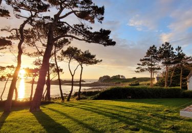
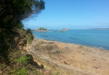
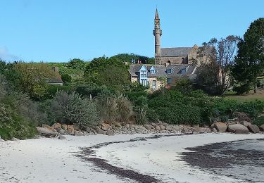
GR34® Les Abers - GR 34® de Morlaix à Carantec - Entre Morlaix et Brest, la côte rocheuse est profondément découpée en criques, en rias, grèves et plages. Bon nombre de récifs et d'îlots la bordent (îles de Batz et Ouessant, archipel de Molène). La structure du massif granitique et les assauts répétés de la mer expliquent la création de sillons étroits et profonds : les Abers. Au fil du sentier, le randonneur longe les bords de l'Aber Vrac'h, de l'Aber Benoît ou de l'Aber Ildut. Ils constituent autant d'abris pour les plaisanciers, les flottilles de pêche côtière, les sabliers et goémoniers. Sur les rives de cette Finis-terrae, la faune marine est d'une extraordinaire richesse : colonies d'oiseaux et mammifères marins rares (phoques, dauphins, loutres d'Europe). Vous trouverez le descriptif détaillé de cette randonnée dans le Topo-guide® de la Fédération Française de la Randonnée Pédestre. Le découpage proposé ici est donné à titre indicatif pour équilibrer la distance de chaque tronçon. Chacun peut l’adapter à son niveau. Pour toute information complémentaire sur la randonnée : Comité départemental du Finistère: 4 ROUTE DE ST RENAN BP 02 29810 PLOUARZEL Tél. : 0298896006
Localisation
Commentaires
Randonnées à proximité
![Randonnée Marche Saint-Martin-des-Champs - 29.08.23 Morlaix -- Carantec - Photo](https://media.geolcdn.com/t/375/260/5e95973a-bb61-48e1-be26-0d4b7c63c8a3.jpg&format=jpg&maxdim=2)
![Marche Marche](https://static1.geolcdn.com/sitytour/trail-icons/101.png)
Marche
![](/images/other/stat-length.png)
![](https://static1.geolcdn.com/siteimages/upload/files/16400158638029165_repeat_loop_refresh_sync_direction_icon.png)
![Randonnée Marche Saint-Martin-des-Champs - Bretagne Nord J4 De Morlaix à Plougasnou - Photo](https://media.geolcdn.com/t/375/260/bdefe06e-9a70-47b4-b168-78b835207a1c.jpg&format=jpg&maxdim=2)
![Marche Marche](https://static1.geolcdn.com/sitytour/trail-icons/101.png)
Marche
![](/images/other/stat-length.png)
![](https://static1.geolcdn.com/siteimages/upload/files/16400158638029165_repeat_loop_refresh_sync_direction_icon.png)
![Randonnée Marche Morlaix - Bretagne nord J3 pm Visite de Morlaix - Photo](https://media.geolcdn.com/t/375/260/a5fc4049-6301-4d21-b592-65eec0e48eef.jpg&format=jpg&maxdim=2)
![Marche Marche](https://static1.geolcdn.com/sitytour/trail-icons/101.png)
Marche
![](/images/other/stat-length.png)
![](https://static1.geolcdn.com/siteimages/upload/files/16400158638029165_repeat_loop_refresh_sync_direction_icon.png)
![Randonnée A pied Saint-Martin-des-Champs - Vallée de la Pennélé - Photo](https://media.geolcdn.com/t/375/260/2f6b944a-859b-4f33-ad39-6ae6504e269d.jpeg&format=jpg&maxdim=2)
![A pied A pied](https://static1.geolcdn.com/sitytour/trail-icons/100.png)
A pied
![](/images/other/stat-length.png)
![](https://static1.geolcdn.com/siteimages/upload/files/16400158638029165_repeat_loop_refresh_sync_direction_icon.png)
![Randonnée A pied Taulé - Circuit du Bois de Lannigou - Photo](https://media.geolcdn.com/t/375/260/f561f4b9-9280-45ba-ac9b-6ff7481177a4.jpeg&format=jpg&maxdim=2)
![A pied A pied](https://static1.geolcdn.com/sitytour/trail-icons/100.png)
A pied
![](/images/other/stat-length.png)
![](https://static1.geolcdn.com/siteimages/upload/files/16400158638029165_repeat_loop_refresh_sync_direction_icon.png)
![Randonnée Marche Saint-Martin-des-Champs - GR 34 étape 24 - Photo](https://media.geolcdn.com/t/375/260/ext.jpg?maxdim=2&url=https%3A%2F%2Fservices.sitytrail.com%2FGeolivesWS%2FDownloadMedia.ashx%3FTrailID%3D318891%26Media%3Dfix__20140514144043.jpg)
![Marche Marche](https://static1.geolcdn.com/sitytour/trail-icons/101.png)
Marche
![](/images/other/stat-length.png)
![](https://static1.geolcdn.com/siteimages/upload/files/16400158638029165_repeat_loop_refresh_sync_direction_icon.png)
![Randonnée Marche Morlaix - morlaix art urbain et venelles - Photo](https://media.geolcdn.com/t/375/260/1a694ed8-5d0d-45d6-8d7b-c7ebb83cb535.jpg&format=jpg&maxdim=2)
![Marche Marche](https://static1.geolcdn.com/sitytour/trail-icons/101.png)
Marche
![](/images/other/stat-length.png)
![](https://static1.geolcdn.com/siteimages/upload/files/16400158638029165_repeat_loop_refresh_sync_direction_icon.png)
![Randonnée A pied Saint-Martin-des-Champs - N°1 Morlaix -- Carantec (29.08.23) - Photo](https://media.geolcdn.com/t/375/260/ext.jpg?maxdim=2&url=https%3A%2F%2Fstatic1.geolcdn.com%2Fsiteimages%2Fupload%2Ffiles%2F1545311037marcheuse_200dpi.jpg)
![A pied A pied](https://static1.geolcdn.com/sitytour/trail-icons/100.png)
A pied
![](/images/other/stat-length.png)
![](https://static1.geolcdn.com/siteimages/upload/files/16400158638029165_repeat_loop_refresh_sync_direction_icon.png)
![Randonnée Cyclotourisme Morlaix - De Morlaix à l'île Callot - Photo](https://media.geolcdn.com/t/375/260/00ea734e-a83f-40a6-b40b-c0c762ef8e6f.jpg&format=jpg&maxdim=2)
![Cyclotourisme Cyclotourisme](https://static1.geolcdn.com/sitytour/trail-icons/204.png)
Cyclotourisme
![](/images/other/stat-length.png)
![](https://static1.geolcdn.com/siteimages/upload/files/16400158638029165_repeat_loop_refresh_sync_direction_icon.png)