![](/images/other/stat-length.png)
![Randonnée Marche Saint-Philippe - GR® R2 Du gîte de Basse Vallée à Basse Vallée - Photo](https://media.geolcdn.com/t/1900/400/ext.pjpeg?maxdim=2&url=https%3A%2F%2Fservices.sitytrail.com%2FGeolivesWS%2FDownloadMedia.ashx%3FTrailID%3D316702%26Media%3D3859_1.jpg)
GR® R2 Du gîte de Basse Vallée à Basse Vallée
tracegps
Utilisateur
![Longueur](/images/other/stat-length.png)
Longueur
5 km
![Altitude max](https://static1.geolcdn.com/siteimages/upload/files/1508320355ic_sort_altitude_max_24dp.png)
Altitude max
629 m
![Dénivelé positif](https://static1.geolcdn.com/siteimages/upload/files/1508320355ic_sort_den_pos_24dp.png)
Dénivelé positif
0 m
![Km-Effort](/images/other/stat-length.png)
Km-Effort
6,9 km
![Altitude min](https://static1.geolcdn.com/siteimages/upload/files/1508320355ic_sort_altitude_min_24dp.png)
Altitude min
43 m
![Dénivelé négatif](https://static1.geolcdn.com/siteimages/upload/files/1508320355ic_sort_den_neg_24dp.png)
Dénivelé négatif
584 m
![Boucle](https://static1.geolcdn.com/siteimages/upload/files/16400158638029165_repeat_loop_refresh_sync_direction_icon.png)
Boucle
Non
Date de création :
2016-03-09 00:00:00.0
Dernière modification :
2016-03-09 00:00:00.0
![Marche](https://static1.geolcdn.com/sitytour/trail-icons/101.png)
2h00
Difficulté : Moyen
![Scannez ce code QR pour ouvrir la randonnée dans l'application SityTrail](https://capi.geolives.com/qq0zvz2zws4bq2lad0pu/sitytour/trails/316702/qr.png?size=200)
Application GPS de randonnée GRATUITE
À propos
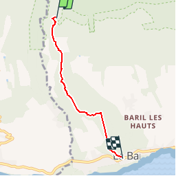
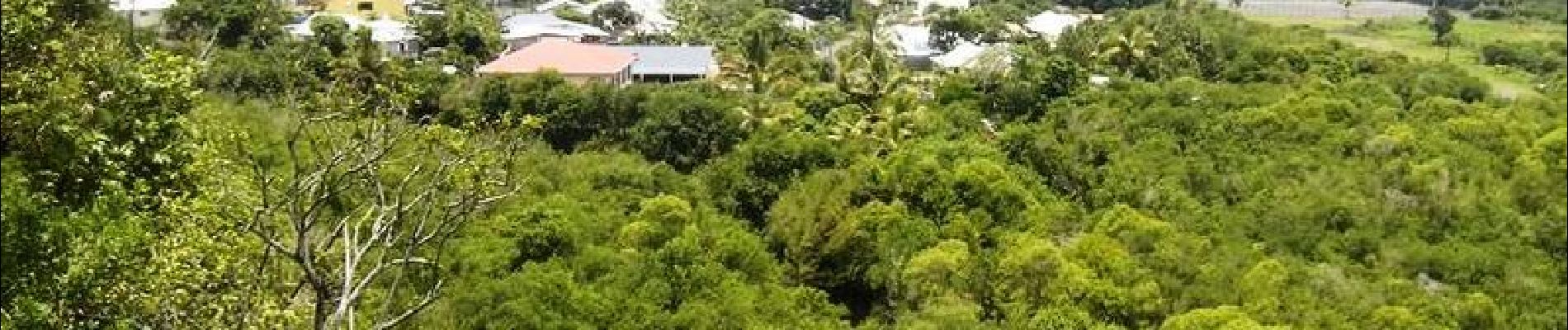
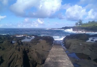
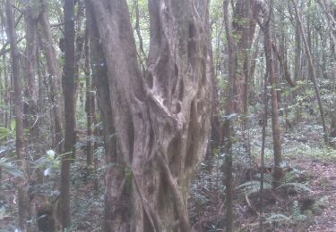
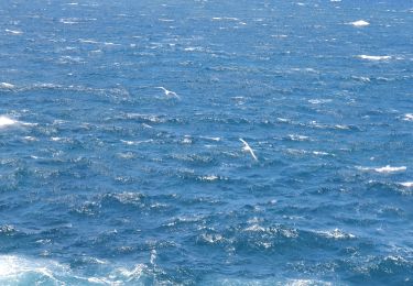
Randonnée Marche de 5 km à découvrir à La Réunion, Inconnu, Saint-Philippe. Cette randonnée est proposée par tracegps.
Description
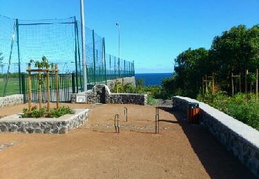
GR® R2 Du gîte de Basse Vallée à Basse Vallée. Dernière étape Vous trouverez le descriptif détaillé de cette randonnée dans le Topo-guide® de la Fédération Française de la Randonnée Pédestre.
Localisation
Pays :
France
Région :
La Réunion
Département/Province :
Inconnu
Commune :
Saint-Philippe
Localité :
Unknown
Départ:(Dec)
Départ:(UTM)
365373 ; 7639861 (40K) S.
Commentaires
Randonnées à proximité
![Randonnée Marche Saint-Joseph - Cap Jaune randonnée famille - Photo](https://media.geolcdn.com/t/375/260/0eb20c45-f963-4b69-a85f-83e3bdaa6b80.jpg&format=jpg&maxdim=2)
![Marche Marche](https://static1.geolcdn.com/sitytour/trail-icons/101.png)
Cap Jaune randonnée famille
Marche
Très facile
Saint-Joseph,
La Réunion,
Inconnu,
France
![](/images/other/stat-length.png)
3,3 km | 4,4 km-effort
2h 0min
![](https://static1.geolcdn.com/siteimages/upload/files/16400158638029165_repeat_loop_refresh_sync_direction_icon.png)
Oui
![Randonnée Marche Saint-Philippe - sentiers botaniques - Photo](https://media.geolcdn.com/t/375/260/ext.jpg?maxdim=2&url=https%3A%2F%2Fservices.sitytrail.com%2FGeolivesWS%2FDownloadMedia.ashx%3FTrailID%3D232114%26Media%3Dfix__20131111125801.jpg)
![Marche Marche](https://static1.geolcdn.com/sitytour/trail-icons/101.png)
sentiers botaniques
Marche
Très facile
Saint-Philippe,
La Réunion,
Inconnu,
France
![](/images/other/stat-length.png)
4,2 km | 6,5 km-effort
1h 50min
![](https://static1.geolcdn.com/siteimages/upload/files/16400158638029165_repeat_loop_refresh_sync_direction_icon.png)
Oui
![Randonnée Marche Saint-Joseph - cap jaune - Photo](https://media.geolcdn.com/t/375/260/b1bf09be-09a9-4227-9178-69439bebcf69.jpg&format=jpg&maxdim=2)
![Marche Marche](https://static1.geolcdn.com/sitytour/trail-icons/101.png)
cap jaune
Marche
Très facile
Saint-Joseph,
La Réunion,
Inconnu,
France
![](/images/other/stat-length.png)
4,9 km | 6,6 km-effort
1h 18min
![](https://static1.geolcdn.com/siteimages/upload/files/16400158638029165_repeat_loop_refresh_sync_direction_icon.png)
Oui
![Randonnée Marche Saint-Philippe - La Réunion - Boucle par le bord de mer de Basse Vallée (secteur St Philippe) - Photo](https://media.geolcdn.com/t/375/260/ext.jpg?maxdim=2&url=https%3A%2F%2Fservices.sitytrail.com%2FGeolivesWS%2FDownloadMedia.ashx%3FTrailID%3D258813%26Media%3Dfix__20140320160717.jpg)
![Marche Marche](https://static1.geolcdn.com/sitytour/trail-icons/101.png)
La Réunion - Boucle par le bord de mer de Basse Vallée (secteur St Philippe)
Marche
Très facile
Saint-Philippe,
La Réunion,
Inconnu,
France
![](/images/other/stat-length.png)
2,4 km | 2,9 km-effort
1h 2min
![](https://static1.geolcdn.com/siteimages/upload/files/16400158638029165_repeat_loop_refresh_sync_direction_icon.png)
Oui
![Randonnée Marche Saint-Philippe - La Réunion - Boucle par le sentier botanique de la forêt de Mare-Longue - Photo](https://media.geolcdn.com/t/375/260/ext.jpg?maxdim=2&url=https%3A%2F%2Fservices.sitytrail.com%2FGeolivesWS%2FDownloadMedia.ashx%3FTrailID%3D255672%26Media%3Dfix__20140309142644.jpg)
![Marche Marche](https://static1.geolcdn.com/sitytour/trail-icons/101.png)
La Réunion - Boucle par le sentier botanique de la forêt de Mare-Longue
Marche
Très facile
Saint-Philippe,
La Réunion,
Inconnu,
France
![](/images/other/stat-length.png)
2,4 km | 3,8 km-effort
1h 29min
![](https://static1.geolcdn.com/siteimages/upload/files/16400158638029165_repeat_loop_refresh_sync_direction_icon.png)
Oui
![Randonnée Marche Saint-Joseph - A/R Terre rouge, Le récif - Photo](https://media.geolcdn.com/t/375/260/ext.jpg?maxdim=2&url=https%3A%2F%2Fstatic1.geolcdn.com%2Fsiteimages%2Fupload%2Ffiles%2F1553511878bg_sport_marche.png)
![Marche Marche](https://static1.geolcdn.com/sitytour/trail-icons/101.png)
A/R Terre rouge, Le récif
Marche
Très facile
Saint-Joseph,
La Réunion,
Inconnu,
France
![](/images/other/stat-length.png)
5 km | 6,8 km-effort
1h 33min
![](https://static1.geolcdn.com/siteimages/upload/files/16400158638029165_repeat_loop_refresh_sync_direction_icon.png)
Oui
![Randonnée Marche Saint-Philippe - vallée heureuse - Photo](https://media.geolcdn.com/t/375/260/ext.jpg?maxdim=2&url=https%3A%2F%2Fstatic1.geolcdn.com%2Fsiteimages%2Fupload%2Ffiles%2F1553511878bg_sport_marche.png)
![Marche Marche](https://static1.geolcdn.com/sitytour/trail-icons/101.png)
vallée heureuse
Marche
Difficile
Saint-Philippe,
La Réunion,
Inconnu,
France
![](/images/other/stat-length.png)
21 km | 44 km-effort
8h 49min
![](https://static1.geolcdn.com/siteimages/upload/files/16400158638029165_repeat_loop_refresh_sync_direction_icon.png)
Oui
![Randonnée Marche Saint-Joseph - piton vincendo - cap poisson d'ail - Photo](https://media.geolcdn.com/t/375/260/ext.jpg?maxdim=2&url=https%3A%2F%2Fstatic1.geolcdn.com%2Fsiteimages%2Fupload%2Ffiles%2F1553511878bg_sport_marche.png)
![Marche Marche](https://static1.geolcdn.com/sitytour/trail-icons/101.png)
piton vincendo - cap poisson d'ail
Marche
Facile
Saint-Joseph,
La Réunion,
Inconnu,
France
![](/images/other/stat-length.png)
5,3 km | 7,2 km-effort
1h 30min
![](https://static1.geolcdn.com/siteimages/upload/files/16400158638029165_repeat_loop_refresh_sync_direction_icon.png)
Oui
![Randonnée sport Saint-Philippe - 2024-10-12_17h15m34_Randopitons Itineraire #1328 - Sentier Botanique Mare Longue Saint Philippe - Photo](https://media.geolcdn.com/t/375/260/ext.jpg?maxdim=2&url=https%3A%2F%2Fsecurestorage.geolives.com%2Fsitytour%2Ftrail-bg%2Fdefault.jpg)
2024-10-12_17h15m34_Randopitons Itineraire #1328 - Sentier Botanique Mare Lon...
sport
Très facile
Saint-Philippe,
La Réunion,
Inconnu,
France
![](/images/other/stat-length.png)
4,2 km | 6,8 km-effort
Inconnu
![](https://static1.geolcdn.com/siteimages/upload/files/16400158638029165_repeat_loop_refresh_sync_direction_icon.png)
Oui