![](/images/other/stat-length.png)
![Randonnée Marche Saint-Denis - GR® R2 Du gîte de la Roche Ecrite à Dos d'Ane - Photo](https://media.geolcdn.com/t/1900/400/ext.pjpeg?maxdim=2&url=https%3A%2F%2Fservices.sitytrail.com%2FGeolivesWS%2FDownloadMedia.ashx%3FTrailID%3D316690%26Media%3D3847_1.jpg)
GR® R2 Du gîte de la Roche Ecrite à Dos d'Ane
tracegps
Utilisateur
![Longueur](/images/other/stat-length.png)
Longueur
10,2 km
![Altitude max](https://static1.geolcdn.com/siteimages/upload/files/1508320355ic_sort_altitude_max_24dp.png)
Altitude max
1855 m
![Dénivelé positif](https://static1.geolcdn.com/siteimages/upload/files/1508320355ic_sort_den_pos_24dp.png)
Dénivelé positif
136 m
![Km-Effort](/images/other/stat-length.png)
Km-Effort
15,1 km
![Altitude min](https://static1.geolcdn.com/siteimages/upload/files/1508320355ic_sort_altitude_min_24dp.png)
Altitude min
930 m
![Dénivelé négatif](https://static1.geolcdn.com/siteimages/upload/files/1508320355ic_sort_den_neg_24dp.png)
Dénivelé négatif
1053 m
![Boucle](https://static1.geolcdn.com/siteimages/upload/files/16400158638029165_repeat_loop_refresh_sync_direction_icon.png)
Boucle
Non
Date de création :
2016-03-09 00:00:00.0
Dernière modification :
2016-03-09 00:00:00.0
![Marche](https://static1.geolcdn.com/sitytour/trail-icons/101.png)
3h00
Difficulté : Moyen
![Scannez ce code QR pour ouvrir la randonnée dans l'application SityTrail](https://capi.geolives.com/qq0zvz2zws4bq2lad0pu/sitytour/trails/316690/qr.png?size=200)
Application GPS de randonnée GRATUITE
À propos
Randonnée Marche de 10,2 km à découvrir à La Réunion, Inconnu, Saint-Denis. Cette randonnée est proposée par tracegps.
Description
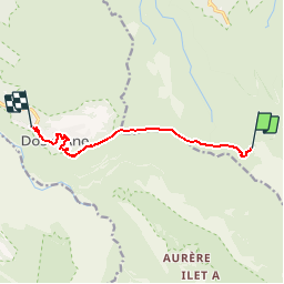
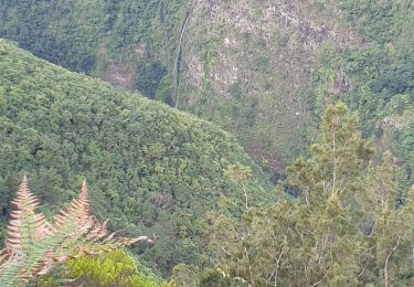
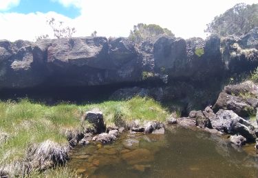
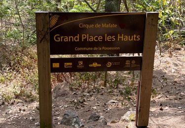
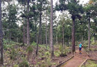
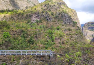
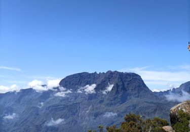
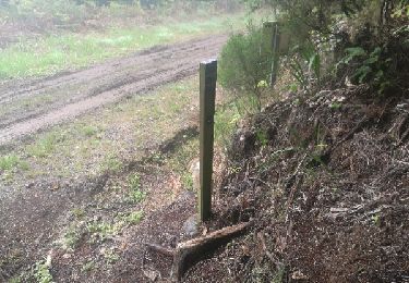
GR® R2 Du gîte de la Roche Ecrite à Dos d'Ane. Attention, il n’existe plus aucun point d’eau entre la Roche Ecrite et Dos d'Ane. Vous trouverez le descriptif détaillé de cette randonnée dans le Topo-guide® de la Fédération Française de la Randonnée Pédestre. Crédit Photos
Localisation
Pays :
France
Région :
La Réunion
Département/Province :
Inconnu
Commune :
Saint-Denis
Localité :
Unknown
Départ:(Dec)
Départ:(UTM)
338281 ; 7678378 (40K) S.
Commentaires
Randonnées à proximité
![Randonnée Marche Saint-Denis - Sentier Marmaille Morne de St François - Photo](https://media.geolcdn.com/t/375/260/168fc3a5-dd47-40c4-bc7f-6e7b5c0b10c6.jpg&format=jpg&maxdim=2)
![Marche Marche](https://static1.geolcdn.com/sitytour/trail-icons/101.png)
Sentier Marmaille Morne de St François
Marche
Très facile
(1)
Saint-Denis,
La Réunion,
Inconnu,
France
![](/images/other/stat-length.png)
4,9 km | 7,8 km-effort
1h 59min
![](https://static1.geolcdn.com/siteimages/upload/files/16400158638029165_repeat_loop_refresh_sync_direction_icon.png)
Oui
![Randonnée Marche Saint-Denis - La Roche Écrite - Photo](https://media.geolcdn.com/t/375/260/c45ea0c3-60f9-402d-bb8e-33b6c31b240c.jpg&format=jpg&maxdim=2)
![Marche Marche](https://static1.geolcdn.com/sitytour/trail-icons/101.png)
La Roche Écrite
Marche
Moyen
Saint-Denis,
La Réunion,
Inconnu,
France
![](/images/other/stat-length.png)
20 km | 35 km-effort
4h 32min
![](https://static1.geolcdn.com/siteimages/upload/files/16400158638029165_repeat_loop_refresh_sync_direction_icon.png)
Oui
![Randonnée sport La Possession - (J4)-Aurère - Mafate les Hauts (fait) - Photo](https://media.geolcdn.com/t/375/260/0d09f72b-41c2-4c29-9aac-6a60b6d1d150.jpg&format=jpg&maxdim=2)
(J4)-Aurère - Mafate les Hauts (fait)
sport
Très facile
La Possession,
La Réunion,
Inconnu,
France
![](/images/other/stat-length.png)
8,4 km | 16,2 km-effort
Inconnu
![](https://static1.geolcdn.com/siteimages/upload/files/16400158638029165_repeat_loop_refresh_sync_direction_icon.png)
Non
![Randonnée sport Saint-Denis - (J2)-Gîte de la Roche Écrite - Dos d’Ane (fait) - Photo](https://media.geolcdn.com/t/375/260/6e842589-3635-43a7-a1bc-65c85b024c08.jpg&format=jpg&maxdim=2)
(J2)-Gîte de la Roche Écrite - Dos d’Ane (fait)
sport
Très facile
Saint-Denis,
La Réunion,
Inconnu,
France
![](/images/other/stat-length.png)
18,4 km | 29 km-effort
Inconnu
![](https://static1.geolcdn.com/siteimages/upload/files/16400158638029165_repeat_loop_refresh_sync_direction_icon.png)
Non
![Randonnée Marche La Possession - jour 2 la Réunion - Photo](https://media.geolcdn.com/t/375/260/175ad4d1-b40a-4791-99a6-341427c8526e.jpg&format=jpg&maxdim=2)
![Marche Marche](https://static1.geolcdn.com/sitytour/trail-icons/101.png)
jour 2 la Réunion
Marche
Moyen
La Possession,
La Réunion,
Inconnu,
France
![](/images/other/stat-length.png)
7,4 km | 13,3 km-effort
7h 7min
![](https://static1.geolcdn.com/siteimages/upload/files/16400158638029165_repeat_loop_refresh_sync_direction_icon.png)
Non
![Randonnée Marche Saint-Denis - La Roche Écrite depuis Le Brûlé - Photo](https://media.geolcdn.com/t/375/260/8636ed34-6c45-4a72-b01a-3d1edcc8cc24.jpg&format=jpg&maxdim=2)
![Marche Marche](https://static1.geolcdn.com/sitytour/trail-icons/101.png)
La Roche Écrite depuis Le Brûlé
Marche
Difficile
Saint-Denis,
La Réunion,
Inconnu,
France
![](/images/other/stat-length.png)
19,6 km | 34 km-effort
6h 12min
![](https://static1.geolcdn.com/siteimages/upload/files/16400158638029165_repeat_loop_refresh_sync_direction_icon.png)
Oui
![Randonnée Marche La Possession - 27 octobre 2022 deux bras - Photo](https://media.geolcdn.com/t/375/260/856679f7-0054-41fb-b163-37467467288d.jpg&format=jpg&maxdim=2)
![Marche Marche](https://static1.geolcdn.com/sitytour/trail-icons/101.png)
27 octobre 2022 deux bras
Marche
Difficile
La Possession,
La Réunion,
Inconnu,
France
![](/images/other/stat-length.png)
13,1 km | 26 km-effort
5h 38min
![](https://static1.geolcdn.com/siteimages/upload/files/16400158638029165_repeat_loop_refresh_sync_direction_icon.png)
Non
![Randonnée Marche Salazie - Le km vertical - Photo](https://media.geolcdn.com/t/375/260/125243b2-d794-403c-8ac0-5a23e190b80e.jpg&format=jpg&maxdim=2)
![Marche Marche](https://static1.geolcdn.com/sitytour/trail-icons/101.png)
Le km vertical
Marche
Difficile
Salazie,
La Réunion,
Inconnu,
France
![](/images/other/stat-length.png)
5,1 km | 16,5 km-effort
2h 56min
![](https://static1.geolcdn.com/siteimages/upload/files/16400158638029165_repeat_loop_refresh_sync_direction_icon.png)
Non
![Randonnée Marche Saint-Denis - Boucle de la plaine d'affouches - Photo](https://media.geolcdn.com/t/375/260/ext.jpg?maxdim=2&url=https%3A%2F%2Fservices.sitytrail.com%2FGeolivesWS%2FDownloadMedia.ashx%3FTrailID%3D869736%26Media%3Dfix__20171129124842.jpg)
![Marche Marche](https://static1.geolcdn.com/sitytour/trail-icons/101.png)
Boucle de la plaine d'affouches
Marche
Moyen
Saint-Denis,
La Réunion,
Inconnu,
France
![](/images/other/stat-length.png)
17,4 km | 28 km-effort
6h 7min
![](https://static1.geolcdn.com/siteimages/upload/files/16400158638029165_repeat_loop_refresh_sync_direction_icon.png)
Oui