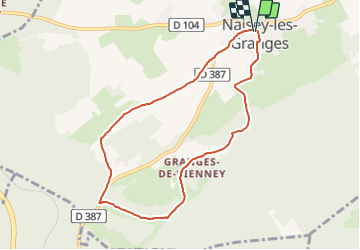
![](/images/other/stat-length.png)
![Randonnée Marche Naisey-les-Granges - Tracé Rando NAISEY LES GRANGES - Photo](https://media.geolcdn.com/t/1900/400/ext.pjpeg?maxdim=2&url=https%3A%2F%2Fstatic1.geolcdn.com%2Fsiteimages%2Fupload%2Ffiles%2F1553511878bg_sport_marche.png)
Tracé Rando NAISEY LES GRANGES
norbertmarteau
Utilisateur
![Longueur](/images/other/stat-length.png)
![Altitude max](https://static1.geolcdn.com/siteimages/upload/files/1508320355ic_sort_altitude_max_24dp.png)
![Dénivelé positif](https://static1.geolcdn.com/siteimages/upload/files/1508320355ic_sort_den_pos_24dp.png)
![Km-Effort](/images/other/stat-length.png)
![Altitude min](https://static1.geolcdn.com/siteimages/upload/files/1508320355ic_sort_altitude_min_24dp.png)
![Dénivelé négatif](https://static1.geolcdn.com/siteimages/upload/files/1508320355ic_sort_den_neg_24dp.png)
![Boucle](https://static1.geolcdn.com/siteimages/upload/files/16400158638029165_repeat_loop_refresh_sync_direction_icon.png)
![Marche](https://static1.geolcdn.com/sitytour/trail-icons/101.png)
2h13
Difficulté : Moyen
![Scannez ce code QR pour ouvrir la randonnée dans l'application SityTrail](https://capi.geolives.com/qq0zvz2zws4bq2lad0pu/sitytour/trails/3161807/qr.png?size=200)
Application GPS de randonnée GRATUITE
À propos
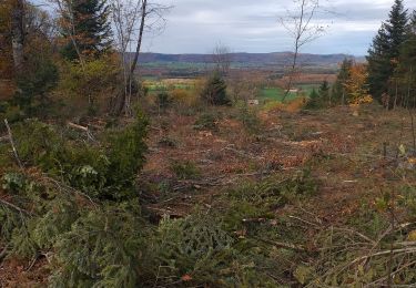
Randonnée Marche de 7,7 km à découvrir à Bourgogne-Franche-Comté, Doubs, Naisey-les-Granges. Cette randonnée est proposée par norbertmarteau.
Description
Belle randonnée pédestre sans difficulté.
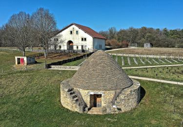
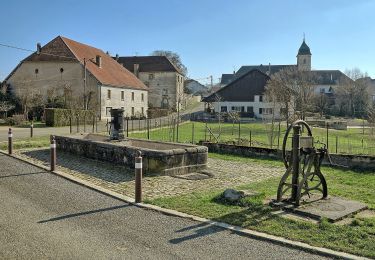
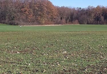
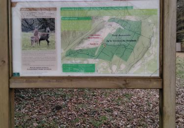
3 points caractéristiques :
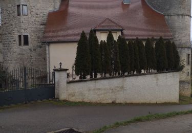
- départ de l'église avec l'Orgue
- passage par un point de vue sur les villages environnants (de Fontain à Champlive
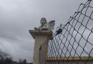
- Passage vers la Vierge (entrée village Hôpital du GrosBois)
Localisation
Commentaires
Randonnées à proximité
![Randonnée A pied Nancray - Circuit du Chêne Président - Photo](https://media.geolcdn.com/t/375/260/dc9e89f0-7636-4693-8413-5b50fbfab35e.jpeg&format=jpg&maxdim=2)
![A pied A pied](https://static1.geolcdn.com/sitytour/trail-icons/100.png)
A pied
![](/images/other/stat-length.png)
![](https://static1.geolcdn.com/siteimages/upload/files/16400158638029165_repeat_loop_refresh_sync_direction_icon.png)
![Randonnée A pied Nancray - Sentier du Fonteny - Photo](https://media.geolcdn.com/t/375/260/fd4c251e-f96c-43e9-888d-c44f200ccc2c.jpeg&format=jpg&maxdim=2)
![A pied A pied](https://static1.geolcdn.com/sitytour/trail-icons/100.png)
A pied
![](/images/other/stat-length.png)
![](https://static1.geolcdn.com/siteimages/upload/files/16400158638029165_repeat_loop_refresh_sync_direction_icon.png)
![Randonnée A pied Nancray - Sentier du Moulin - Photo](https://media.geolcdn.com/t/375/260/fd4c251e-f96c-43e9-888d-c44f200ccc2c.jpeg&format=jpg&maxdim=2)
![A pied A pied](https://static1.geolcdn.com/sitytour/trail-icons/100.png)
A pied
![](/images/other/stat-length.png)
![](https://static1.geolcdn.com/siteimages/upload/files/16400158638029165_repeat_loop_refresh_sync_direction_icon.png)
![Randonnée Marche Nancray - Nancray-danse - Photo](https://media.geolcdn.com/t/375/260/8f480ddf-1fd3-4568-9b1d-9c27b999fa3d.jpg&format=jpg&maxdim=2)
![Marche Marche](https://static1.geolcdn.com/sitytour/trail-icons/101.png)
Marche
![](/images/other/stat-length.png)
![](https://static1.geolcdn.com/siteimages/upload/files/16400158638029165_repeat_loop_refresh_sync_direction_icon.png)
![Randonnée Marche Naisey-les-Granges - Naisey les Grande - Photo](https://media.geolcdn.com/t/375/260/20e70f5b-f761-4060-a739-20ed2d6736dc.jpg&format=jpg&maxdim=2)
![Marche Marche](https://static1.geolcdn.com/sitytour/trail-icons/101.png)
Marche
![](/images/other/stat-length.png)
![](https://static1.geolcdn.com/siteimages/upload/files/16400158638029165_repeat_loop_refresh_sync_direction_icon.png)
![Randonnée Marche Nancray - Nancray moulin - Photo](https://media.geolcdn.com/t/375/260/8957ca98-610e-4c7e-8842-df399f24b994.jpg&format=jpg&maxdim=2)
![Marche Marche](https://static1.geolcdn.com/sitytour/trail-icons/101.png)
Marche
![](/images/other/stat-length.png)
![](https://static1.geolcdn.com/siteimages/upload/files/16400158638029165_repeat_loop_refresh_sync_direction_icon.png)
![Randonnée Marche Bouclans - Bouclans - Photo](https://media.geolcdn.com/t/375/260/b38b1ef6-7b8d-4e86-b122-282d5b75dca7.jpg&format=jpg&maxdim=2)
![Marche Marche](https://static1.geolcdn.com/sitytour/trail-icons/101.png)
Marche
![](/images/other/stat-length.png)
![](https://static1.geolcdn.com/siteimages/upload/files/16400158638029165_repeat_loop_refresh_sync_direction_icon.png)
![Randonnée Marche Étalans - étalant - Photo](https://media.geolcdn.com/t/375/260/fee41992-5521-490d-8dcc-f2876a6ea857.jpg&format=jpg&maxdim=2)
![Marche Marche](https://static1.geolcdn.com/sitytour/trail-icons/101.png)
Marche
![](/images/other/stat-length.png)
![](https://static1.geolcdn.com/siteimages/upload/files/16400158638029165_repeat_loop_refresh_sync_direction_icon.png)
![Randonnée V.T.T. Nancray - Téléthon 2023 - Photo](https://media.geolcdn.com/t/375/260/8ddc302b-e86c-460e-b5ea-35bc000549b5.png&format=jpg&maxdim=2)
![V.T.T. V.T.T.](https://static1.geolcdn.com/sitytour/trail-icons/202.png)
V.T.T.
![](/images/other/stat-length.png)
![](https://static1.geolcdn.com/siteimages/upload/files/16400158638029165_repeat_loop_refresh_sync_direction_icon.png)