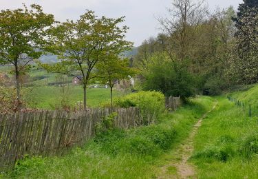
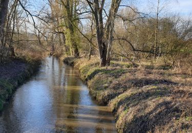
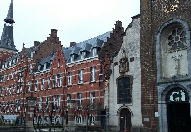
![](/images/other/stat-length.png)
![Randonnée A pied Overijse - Keizer Karelwandeling - Photo](https://media.geolcdn.com/t/1900/400/ext.pjpeg?maxdim=2&url=https%3A%2F%2Fstatic1.geolcdn.com%2Fsiteimages%2Fupload%2Ffiles%2F1545311037marcheuse_200dpi.jpg)
Keizer Karelwandeling
SityTrail - itinéraires balisés pédestres
Tous les sentiers balisés d’Europe GUIDE+
![Longueur](/images/other/stat-length.png)
Longueur
4,9 km
![Altitude max](https://static1.geolcdn.com/siteimages/upload/files/1508320355ic_sort_altitude_max_24dp.png)
Altitude max
98 m
![Dénivelé positif](https://static1.geolcdn.com/siteimages/upload/files/1508320355ic_sort_den_pos_24dp.png)
Dénivelé positif
85 m
![Km-Effort](/images/other/stat-length.png)
Km-Effort
6 km
![Altitude min](https://static1.geolcdn.com/siteimages/upload/files/1508320355ic_sort_altitude_min_24dp.png)
Altitude min
42 m
![Dénivelé négatif](https://static1.geolcdn.com/siteimages/upload/files/1508320355ic_sort_den_neg_24dp.png)
Dénivelé négatif
54 m
![Boucle](https://static1.geolcdn.com/siteimages/upload/files/16400158638029165_repeat_loop_refresh_sync_direction_icon.png)
Boucle
Non
Balise
Date de création :
2022-03-10 09:15:27.233
Dernière modification :
2022-03-10 09:15:27.233
![A pied](https://static1.geolcdn.com/sitytour/trail-icons/100.png)
1h21
Difficulté : Facile
![Scannez ce code QR pour ouvrir la randonnée dans l'application SityTrail](https://capi.geolives.com/qq0zvz2zws4bq2lad0pu/sitytour/trails/3161478/qr.png?size=200)
Application GPS de randonnée GRATUITE
À propos
Randonnée A pied de 4,9 km à découvrir à Flandre, Brabant flamand, Overijse. Cette randonnée est proposée par SityTrail - itinéraires balisés pédestres.
Description
Randonnée créée par Regionaal Landschap Dijleland vzw.
Localisation
Pays :
Belgique
Région :
Flandre
Département/Province :
Brabant flamand
Commune :
Overijse
Localité :
Unknown
Départ:(Dec)
Départ:(UTM)
610388 ; 5623351 (31U) N.
Commentaires
Randonnées à proximité
![Randonnée Marche Rixensart - Balade de Rixensart au lac de Genval - Photo](https://media.geolcdn.com/t/375/260/ext.jpg?maxdim=2&url=https%3A%2F%2Fservices.sitytrail.com%2FGeolivesWS%2FDownloadMedia.ashx%3FTrailID%3D486338%26Media%3D5e34c7a6-42f3-4c4e-bd52-3a98cd84457e.JPG)
![Marche Marche](https://static1.geolcdn.com/sitytour/trail-icons/101.png)
Balade de Rixensart au lac de Genval
Marche
Facile
(2)
Rixensart,
Wallonie,
Brabant wallon,
Belgique
![](/images/other/stat-length.png)
10,8 km | 13,3 km-effort
2h 52min
![](https://static1.geolcdn.com/siteimages/upload/files/16400158638029165_repeat_loop_refresh_sync_direction_icon.png)
Oui
![Randonnée Marche Wavre - RB-Bw-07 - Basse-Wavre - Via variantes 1 et 2 - Photo](https://media.geolcdn.com/t/375/260/ext.jpg?maxdim=2&url=https%3A%2F%2Fservices.sitytrail.com%2FGeolivesWS%2FDownloadMedia.ashx%3FTrailID%3D179582%26Media%3D72f18e5f-b96b-4732-9bbe-457fabd000c2.jpg)
![Marche Marche](https://static1.geolcdn.com/sitytour/trail-icons/101.png)
RB-Bw-07 - Basse-Wavre - Via variantes 1 et 2
Marche
Moyen
(4)
Wavre,
Wallonie,
Brabant wallon,
Belgique
![](/images/other/stat-length.png)
27 km | 34 km-effort
7h 5min
![](https://static1.geolcdn.com/siteimages/upload/files/16400158638029165_repeat_loop_refresh_sync_direction_icon.png)
Oui
![Marche Marche](https://static1.geolcdn.com/sitytour/trail-icons/101.png)
#230220 - Terlanen, Schaatbroekbos, GR579****
Marche
Moyen
(2)
Overijse,
Flandre,
Brabant flamand,
Belgique
![](/images/other/stat-length.png)
7,2 km | 8,4 km-effort
1h 55min
![](https://static1.geolcdn.com/siteimages/upload/files/16400158638029165_repeat_loop_refresh_sync_direction_icon.png)
Oui
![Marche Marche](https://static1.geolcdn.com/sitytour/trail-icons/101.png)
#201030 - Wavre, Bois de Beumont, Golf de la Bawette, Parc des Saules et Oran...
Marche
Moyen
(2)
Wavre,
Wallonie,
Brabant wallon,
Belgique
![](/images/other/stat-length.png)
7,7 km | 9,4 km-effort
1h 57min
![](https://static1.geolcdn.com/siteimages/upload/files/16400158638029165_repeat_loop_refresh_sync_direction_icon.png)
Oui
![Marche Marche](https://static1.geolcdn.com/sitytour/trail-icons/101.png)
#201012 - Ottenburg, Grote-Greube et Rodebos****
Marche
Moyen
(1)
Huldenberg,
Flandre,
Brabant flamand,
Belgique
![](/images/other/stat-length.png)
8,1 km | 10,3 km-effort
2h 13min
![](https://static1.geolcdn.com/siteimages/upload/files/16400158638029165_repeat_loop_refresh_sync_direction_icon.png)
Oui
![Randonnée Marche Huldenberg - Terlanen - Up and Down - Photo](https://media.geolcdn.com/t/375/260/527cae95-1063-4642-b0e4-15ade4f0fc04.jpg&format=jpg&maxdim=2)
![Marche Marche](https://static1.geolcdn.com/sitytour/trail-icons/101.png)
Terlanen - Up and Down
Marche
Moyen
(2)
Huldenberg,
Flandre,
Brabant flamand,
Belgique
![](/images/other/stat-length.png)
8,4 km | 10,7 km-effort
2h 25min
![](https://static1.geolcdn.com/siteimages/upload/files/16400158638029165_repeat_loop_refresh_sync_direction_icon.png)
Oui
![Randonnée Marche Wavre - Wavre Downtown - Photo](https://media.geolcdn.com/t/375/260/a5de658a-88b1-453f-aab0-8b7ba61a9015.jpg&format=jpg&maxdim=2)
![Marche Marche](https://static1.geolcdn.com/sitytour/trail-icons/101.png)
Wavre Downtown
Marche
Difficile
(1)
Wavre,
Wallonie,
Brabant wallon,
Belgique
![](/images/other/stat-length.png)
11,5 km | 13,2 km-effort
3h 0min
![](https://static1.geolcdn.com/siteimages/upload/files/16400158638029165_repeat_loop_refresh_sync_direction_icon.png)
Oui
![Randonnée Marche Wavre - Basse Wavre Hiver 03 01 2017 Nathalie Demain - Photo](https://media.geolcdn.com/t/375/260/ext.jpg?maxdim=2&url=https%3A%2F%2Fservices.sitytrail.com%2FGeolivesWS%2FDownloadMedia.ashx%3FTrailID%3D679843%26Media%3Dfix__20170103164242.jpg)
![Marche Marche](https://static1.geolcdn.com/sitytour/trail-icons/101.png)
Basse Wavre Hiver 03 01 2017 Nathalie Demain
Marche
Facile
(1)
Wavre,
Wallonie,
Brabant wallon,
Belgique
![](/images/other/stat-length.png)
13,5 km | 16 km-effort
6h 41min
![](https://static1.geolcdn.com/siteimages/upload/files/16400158638029165_repeat_loop_refresh_sync_direction_icon.png)
Oui
![Randonnée Marche Huldenberg - #190426 - Merveilleux parcours au départ de Sint-Agatha-Rode**** - Photo](https://media.geolcdn.com/t/375/260/ext.jpg?maxdim=2&url=https%3A%2F%2Fstatic1.geolcdn.com%2Fsiteimages%2Fupload%2Ffiles%2F1553511878bg_sport_marche.png)
![Marche Marche](https://static1.geolcdn.com/sitytour/trail-icons/101.png)
#190426 - Merveilleux parcours au départ de Sint-Agatha-Rode****
Marche
Moyen
(1)
Huldenberg,
Flandre,
Brabant flamand,
Belgique
![](/images/other/stat-length.png)
6,1 km | 7,5 km-effort
1h 41min
![](https://static1.geolcdn.com/siteimages/upload/files/16400158638029165_repeat_loop_refresh_sync_direction_icon.png)
Oui