


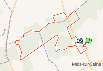

11,2 km | 14,4 km-effort

Utilisateur


Application GPS de randonnée GRATUITE
 SityTrail
IGN / Instituts géographiques
SityTrail World
Le monde est à vous
Randonnée Marche de 12,2 km à découvrir à Île-de-France, Seine-et-Marne, Melz-sur-Seine. Cette randonnée est proposée par jeannine grandjean.
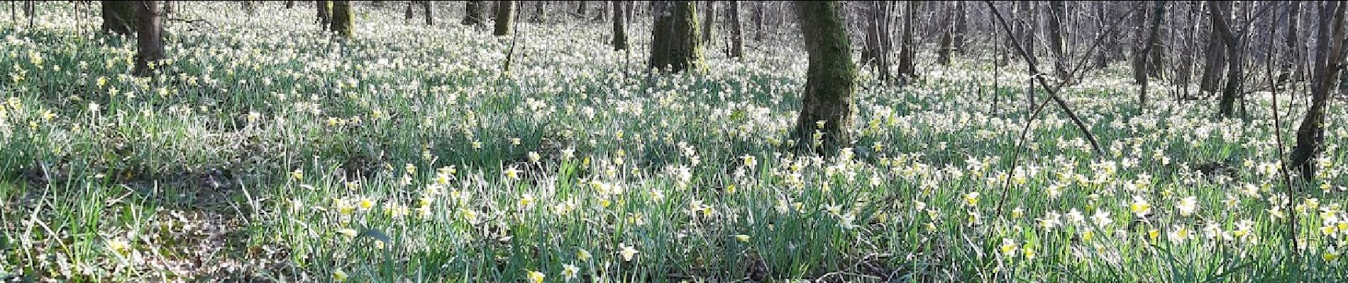
Agréable randonnée dans une forêt très bien entretenue. Chemins très praticables, jolies clairières. En mars, des couverts de jonquilles !


Marche
Marche
Autre activité

Marche
Marche
Marche
Marche
Marche
Marche
Très belle randonnée, variée et facile À faire au printemps pour les jonquilles