


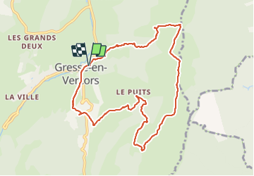

14,3 km | 31 km-effort

Utilisateur


Application GPS de randonnée GRATUITE
 SityTrail
IGN / Instituts géographiques
SityTrail World
Le monde est à vous
Randonnée Raquettes à neige de 10,4 km à découvrir à Auvergne-Rhône-Alpes, Isère, Gresse-en-Vercors. Cette randonnée est proposée par Valgaudemar.
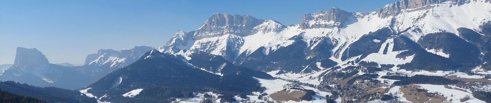
Rando faite avec petits crampons, l'enneigement faible sur les hauteurs a permis de longer les crêtes.
Panorama splendide ,


Marche

Marche

Marche

Marche

Marche

Marche

Marche

Marche
Marche