![](/images/other/stat-length.png)
![Randonnée Vélo Lens-Lestang - Lens Lestang ballade historique en vélo - Photo](https://media.geolcdn.com/t/1900/400/75910d13-8c4a-4cf1-8a55-7a307b59f910.jpg&format=pjpeg&maxdim=2)
Lens Lestang ballade historique en vélo
crocau
Utilisateur
![Longueur](/images/other/stat-length.png)
Longueur
13,1 km
![Altitude max](https://static1.geolcdn.com/siteimages/upload/files/1508320355ic_sort_altitude_max_24dp.png)
Altitude max
437 m
![Dénivelé positif](https://static1.geolcdn.com/siteimages/upload/files/1508320355ic_sort_den_pos_24dp.png)
Dénivelé positif
296 m
![Km-Effort](/images/other/stat-length.png)
Km-Effort
17,1 km
![Altitude min](https://static1.geolcdn.com/siteimages/upload/files/1508320355ic_sort_altitude_min_24dp.png)
Altitude min
233 m
![Dénivelé négatif](https://static1.geolcdn.com/siteimages/upload/files/1508320355ic_sort_den_neg_24dp.png)
Dénivelé négatif
296 m
![Boucle](https://static1.geolcdn.com/siteimages/upload/files/16400158638029165_repeat_loop_refresh_sync_direction_icon.png)
Boucle
Oui
Date de création :
2022-02-27 16:15:24.404
Dernière modification :
2022-05-11 21:49:29.21
![Vélo](https://static1.geolcdn.com/sitytour/trail-icons/200.png)
--
Difficulté : Moyen
![Scannez ce code QR pour ouvrir la randonnée dans l'application SityTrail](https://capi.geolives.com/qq0zvz2zws4bq2lad0pu/sitytour/trails/3148651/qr.png?size=200)
Application GPS de randonnée GRATUITE
À propos
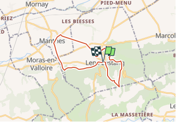
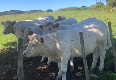
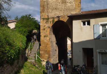
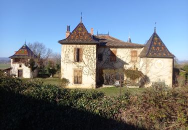
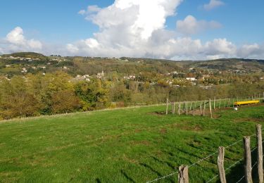
Randonnée Vélo de 13,1 km à découvrir à Auvergne-Rhône-Alpes, Drôme, Lens-Lestang. Cette randonnée est proposée par crocau.
Description
Circuit bâti à partir de cet article :
https://www.ledauphine.com/drome/2012/08/09/le-riche-patrimoine-de-lens-lestang
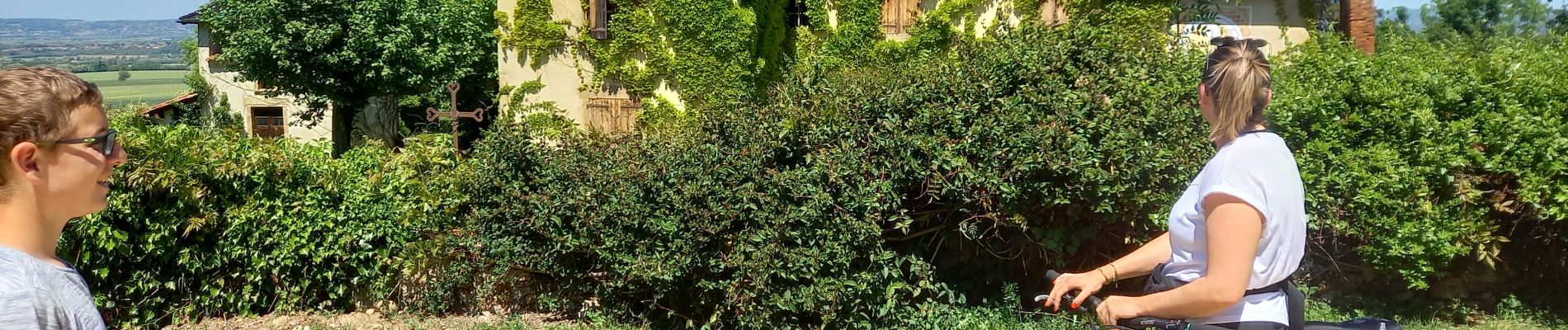
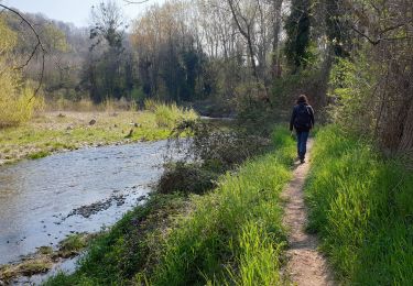
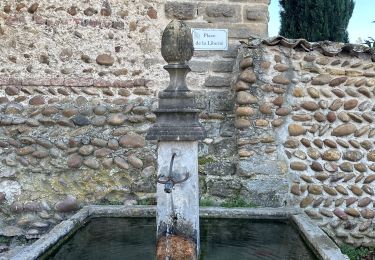
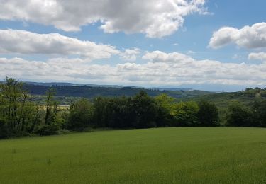
Localisation
Pays :
France
Région :
Auvergne-Rhône-Alpes
Département/Province :
Drôme
Commune :
Lens-Lestang
Localité :
Unknown
Départ:(Dec)
Départ:(UTM)
660027 ; 5017393 (31T) N.
Commentaires
Randonnées à proximité
![Randonnée Marche Hauterives - boucle idéale - Photo](https://media.geolcdn.com/t/375/260/b847dbd1-b22b-4333-8c83-1297ebdeae39.jpg&format=jpg&maxdim=2)
![Marche Marche](https://static1.geolcdn.com/sitytour/trail-icons/101.png)
boucle idéale
Marche
Facile
(1)
Hauterives,
Auvergne-Rhône-Alpes,
Drôme,
France
![](/images/other/stat-length.png)
7,9 km | 9,1 km-effort
2h 29min
![](https://static1.geolcdn.com/siteimages/upload/files/16400158638029165_repeat_loop_refresh_sync_direction_icon.png)
Oui
![Randonnée sport Moras-en-Valloire - Moras en valloire l’ecolline - Photo](https://media.geolcdn.com/t/375/260/e19f84ca-f352-4c87-8922-7a4e48f9f8b6.jpg&format=jpg&maxdim=2)
Moras en valloire l’ecolline
sport
Très facile
Moras-en-Valloire,
Auvergne-Rhône-Alpes,
Drôme,
France
![](/images/other/stat-length.png)
15,7 km | 20 km-effort
Inconnu
![](https://static1.geolcdn.com/siteimages/upload/files/16400158638029165_repeat_loop_refresh_sync_direction_icon.png)
Oui
![Randonnée Marche Hauterives - Hauterives amicale - Photo](https://media.geolcdn.com/t/375/260/c40e550d-f5cd-4e6d-937a-11509e095014.jpg&format=jpg&maxdim=2)
![Marche Marche](https://static1.geolcdn.com/sitytour/trail-icons/101.png)
Hauterives amicale
Marche
Facile
Hauterives,
Auvergne-Rhône-Alpes,
Drôme,
France
![](/images/other/stat-length.png)
13,1 km | 17,2 km-effort
3h 4min
![](https://static1.geolcdn.com/siteimages/upload/files/16400158638029165_repeat_loop_refresh_sync_direction_icon.png)
Oui
![Randonnée Vélo de route Lens-Lestang - Lens-lestang à Veyrac - Photo](https://media.geolcdn.com/t/375/260/ext.jpg?maxdim=2&url=https%3A%2F%2Fstatic1.geolcdn.com%2Fsiteimages%2Fupload%2Ffiles%2F1524743154velo.jpg)
![Vélo de route Vélo de route](https://static1.geolcdn.com/sitytour/trail-icons/201.png)
Lens-lestang à Veyrac
Vélo de route
Très difficile
(1)
Lens-Lestang,
Auvergne-Rhône-Alpes,
Drôme,
France
![](/images/other/stat-length.png)
146 km | 178 km-effort
10h 46min
![](https://static1.geolcdn.com/siteimages/upload/files/16400158638029165_repeat_loop_refresh_sync_direction_icon.png)
Non
![Randonnée Marche Hauterives - 26 hauterives 01.05.23 - Photo](https://media.geolcdn.com/t/375/260/695824ed-e11f-4942-a8d5-167f50e85b62.jpg&format=jpg&maxdim=2)
![Marche Marche](https://static1.geolcdn.com/sitytour/trail-icons/101.png)
26 hauterives 01.05.23
Marche
Facile
Hauterives,
Auvergne-Rhône-Alpes,
Drôme,
France
![](/images/other/stat-length.png)
15,2 km | 19,4 km-effort
4h 10min
![](https://static1.geolcdn.com/siteimages/upload/files/16400158638029165_repeat_loop_refresh_sync_direction_icon.png)
Oui
![Randonnée Marche Lens-Lestang - Lens Lestang- route des Châteaux - Photo](https://media.geolcdn.com/t/375/260/ad478f74-f6f1-4d23-b23c-0533237814a2.jpg&format=jpg&maxdim=2)
![Marche Marche](https://static1.geolcdn.com/sitytour/trail-icons/101.png)
Lens Lestang- route des Châteaux
Marche
Facile
Lens-Lestang,
Auvergne-Rhône-Alpes,
Drôme,
France
![](/images/other/stat-length.png)
9,4 km | 11,7 km-effort
1h 42min
![](https://static1.geolcdn.com/siteimages/upload/files/16400158638029165_repeat_loop_refresh_sync_direction_icon.png)
Oui
![Randonnée Marche Hauterives - Hauterives - Photo](https://media.geolcdn.com/t/375/260/8f51211a-d544-41d0-9822-209ca83a3066.jpg&format=jpg&maxdim=2)
![Marche Marche](https://static1.geolcdn.com/sitytour/trail-icons/101.png)
Hauterives
Marche
Facile
Hauterives,
Auvergne-Rhône-Alpes,
Drôme,
France
![](/images/other/stat-length.png)
10,5 km | 13,2 km-effort
3h 3min
![](https://static1.geolcdn.com/siteimages/upload/files/16400158638029165_repeat_loop_refresh_sync_direction_icon.png)
Oui
![Randonnée Marche Hauterives - marche du facteur Cheval 2024 - Photo](https://media.geolcdn.com/t/375/260/c0bb333c-d9c7-4640-b583-7395dd087ab3.jpg&format=jpg&maxdim=2)
![Marche Marche](https://static1.geolcdn.com/sitytour/trail-icons/101.png)
marche du facteur Cheval 2024
Marche
Difficile
Hauterives,
Auvergne-Rhône-Alpes,
Drôme,
France
![](/images/other/stat-length.png)
12,3 km | 16,1 km-effort
5h 21min
![](https://static1.geolcdn.com/siteimages/upload/files/16400158638029165_repeat_loop_refresh_sync_direction_icon.png)
Non
![Randonnée Cyclotourisme Hauterives - Hauterive - Crest - Photo](https://media.geolcdn.com/t/375/260/04777597-a82a-4bb7-b8c4-83cc6eeb26f8.jpg&format=jpg&maxdim=2)
![Cyclotourisme Cyclotourisme](https://static1.geolcdn.com/sitytour/trail-icons/204.png)
Hauterive - Crest
Cyclotourisme
Moyen
Hauterives,
Auvergne-Rhône-Alpes,
Drôme,
France
![](/images/other/stat-length.png)
78 km | 90 km-effort
4h 23min
![](https://static1.geolcdn.com/siteimages/upload/files/16400158638029165_repeat_loop_refresh_sync_direction_icon.png)
Non
Une grosse bavante au tout début puis de très agréables sentiers. Attention, les chatelins hyper désagréables